File:Bowie_Seamount_map.jpg
From Wikipedia, the free encyclopedia
No higher resolution available.
Bowie_Seamount_map.jpg (434 × 341 pixels, file size: 14 KB, MIME type: image/jpeg)
| This is a file from the Wikimedia Commons. Information from its description page there is shown below. Commons is a freely licensed media file repository. You can help. |
Summary
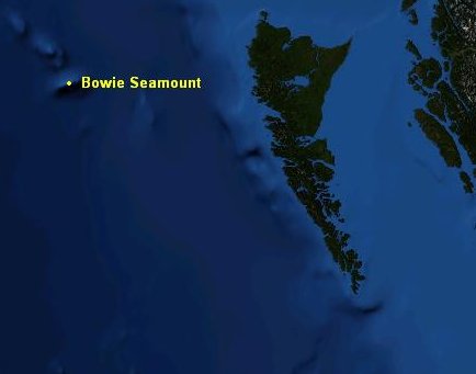
| DescriptionBowie Seamount map.jpg |
English: Map of Bowie Seamount |
| Date | |
| Source | NASA World Wind |
| Author | NASA/Black Tusk |
| Permission (Reusing this file) |
NASA, public domain |
Licensing
| Public domainPublic domainfalsefalse |
| This image is in the public domain because it is a screenshot from NASA’s globe software World Wind using a public domain layer, such as Blue Marble, MODIS, Landsat, SRTM, USGS or GLOBE.
العربيَّة | English | فارسی | français | עברית | македонски | മലയാളം | Nederlands | русский | 中文(中国大陆) | +/− |
 |
Captions
Add a one-line explanation of what this file represents
Items portrayed in this file
depicts
25 October 2008
image/jpeg
a22da20460a01967ac06052d6f91c933fa84d1fe
14,514 byte
341 pixel
434 pixel
File history
Click on a date/time to view the file as it appeared at that time.
| Date/Time | Thumbnail | Dimensions | User | Comment | |
|---|---|---|---|---|---|
| current | 00:46, 26 October 2008 | | 434 × 341 (14 KB) | Black Tusk | {{Information |Description={{en|1=Map of Bowie Seamount}} |Source=NASA World Wind |Author=NASA/Black Tusk |Date=October 25, 2008 |Permission=NASA, public domain |other_versions= }} <!--{{ImageUpload|full}}--> [[Category:Volcanoes |
File usage
The following pages on the English Wikipedia use this file (pages on other projects are not listed):
Global file usage
The following other wikis use this file:
- Usage on it.wikipedia.org
- Usage on ja.wikipedia.org
Metadata
This file contains additional information, probably added from the digital camera or scanner used to create or digitize it.
If the file has been modified from its original state, some details may not fully reflect the modified file.
| _error | 0 |
|---|
Retrieved from "https://en.wikipedia.org/wiki/File:Bowie_Seamount_map.jpg"