File:Arktika-hsb.svg
From Wikipedia, the free encyclopedia

Size of this PNG preview of this SVG file: 478 × 599 pixels. Other resolutions: 191 × 240 pixels | 383 × 480 pixels | 613 × 768 pixels | 817 × 1,024 pixels | 1,634 × 2,048 pixels | 505 × 633 pixels.
Original file (SVG file, nominally 505 × 633 pixels, file size: 1.59 MB)
| This is a file from the Wikimedia Commons. Information from its description page there is shown below. Commons is a freely licensed media file repository. You can help. |
Summary
| DescriptionArktika-hsb.svg |
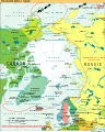
Hornjoserbsce: Karta Arktiki.
English: Map of the Arctic. |
| Date | |
| Source | |
| Author |
|
| Other versions |
[edit]
|


.svg)


Other versions
-
 Македонски
 -
 Francais

Licensing
| Public domainPublic domainfalsefalse |
This image is in the public domain because it contains materials that originally came from the United States Central Intelligence Agency's World Factbook.
Bahasa Indonesia ∙ čeština ∙ Deutsch ∙ eesti ∙ English ∙ español ∙ Esperanto ∙ français ∙ galego ∙ hrvatski ∙ italiano ∙ Nederlands ∙ norsk nynorsk ∙ polski ∙ português ∙ sicilianu ∙ slovenščina ∙ suomi ∙ Türkçe ∙ Zazaki ∙ беларуская (тарашкевіца) ∙ македонски ∙ русский ∙ српски / srpski ∙ українська ∙ ქართული ∙ বাংলা ∙ தமிழ் ∙ മലയാളം ∙ 한국어 ∙ 日本語 ∙ 中文 ∙ 中文(简体) ∙ 中文(繁體) ∙ العربية ∙ +/− |
 |
Captions
Add a one-line explanation of what this file represents
Items portrayed in this file
depicts
8 September 2011
image/svg+xml
0a6bc7c787f872f783ecc2e756140df47edc6b79
1,662,023 byte
633 pixel
505 pixel
File history
Click on a date/time to view the file as it appeared at that time.
| Date/Time | Thumbnail | Dimensions | User | Comment | |
|---|---|---|---|---|---|
| current | 08:10, 8 September 2011 | | 505 × 633 (1.59 MB) | J budissin | {{Information |Description= {{hsb|Karta Arktiki.}} {{en|Map of the Arctic.}} |Source=*Arctic.svg |Date=2011-09-08 |Author=*Arctic.svg: Ysangkok. Translated by [[User:J budiss |
File usage
No pages on the English Wikipedia use this file (pages on other projects are not listed).
Retrieved from "https://en.wikipedia.org/wiki/File:Arktika-hsb.svg"