File:Antarctica_(4),_Adelaide_Island,_Stonehouse_Bay.JPG
From Wikipedia, the free encyclopedia
Size of this preview: 800 × 531 pixels. Other resolutions: 320 × 213 pixels | 640 × 425 pixels | 1,024 × 680 pixels | 1,280 × 850 pixels | 1,716 × 1,140 pixels.
Original file (1,716 × 1,140 pixels, file size: 449 KB, MIME type: image/jpeg)
| This is a file from the Wikimedia Commons. Information from its description page there is shown below. Commons is a freely licensed media file repository. You can help. |
Summary
| DescriptionAntarctica (4), Adelaide Island, Stonehouse Bay.JPG |
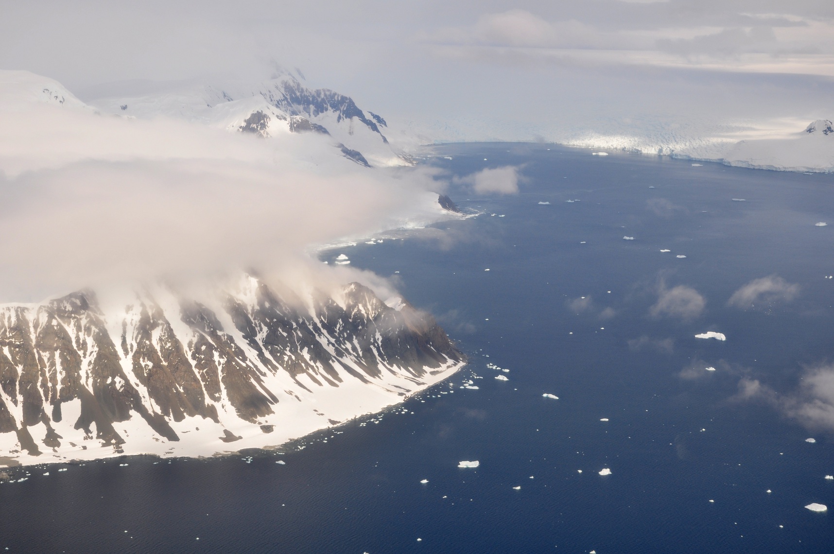
English: This picture is from the SW Antarctic Peninsula region.
It's an aerial view, looking West, from a position over Laubeuf Fjord to a part of Adelaide Island's east coast. In the foreground on the left is Sighing Peak, which forms the NE extremity of Adelaide Island's Wright Peninsula. The mountains behind it are the Stokes Peaks. The channel in front of Sighing Peak is called Cole Channel (and is actually a part of Laubeuf Fjord). The large body of water on the right is Stonehouse Bay. In the upper right hand corner of the picture, at the western end of Stonehouse Bay, is the huge and heavily crevassed Shambles Glacier; Adelaide Island's largest glacier. To the right of the glacier, at the extreme edge of the picture, is Dewar Nunatak. |
| Date | |
| Source | Own work |
| Author | Vincent van Zeijst |
•
| Camera location | 67° 23′ 54.66″ S, 67° 52′ 19.78″ W | View this and other nearby images on: OpenStreetMap |
|---|
Licensing
I, the copyright holder of this work, hereby publish it under the following license:
This file is licensed under the Creative Commons Attribution-Share Alike 3.0 Unported license.
- You are free:
- to share – to copy, distribute and transmit the work
- to remix – to adapt the work
- Under the following conditions:
- attribution – You must give appropriate credit, provide a link to the license, and indicate if changes were made. You may do so in any reasonable manner, but not in any way that suggests the licensor endorses you or your use.
- share alike – If you remix, transform, or build upon the material, you must distribute your contributions under the same or compatible license as the original.
Captions
Add a one-line explanation of what this file represents
Items portrayed in this file
depicts
9 February 2011
67°23'54.661"S, 67°52'19.780"W
0.004 second
10
50 millimetre
200
image/jpeg
840f622a5e182f30bfe60678ca5d89d19c295dad
460,034 byte
1,140 pixel
1,716 pixel
File history
Click on a date/time to view the file as it appeared at that time.
| Date/Time | Thumbnail | Dimensions | User | Comment | |
|---|---|---|---|---|---|
| current | 22:29, 10 March 2011 | | 1,716 × 1,140 (449 KB) | Loranchet | {{Information |Description ={{en|1=This picture is from the SW Antarctic Peninsula region. It's an aerial view, looking West, from a position over Laubeuf Fjord to a part of Adelaide Island's east coast. In the foreground on the left is Sighing Peak, w |
File usage
The following pages on the English Wikipedia use this file (pages on other projects are not listed):
Global file usage
The following other wikis use this file:
- Usage on arz.wikipedia.org
- Usage on azb.wikipedia.org
- Usage on ceb.wikipedia.org
- Usage on de.wikipedia.org
- Usage on es.wikipedia.org
- Usage on id.wikipedia.org
- Usage on it.wikipedia.org
- Usage on lld.wikipedia.org
- Usage on mk.wikipedia.org
- Usage on nn.wikipedia.org
- Usage on pl.wikipedia.org
- Usage on sv.wikipedia.org
- Usage on www.wikidata.org
- Usage on zh.wikipedia.org
Metadata
This file contains additional information, probably added from the digital camera or scanner used to create or digitize it.
If the file has been modified from its original state, some details may not fully reflect the modified file.
| Camera manufacturer | NIKON CORPORATION |
|---|---|
| Camera model | NIKON D5000 |
| Exposure time | 1/250 sec (0.004) |
| F-number | f/10 |
| ISO speed rating | 200 |
| Date and time of data generation | 13:24, 9 February 2011 |
| Lens focal length | 50 mm |
| Orientation | Normal |
| Software used | Ver.1.00 |
| File change date and time | 13:24, 9 February 2011 |
| Y and C positioning | Co-sited |
| Exposure Program | Not defined |
| Exif version | 2.21 |
| Date and time of digitizing | 13:24, 9 February 2011 |
| Image compression mode | 2 |
| Exposure bias | 0 |
| Maximum land aperture | 4.6 APEX (f/4.92) |
| Metering mode | Pattern |
| Light source | Unknown |
| Flash | Flash did not fire, auto mode |
| DateTime subseconds | 50 |
| DateTimeOriginal subseconds | 50 |
| DateTimeDigitized subseconds | 50 |
| Color space | sRGB |
| Sensing method | One-chip color area sensor |
| Custom image processing | Normal process |
| Exposure mode | Auto exposure |
| White balance | Auto white balance |
| Digital zoom ratio | 1 |
| Focal length in 35 mm film | 75 mm |
| Scene capture type | Landscape |
| Contrast | Normal |
| Saturation | Normal |
| Sharpness | Normal |
| Subject distance range | Unknown |
,_Adelaide_Island,_Stonehouse_Bay.JPG)