File:Angleseymôncloseup.png
From Wikipedia, the free encyclopedia
No higher resolution available.
Angleseymôncloseup.png (541 × 522 pixels, file size: 14 KB, MIME type: image/png)
| This is a file from the Wikimedia Commons. Information from its description page there is shown below. Commons is a freely licensed media file repository. You can help. |
Summary
| DescriptionAngleseymôncloseup.png |
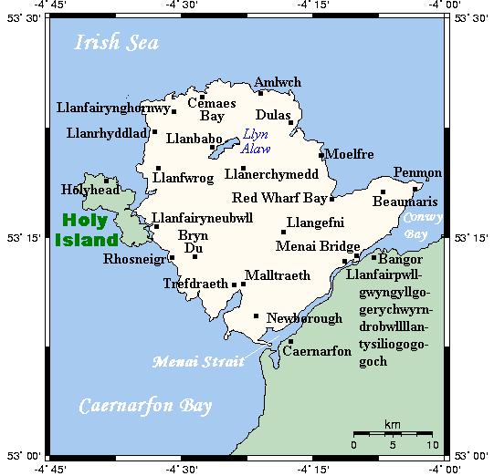
English: A map showing the Isle of Anglesey/Ynys Môn and nearby areas. This map's source is here, with the uploader's modifications, and the GMT homepage says that the tools are released under the GNU General Public License. |
| Date | 10 July 2007 (original upload date) |
| Source | Transferred from en.wikipedia to Commons. |
| Author | Kelisi at English Wikipedia |
Licensing
Kelisi at the English-language Wikipedia, the copyright holder of this work, hereby publishes it under the following license:
| This file is licensed under the Creative Commons Attribution-Share Alike 3.0 Unported license. Subject to disclaimers. | ||
| Attribution: Kelisi at the English-language Wikipedia | ||
| ||
| This licensing tag was added to this file as part of the GFDL licensing update.http://creativecommons.org/licenses/by-sa/3.0/CC BY-SA 3.0Creative Commons Attribution-Share Alike 3.0truetrue |

|
Permission is granted to copy, distribute and/or modify this document under the terms of the GNU Free Documentation License, Version 1.2 or any later version published by the Free Software Foundation; with no Invariant Sections, no Front-Cover Texts, and no Back-Cover Texts. A copy of the license is included in the section entitled GNU Free Documentation License. Subject to disclaimers.http://www.gnu.org/copyleft/fdl.htmlGFDLGNU Free Documentation Licensetruetrue |
Original upload log
The original description page was here. All following user names refer to en.wikipedia.
- 2007-07-11 16:08 Kelisi 541×522× (14004 bytes) oops again
- 2007-07-10 23:02 Kelisi 542×522× (13753 bytes) oops
- 2007-07-10 22:53 Kelisi 542×522× (13770 bytes) == Summary == A map showing the Isle of Anglesey/Ynys Môn and nearby areas. This map's source is [http://www.aquarius.ifm-geomar.de/ here], with the uploader's modifications, and the [http://gmt.soest.hawaii.edu/ GMT homepage] says that the tools are rel
Captions
Add a one-line explanation of what this file represents
Items portrayed in this file
depicts
10 July 2007
image/png
e87ab34ecbf75b28832f932decde0a69624efef6
14,004 byte
522 pixel
541 pixel
File history
Click on a date/time to view the file as it appeared at that time.
| Date/Time | Thumbnail | Dimensions | User | Comment | |
|---|---|---|---|---|---|
| current | 15:20, 6 April 2013 | | 541 × 522 (14 KB) | OgreBot | (BOT): Reverting to most recent version before archival |
| 15:20, 6 April 2013 |  | 542 × 522 (13 KB) | OgreBot | (BOT): Uploading old version of file from en.wikipedia; originally uploaded on 2007-07-10 23:02:09 by Kelisi | |
| 15:20, 6 April 2013 |  | 542 × 522 (13 KB) | OgreBot | (BOT): Uploading old version of file from en.wikipedia; originally uploaded on 2007-07-10 22:53:32 by Kelisi | |
| 19:26, 5 April 2013 |  | 541 × 522 (14 KB) | Hogweard | == {{int:filedesc}} == {{Information |Description={{en|A map showing the Isle of Anglesey/Ynys Môn and nearby areas. This map's source is [http://www.aquarius.ifm-geomar.de/ here], with the uploader's modifications, and the [http://gmt.soest.hawaii.ed... |
File usage
The following pages on the English Wikipedia use this file (pages on other projects are not listed):
Global file usage
The following other wikis use this file:
- Usage on de.wikipedia.org
- Usage on el.wikipedia.org
- Usage on fi.wikipedia.org
- Usage on fr.wikipedia.org
- Usage on nl.wikipedia.org
- Usage on pl.wikipedia.org
- Usage on zh.wikipedia.org
Metadata
This file contains additional information, probably added from the digital camera or scanner used to create or digitize it.
If the file has been modified from its original state, some details may not fully reflect the modified file.
| File change date and time | 17:13, 11 July 2007 |
|---|
Retrieved from "https://en.wikipedia.org/wiki/File:Angleseymôncloseup.png"