File:Androscoggin_watershed.png
From Wikipedia, the free encyclopedia
No higher resolution available.
Androscoggin_watershed.png (300 × 277 pixels, file size: 59 KB, MIME type: image/png)
| This is a file from the Wikimedia Commons. Information from its description page there is shown below. Commons is a freely licensed media file repository. You can help. |
Summary
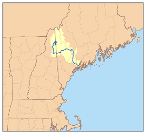
| DescriptionAndroscoggin watershed.png | This is a map of the Androscoggin River watershed. I, Pfly, made it, based on USGS data. |
| Date | |
| Source | Own work |
| Author | Pfly |

|
This map image could be re-created using vector graphics as an SVG file. This has several advantages; see Commons:Media for cleanup for more information. If an SVG form of this image is available, please upload it and afterwards replace this template with
{{vector version available|new image name}}.
It is recommended to name the SVG file “Androscoggin watershed.svg”—then the template Vector version available (or Vva) does not need the new image name parameter. |
Licensing
I, the copyright holder of this work, hereby publish it under the following license:
This file is licensed under the Creative Commons Attribution-Share Alike 2.5 Generic license.
- You are free:
- to share – to copy, distribute and transmit the work
- to remix – to adapt the work
- Under the following conditions:
- attribution – You must give appropriate credit, provide a link to the license, and indicate if changes were made. You may do so in any reasonable manner, but not in any way that suggests the licensor endorses you or your use.
- share alike – If you remix, transform, or build upon the material, you must distribute your contributions under the same or compatible license as the original.
Captions
Add a one-line explanation of what this file represents
Items portrayed in this file
depicts
5 January 2007
image/png
38a2c09fdc838ce5bb4702c2686f969a049ad998
60,747 byte
277 pixel
300 pixel
File history
Click on a date/time to view the file as it appeared at that time.
| Date/Time | Thumbnail | Dimensions | User | Comment | |
|---|---|---|---|---|---|
| current | 05:29, 6 January 2007 | | 300 × 277 (59 KB) | Pfly | {{Information |Description=This is a map of the Androscoggin River watershed. I, Pfly, made it, based on USGS data. |Source=Own work. |Date=January 5, 2007 |Author=Pfly |Permission= |other_versions |
File usage
The following pages on the English Wikipedia use this file (pages on other projects are not listed):
Global file usage
The following other wikis use this file:
- Usage on bg.wikipedia.org
- Usage on de.wikipedia.org
- Usage on es.wikipedia.org
- Usage on fr.wikipedia.org
- Usage on it.wikipedia.org
- Usage on pl.wikipedia.org
- Usage on ru.wikipedia.org
Retrieved from "https://en.wikipedia.org/wiki/File:Androscoggin_watershed.png"