File:Andreanof_Map_Delarof.jpg
From Wikipedia, the free encyclopedia
No higher resolution available.
Andreanof_Map_Delarof.jpg (560 × 249 pixels, file size: 60 KB, MIME type: image/jpeg)
| This is a file from the Wikimedia Commons. Information from its description page there is shown below. Commons is a freely licensed media file repository. You can help. |
Summary
| DescriptionAndreanof Map Delarof.jpg |
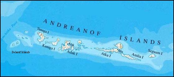
English: Delarof Islands, Aleutian Islands
Deutsch: Delarof-Inseln (Aleuten) |
| Date | |
| Source | http://www.lib.utexas.edu/maps/united_states/united_states_wall_2002_ak.jpg, cropped |
| Author | nationalatlas.gov/U.S. Geological Survey, edited by Ulrich Kaden |
Licensing
| Public domainPublic domainfalsefalse |
This image is in the public domain in the United States because it only contains materials that originally came from the United States Geological Survey, an agency of the United States Department of the Interior. For more information, see the official USGS copyright policy.
Bahasa Indonesia ∙ català ∙ čeština ∙ Deutsch ∙ eesti ∙ English ∙ español ∙ français ∙ galego ∙ italiano ∙ Nederlands ∙ português ∙ polski ∙ sicilianu ∙ suomi ∙ Tiếng Việt ∙ Türkçe ∙ български ∙ македонски ∙ русский ∙ മലയാളം ∙ 한국어 ∙ 日本語 ∙ 中文 ∙ 中文(简体) ∙ 中文(繁體) ∙ العربية ∙ فارسی ∙ +/− |
Captions
Add a one-line explanation of what this file represents
Items portrayed in this file
depicts
13 February 2009
image/jpeg
6bbc7153484d1476a607609ad68ab6cb70ec5fac
61,748 byte
249 pixel
560 pixel
File history
Click on a date/time to view the file as it appeared at that time.
| Date/Time | Thumbnail | Dimensions | User | Comment | |
|---|---|---|---|---|---|
| current | 15:41, 13 February 2009 | | 560 × 249 (60 KB) | Ulrich Kaden | {{Information |Description={{en|1=Delarof Islands}} {{de|1=Delarof-Inseln (Aleuten)}} |Source=http://www.lib.utexas.edu/maps/united_states/united_states_wall_2002_ak.jpg |Author=U.S. Geological Survey / Own Work |Date=13.2. 2009 |Permission= |other_versio |
File usage
The following pages on the English Wikipedia use this file (pages on other projects are not listed):
Global file usage
The following other wikis use this file:
- Usage on bg.wikipedia.org
- Usage on ca.wikipedia.org
- Usage on cs.wikipedia.org
- Usage on de.wikipedia.org
- Usage on fr.wikipedia.org
- Usage on it.wikipedia.org
- Usage on ja.wikipedia.org
- Usage on lt.wikipedia.org
- Usage on ru.wikipedia.org
- Usage on uk.wikipedia.org
- Usage on www.wikidata.org
Metadata
This file contains additional information, probably added from the digital camera or scanner used to create or digitize it.
If the file has been modified from its original state, some details may not fully reflect the modified file.
| Orientation | Normal |
|---|---|
| Horizontal resolution | 400 dpi |
| Vertical resolution | 400 dpi |
| Software used | GIMP 2.6.3 |
| File change date and time | 16:26, 13 February 2009 |
| Color space | Uncalibrated |
Retrieved from "https://en.wikipedia.org/wiki/File:Andreanof_Map_Delarof.jpg"