File:Ammanford_railway_station_-_geograph.org.uk_-_4345208.jpg
From Wikipedia, the free encyclopedia
Size of this preview: 618 × 599 pixels. Other resolutions: 247 × 240 pixels | 495 × 480 pixels.
Original file (800 × 776 pixels, file size: 217 KB, MIME type: image/jpeg)
| This is a file from the Wikimedia Commons. Information from its description page there is shown below. Commons is a freely licensed media file repository. You can help. |
Summary
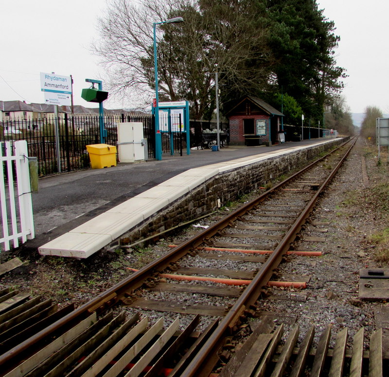
| DescriptionAmmanford railway station - geograph.org.uk - 4345208.jpg |
English: Ammanford railway station. Viewed from the Station Road level crossing, looking south. Ammanford is a single-track, single-platform station on the Heart of Wales line between Pantyffynnon station to the south and Llandybie station to the north. |
| Date | |
| Source | From geograph.org.uk |
| Author | Jaggery |
| Permission (Reusing this file) |
Creative Commons Attribution Share-alike license 2.0 |
| Attribution (required by the license) InfoField | Jaggery / Ammanford railway station / |
InfoField | Jaggery / Ammanford railway station |
| Camera location | 51° 47′ 45.17″ N, 3° 59′ 48.75″ W | View this and other nearby images on: OpenStreetMap |
|---|
Licensing

|
This image was taken from the Geograph project collection. See this photograph's page on the Geograph website for the photographer's contact details. The copyright on this image is owned by Jaggery and is licensed for reuse under the Creative Commons Attribution-ShareAlike 2.0 license.
|
This file is licensed under the Creative Commons Attribution-Share Alike 2.0 Generic license.
Attribution: Jaggery
- You are free:
- to share – to copy, distribute and transmit the work
- to remix – to adapt the work
- Under the following conditions:
- attribution – You must give appropriate credit, provide a link to the license, and indicate if changes were made. You may do so in any reasonable manner, but not in any way that suggests the licensor endorses you or your use.
- share alike – If you remix, transform, or build upon the material, you must distribute your contributions under the same or compatible license as the original.
Captions
Add a one-line explanation of what this file represents
Items portrayed in this file
depicts
11 February 2015
51°47'45.172"N, 3°59'48.754"W
image/jpeg
01daffa865587609152ff99ac38d8a38328430d6
222,039 byte
776 pixel
800 pixel
File history
Click on a date/time to view the file as it appeared at that time.
| Date/Time | Thumbnail | Dimensions | User | Comment | |
|---|---|---|---|---|---|
| current | 15:47, 4 August 2015 | | 800 × 776 (217 KB) | Salen9 | == {{int:filedesc}} == {{Information |Description={{en|1=Ammanford railway station. Viewed from the Station Road level crossing, looking south. Ammanford is a single-track, single-platform station on the Heart of Wales line between Pantyffynnon station... |
File usage
The following pages on the English Wikipedia use this file (pages on other projects are not listed):
Global file usage
The following other wikis use this file:
- Usage on fi.wikipedia.org