File:Aesica_Roman_Fort_-_geograph.org.uk_-_251498.jpg
From Wikipedia, the free encyclopedia
No higher resolution available.
Aesica_Roman_Fort_-_geograph.org.uk_-_251498.jpg (600 × 450 pixels, file size: 103 KB, MIME type: image/jpeg)
| This is a file from the Wikimedia Commons. Information from its description page there is shown below. Commons is a freely licensed media file repository. You can help. |
Summary
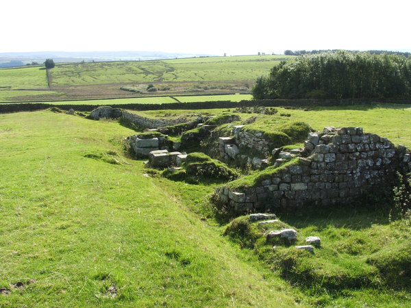
| DescriptionAesica Roman Fort - geograph.org.uk - 251498.jpg |
English: Aesica Roman Fort Fort on Hadrian's Wall. |
| Date | |
| Source | From geograph.org.uk |
| Author | mauldy |
| Attribution (required by the license) InfoField | mauldy / Aesica Roman Fort / |
InfoField | mauldy / Aesica Roman Fort |
| Camera location | 54° 59′ 43″ N, 2° 27′ 54″ W | View this and other nearby images on: OpenStreetMap |
|---|
Licensing

|
This image was taken from the Geograph project collection. See this photograph's page on the Geograph website for the photographer's contact details. The copyright on this image is owned by mauldy and is licensed for reuse under the Creative Commons Attribution-ShareAlike 2.0 license.
|
This file is licensed under the Creative Commons Attribution-Share Alike 2.0 Generic license.
Attribution: mauldy
- You are free:
- to share – to copy, distribute and transmit the work
- to remix – to adapt the work
- Under the following conditions:
- attribution – You must give appropriate credit, provide a link to the license, and indicate if changes were made. You may do so in any reasonable manner, but not in any way that suggests the licensor endorses you or your use.
- share alike – If you remix, transform, or build upon the material, you must distribute your contributions under the same or compatible license as the original.
- Remove redundant categories and try to put this image in the most specific category/categories
- Remove this template
- The location categories are based on information from this geonames tool and this OpenStreetMap tool combined with a database. You can also have a look at this tool from mysociety.
- The topic category from Geograph was Roman archaeological site (find similar images archaeological site at Geograph)
English | suomi | français | galego | עברית | magyar | македонски | മലയാളം | português | português do Brasil | Türkçe | +/−
Captions
Add a one-line explanation of what this file represents
Items portrayed in this file
depicts
30 September 2006
54°59'43.1"N, 2°27'54.0"W
image/jpeg
2e447f858ff3e65d0ed815894996b304057cb019
105,946 byte
450 pixel
600 pixel
File history
Click on a date/time to view the file as it appeared at that time.
| Date/Time | Thumbnail | Dimensions | User | Comment | |
|---|---|---|---|---|---|
| current | 16:32, 25 August 2010 | | 600 × 450 (103 KB) | GeographBot | == {{int:filedesc}} == {{Information |description={{en|1=Aesica Roman Fort Fort on Hadrian's Wall.}} |date=2006-09-30 |source=From [http://www.geograph.org.uk/photo/251498 geograph.org.uk] |author=[http://www.geograph.org.uk/profile/6218 mauldy] |permissi |
File usage
The following pages on the English Wikipedia use this file (pages on other projects are not listed):
Global file usage
The following other wikis use this file:
- Usage on cs.wikipedia.org
- Usage on de.wikipedia.org
- Usage on es.wikipedia.org
- Usage on fr.wikipedia.org
- Usage on it.wikipedia.org
- Usage on www.wikidata.org
Metadata
This file contains additional information, probably added from the digital camera or scanner used to create or digitize it.
If the file has been modified from its original state, some details may not fully reflect the modified file.
| _error | 0 |
|---|