File:Index_-_Operational_Navigation_Chart_-_Arctic.png
From Wikipedia, the free encyclopedia
Size of this preview: 602 × 599 pixels. Other resolutions: 241 × 240 pixels | 482 × 480 pixels | 834 × 830 pixels.
Original file (834 × 830 pixels, file size: 402 KB, MIME type: image/png)
| This is a file from the Wikimedia Commons. Information from its description page there is shown below. Commons is a freely licensed media file repository. You can help. |
Summary
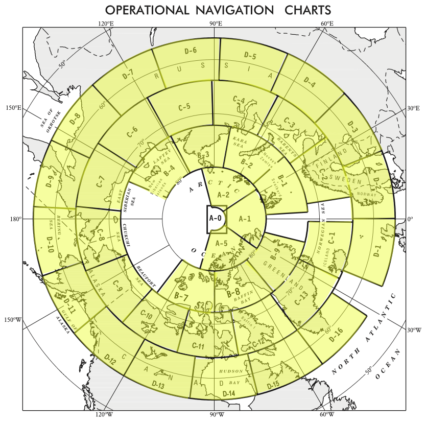
| DescriptionIndex - Operational Navigation Chart - Arctic.png |
English: Index map of the Arctic for the 1:1,000,000 Operational Navigation Chart series. |
||
| Date | Unknown date | ||
| Source |
|
||
| Author | Unknown authorUnknown author |
Licensing
| Public domainPublic domainfalsefalse |
This file is in the public domain because per http://www.lib.utexas.edu/maps/faq.html#3.html all maps in the Perry-Castañeda Library that are not clearly marked as copyrighted are in the public domain.
|
Captions
Add a one-line explanation of what this file represents
Items portrayed in this file
depicts
image/png
File history
Click on a date/time to view the file as it appeared at that time.
| Date/Time | Thumbnail | Dimensions | User | Comment | |
|---|---|---|---|---|---|
| current | 20:37, 6 September 2014 | | 834 × 830 (402 KB) | Revent | User created page with UploadWizard |
File usage
No pages on the English Wikipedia use this file (pages on other projects are not listed).
Metadata
This file contains additional information, probably added from the digital camera or scanner used to create or digitize it.
If the file has been modified from its original state, some details may not fully reflect the modified file.
| Horizontal resolution | 28.35 dpc |
|---|---|
| Vertical resolution | 28.35 dpc |