Docidava (castra)
Fort in the Roman province of Dacia From Wikipedia, the free encyclopedia
Docidava[3] was a fort in the Roman province of Dacia in the 2nd and 3rd centuries AD.[1][2] Remains of the surrounding vicus were also unearthed.[2] The castra's ruins are located in Buciumi, Romania.[1][2]
| Docidava | |
|---|---|
 Principia | |
 Location within Romania | |
| Alternative name(s) | castra of Buciumi |
| Founded during the reign of | Trajan |
| Founded | 2nd century AD[1] |
| Abandoned | 3rd century AD[1] |
| Place in the Roman world | |
| Province | Dacia Superior |
| Administrative unit | Dacia Porolissensis |
| Limes | Porolissensis |
| Directly connected to | |
| Structure | |
| — Stone structure — | |
| Size and area | 134 m × 167 m (2.2 ha) |
| — Wood and earth structure — | |
| Size and area | 125 m × 160 m (2.0 ha) |
| Stationed military units | |
| — Cohorts — | |
| I Augusta Ituraeorum, II Augusta Brittonum | |
| Location | |
| Coordinates | 47.048292°N 23.044678°E |
| Altitude | 373 m |
| Place name | Grădiște |
| Town | Buciumi |
| Country | |
| Reference | |
| RO-LMI | SJ-I-s-A-04862[2] |
| RO-RAN | 140388.03[1] |
| Site notes | |
| Recognition | |
| Condition | Ruined |
| Exhibitions | County Museum of History and Art, Zalău |
It controlled the road through the Rag pass cutting through Meseș Mountains which was blocked by a stone wall (clausura) directing the traffic to a guarded entrance, and the road from the fort of Bologa towards the central area of the NW segment of Limes Porolissensis. It was supported by two fortlets and approximately 23 towers.[4]
History
Three construction phases were highlighted:[5]
1. The earthen fort, rectangular plan, 125x160m, wood and earth walls 10 m thick and 1.75 m high; simple ditches with an opening of 9-10 m and a depth of 1.50-2 m; porta praetoria on the S side; traces of barracks in the praetentura. Troops: the I Augusta Ituraeorum cohort was initially and after 114, cohort II Augusta Nerviana milliaria Brittonum;
2. The stone fort, built at the beginning of the 3rd century during the reign of Caracalla (211-217) and occupied by cohort II Augusta Nerviana milliaria Brittonum, which also bore the name Antoniniana (Caracalla); rectangular plan with rounded corners, 134x167 m, with the same orientation as the previous fort; 1.20 thick walls in opus incertum; trapezoidal corner towers, 5.40x5.50x5.50x7m; square curtain towers on the S side; three gates with double entrances; porta decumana simple entrance; apart from the porta praetoria which has quadrangular towers, the others have semicircular towers; inside: Principia 26x32 m; atrium 15.50x16.20 m; basilica with court 8.25x26m; behind aedes princiorum flanked by two chambers; in latus sinistrum two horrea 12x26 m; in latus dextrum, praetorium 28x30m; in the praetentura 6 stone barracks, three on each side of the via praetoria.
3. Probably during the reign of Severus Alexander (222-235), some buildings were built over the via sagularis; on the S side near the porta praetoria, two buildings were built over the wave and over the via sagularis; these buildings seem to date, however, to the late 3rd century.
To the NE of the fort are traces of civil settlements; to the SE were probably the bath.
Gallery
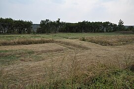 Via Praetoria
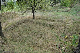 Porta Praetoria
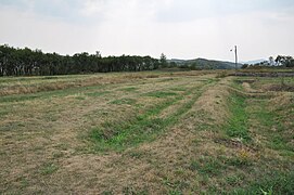 Via Principalis
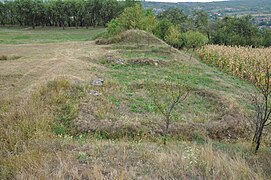 Porta Principalis Dextra
 Porta Principalis Sinistra
 South round tower
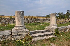 Columns of Principia
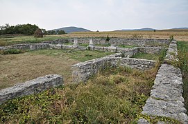 Principia


See also
Notes
External links
Wikiwand in your browser!
Seamless Wikipedia browsing. On steroids.
Every time you click a link to Wikipedia, Wiktionary or Wikiquote in your browser's search results, it will show the modern Wikiwand interface.
Wikiwand extension is a five stars, simple, with minimum permission required to keep your browsing private, safe and transparent.