Top Qs
Timeline
Chat
Perspective
List of California wildfires
From Wikipedia, the free encyclopedia
Remove ads
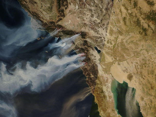
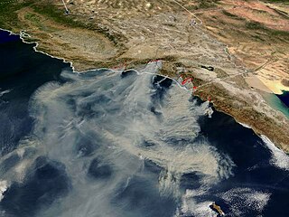
This is a partial and incomplete list of wildfires in the US state of California. California has dry, windy, and often hot weather conditions from spring through late autumn that can produce moderate to severe wildfires. Pre-1800, when the area was much more forested and the ecology much more resilient, 4.4-11.9 million acres (1.8-4.8 million hectares) of forest and shrubland burned annually.[2] California land area totals 99,813,760 or roughly 100 million acres, so since 2000, the area that burned annually has ranged between 90,000 acres, or 0.09%, and 1,590,000 acres, or 1.59% of the total land of California.[3] During the 2020 wildfire season alone, over 8,100 fires contributed to the burning of nearly 4.5 million acres of land.


Remove ads
Background
The timing of "fire season" in California is variable, depending on the amount of prior winter and spring precipitation, the frequency and severity of weather such as heat waves and wind events, and moisture content in vegetation. Northern California typically sees wildfire activity between late spring and early fall, peaking in the summer with hotter and drier conditions. Occasional cold frontal passages can bring wind and lightning. The timing of fire season in Southern California is similar, peaking between late spring and fall. The severity and duration of peak activity in either part of the state is modulated in part by weather events: downslope/offshore wind events can lead to critical fire weather, while onshore flow and Pacific weather systems can bring conditions that hamper wildfire growth.[4][5]
Remove ads
Causes
Summarize
Perspective
Climate change in California has lengthened the fire season and made it more extreme from the middle of the 20th century.[6][7]
Since the early 2010s, wildfires in California have grown more dangerous because of the accumulation of wood fuel in forests, higher population, and aging and often poorly maintained electricity transmission and distribution lines, particularly in areas serviced by Pacific Gas and Electric.[8][9][10] United States taxpayers pay about US$3 billion a year to fight wildfires, and big fires can lead to billions of dollars in property losses.[11] At times, these wildfires are fanned or made worse by strong, dry winds, known as Diablo winds when they occur in the northern part of the state and Santa Ana winds when they occur in the south. However, from a historical perspective, it has been estimated that prior to 1850, about 4.5 million acres (17,000 km2) burned yearly, in fires that lasted for months, with wildfire activity peaking roughly every 30 years, when up to 11.8 million acres (47,753 km3) of land burned.[12][13] The much larger wildfire seasons in the past can be attributed to the policy of Native Californians regularly setting controlled burns and allowing natural fires to run their course, which prevented devastating wildfires from overrunning the state.[12] There are conservation issues that prevent some controlled burns necessary to lessen the damage for when a wildfire starts.[14]
Remove ads
Effects
More than 350,000 people in California live in towns sited completely within zones deemed to be at very high risk of fire. In total, more than 2.7 million people live in "very high fire hazard severity zones", which also include areas at lesser risk.[15]
On lands under CAL FIRE's jurisdictional protection (i.e. not federal or local responsibility areas), the majority of wildfire ignitions since 1980 have been caused by humans. The four most common ignition sources for wildfires on CAL FIRE-protected lands are, in order: equipment use, powerlines, arson, and lightning.[16]
A 2023 study found that these wildfires are affecting the California ecosystem and disrupting the habitats.[17][18] It found that in the 2020 and 2021 fire seasons 58% of the area affected by wildfires occurred in those two seasons since 2012.[17][18] These two fires destroyed 30% of the habitat of 50 species as well as 100 species that had 10% of their habitats burn. 5-14% of the species' habitats burned at a "high severity."[17][18]
Statistics
Summarize
Perspective
Area burned per year


Starting in 2001, the National Interagency Fire Center began keeping more accurate records on the total fire acreage burned in each state.[19]
Remove ads
Largest wildfires
Summarize
Perspective
As of October 2, 2024[update], the 20 largest wildfires since 1932 according to the California Department of Forestry and Fire Protection have been:[57]
Remove ads
Deadliest wildfires
Summarize
Perspective
As of January 28, 2025[update], the 20 deadliest wildfires since 1932 according to the California Department of Forestry and Fire Protection have been:[58]
Remove ads
Most destructive wildfires
Summarize
Perspective
As of January 28, 2025[update], the 20 most destructive wildfires since 1932 according to the California Department of Forestry and Fire Protection have been:[59]
Remove ads
Areas of repeated ignition
Summarize
Perspective

In some parts of California, fires recur with some regularity. In Oakland, for example, fires of various size and ignition occurred in 1923, 1931, 1933, 1937, 1946, 1955, 1960, 1961, 1968, 1970, 1980, 1990, 1991, 1995, 2002, 2008, and 2024.[60][61][62] Orange County, Riverside County, San Bernardino County, and Los Angeles County are other examples. Orange and San Bernardino counties share a border that runs north to south through the Chino Hills State Park, with the park's landscape ranging from large green coastal sage scrub, grassland, and woodland, to areas of brown sparsely dense vegetation made drier by droughts or hot summers. The valley's grass and barren land can become easily susceptible to dry spells and drought, therefore making it a prime spot for brush fires and conflagrations, many of which have occurred since 1914. Hills and canyons have seen brush or wildfires in 1914, the 1920s, 1930s, 1940s, 1950s, 1960s, 1970s, 1980s, 1990s, 2000s, and into today.[63]
On occasion, lightning strikes from thunderstorms may also spark wildfires in areas that have seen past ignition. Examples of this are the 1999 Megram Fire, the 2008 California wildfires,[citation needed] as well as the LNU and SCU Lightning Complex fires (both in 2020).
Remove ads
See also
References
External links
Wikiwand - on
Seamless Wikipedia browsing. On steroids.
Remove ads
