Blue Whale Harbour (54°4′S 37°1′W) is a small, sheltered anchorage entered 1 nautical mile (2 km) west-southwest of Cape Constance, along the north coast of South Georgia Island. It was charted in 1930 by Discovery Investigations personnel, along with its constituent features. It is named for the blue whale, a commercially important species which was once widely distributed in polar and subpolar waters; numbers are now very small.[1]
| Blue Whale Harbour | |
|---|---|
 Click on the map for a fullscreen view | |
| Location | |
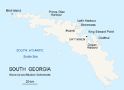
| Location | South Atlantic Ocean, Antarctica |
| Coordinates | 54°4′S 37°1′W |
| Details | |
| Opened | 1930 |
| Operated by | Discovery Investigations personnel (1930s) |
| Type of harbour | Harbour |
Overview
The headland Brow Point defines the harbour's westernmost boundary.[2] Shelter Point projects into the west side of the harbour.[3] Blue Whale Mountain rises to 490 metres (1,600 ft) at the west side of Brow Point.[4]
Clarity Point is a headland on the east shore of the harbor. The feature was charted and initially named Clear Point by DI personnel. The name was amended by the United Kingdom Antarctic Place-Names Committee (UKAPC) in 1991 to avoid duplication of Clear Point at Leith Harbor in Stromness Bay.[5] Cone Point marks the east side of the entrance to the harbour. The name appears to be first used on a 1931 British Admiralty chart.[6]
References
Wikiwand in your browser!
Seamless Wikipedia browsing. On steroids.
Every time you click a link to Wikipedia, Wiktionary or Wikiquote in your browser's search results, it will show the modern Wikiwand interface.
Wikiwand extension is a five stars, simple, with minimum permission required to keep your browsing private, safe and transparent.