Artush
County-level city in Xinjiang, China From Wikipedia, the free encyclopedia
Artush[3][4] (/ɑːrˈtʊʃ/ ar-TUUSH; also transliterated as Artux[5] or Atush[6]) is a county-level city and the capital of Kizilsu Kyrgyz Autonomous Prefecture in Xinjiang, China. The government seat is in Guangming Road Subdistrict.[7] As of 2018, it has a population of 285,507 people, 81.4 per cent of whom are Uyghurs.[8]
Artush
Artux, Atush | |
|---|---|
 Tomb of Sultan Satuk Bughra Khan | |
| Coordinates (Artush municipal government): 39°42′58″N 76°10′06″E | |
| Country | China |
| Autonomous region | Xinjiang |
| Autonomous prefecture | Kizilsu |
| Municipal seat | Guangming Road Subdistrict |
| Area | |
| • Total | 15,697.78 km2 (6,060.95 sq mi) |
| Population (2020)[2] | |
| • Total | 290,936 |
| • Density | 19/km2 (48/sq mi) |
| Demographics | |
| • Major ethnic groups |
|
| Time zone | UTC+8 (China Standard[a]) |
| Website | www |
| Artush | |||||||||||
|---|---|---|---|---|---|---|---|---|---|---|---|
| Chinese name | |||||||||||
| Simplified Chinese | 阿图什 | ||||||||||
| Traditional Chinese | 阿圖什 | ||||||||||
| |||||||||||
| Uyghur name | |||||||||||
| Uyghur | ئاتۇش | ||||||||||
| |||||||||||
| Kyrgyz name | |||||||||||
| Kyrgyz | ارتىش Артыш Artysh | ||||||||||
History


In January 1943, Artush County was established.[1][9]
In June 1986, Artush County became Artush City.[1][9]
In 2018, the dome of Eshtachi Mosque (39°41′33.46″N 76°7′25.88″E) was removed.[3][4] In recent times other mosques have been taken down too.
At 10:23 pm on January 19, 2020, a 5.2 magnitude earthquake struck in Artush.[5]
Geography and climate
It is situated in the northwest part of the Tarim Basin, south of the Tien Shan mountains. Like most of Xinjiang, Artush has a cool arid climate (Köppen BWk) with hot summers, freezing winters and little precipitation and low humidity year-round. The annual mean temperature is 13.1 °C (55.6 °F) and the annual mean precipitation around 95 millimetres or 3.74 inches. Most of this limited precipitation falls from erratic thunderstorms in the summer months, although at this time relative humidity averages less than 35 percent.
| Climate data for Artush, elevation 1,268 m (4,160 ft), (1991–2020 normals, extremes 1981–2010) | |||||||||||||
|---|---|---|---|---|---|---|---|---|---|---|---|---|---|
| Month | Jan | Feb | Mar | Apr | May | Jun | Jul | Aug | Sep | Oct | Nov | Dec | Year |
| Record high °C (°F) | 19.0 (66.2) |
18.6 (65.5) |
28.4 (83.1) |
34.9 (94.8) |
36.0 (96.8) |
39.5 (103.1) |
41.0 (105.8) |
41.8 (107.2) |
37.0 (98.6) |
30.9 (87.6) |
25.1 (77.2) |
18.9 (66.0) |
41.8 (107.2) |
| Mean daily maximum °C (°F) | 0.0 (32.0) |
6.0 (42.8) |
15.2 (59.4) |
23.3 (73.9) |
27.8 (82.0) |
31.7 (89.1) |
33.5 (92.3) |
32.2 (90.0) |
27.7 (81.9) |
20.5 (68.9) |
11.1 (52.0) |
2.0 (35.6) |
19.2 (66.7) |
| Daily mean °C (°F) | −5.0 (23.0) |
0.8 (33.4) |
9.7 (49.5) |
17.2 (63.0) |
21.6 (70.9) |
25.3 (77.5) |
27.1 (80.8) |
25.9 (78.6) |
21.3 (70.3) |
13.9 (57.0) |
5.1 (41.2) |
−2.7 (27.1) |
13.4 (56.0) |
| Mean daily minimum °C (°F) | −9.0 (15.8) |
−3.9 (25.0) |
4.4 (39.9) |
11.5 (52.7) |
15.8 (60.4) |
19.3 (66.7) |
21.0 (69.8) |
19.8 (67.6) |
15.3 (59.5) |
7.9 (46.2) |
0.1 (32.2) |
−6.3 (20.7) |
8.0 (46.4) |
| Record low °C (°F) | −20.5 (−4.9) |
−20.7 (−5.3) |
−7.9 (17.8) |
−0.1 (31.8) |
4.1 (39.4) |
8.1 (46.6) |
11.4 (52.5) |
11.5 (52.7) |
6.5 (43.7) |
−2.2 (28.0) |
−12.6 (9.3) |
−19.9 (−3.8) |
−20.7 (−5.3) |
| Average precipitation mm (inches) | 3.3 (0.13) |
8.2 (0.32) |
6.8 (0.27) |
6.0 (0.24) |
15.8 (0.62) |
14.8 (0.58) |
14.5 (0.57) |
15.5 (0.61) |
10.9 (0.43) |
5.8 (0.23) |
3.1 (0.12) |
3.6 (0.14) |
108.3 (4.26) |
| Average precipitation days (≥ 0.1 mm) | 2.2 | 2.3 | 1.9 | 2.0 | 4.1 | 5.5 | 5.6 | 4.7 | 3.9 | 1.3 | 0.7 | 2.2 | 36.4 |
| Average snowy days | 6.2 | 3.9 | 1.0 | 0.1 | 0 | 0 | 0 | 0 | 0 | 0 | 1.0 | 5.5 | 17.7 |
| Average relative humidity (%) | 63 | 51 | 37 | 29 | 31 | 31 | 33 | 37 | 40 | 43 | 52 | 65 | 43 |
| Mean monthly sunshine hours | 147.7 | 154.2 | 175.4 | 210.1 | 261.9 | 293.1 | 307.3 | 283.3 | 240.7 | 227.9 | 181.4 | 135.3 | 2,618.3 |
| Percent possible sunshine | 49 | 50 | 47 | 52 | 59 | 66 | 68 | 68 | 66 | 67 | 62 | 47 | 58 |
| Source: China Meteorological Administration[10][11] | |||||||||||||
Administrative divisions
Artush includes three subdistricts, one town, six townships and one other area:[12][1][13]
| Name | Simplified Chinese | Hanyu Pinyin | Uyghur (UEY) | Uyghur Latin (ULY) | Kyrgyz (Arabic script) | Kyrgyz (Cyrillic script) | Administrative division code | |
|---|---|---|---|---|---|---|---|---|
| Subdistricts | ||||||||
| Xingfu Road Subdistrict (Bext Road Subdistrict) |
幸福路街道 | Xìngfúlù Jiēdào | بەخت يولى كوچا باشقارمىسى | bext yoli kocha bashqarmisi | باقىت جولۇ كۅچۅ باشقارماسى | Бакыт жолу көчө башкармасы | 653001001 | |
| Guangming Road Subdistrict (Nurluq Road Subdistrict) |
光明路街道 | Guāngmínglù Jiēdào | نۇرلۇق يولى كوچا باشقارمىسى | nurluq yoli kocha bashqarmisi | نۇرلۇق جولۇ كۅچۅ باشقارماسى | Нурлук жолу көчө башкармасы | 653001002 | |
| Xincheng Subdistrict | 新城街道 | Xīnchéng Jiēdào | يېڭى شەھەر كوچا باشقارمىسى | yëngi sheher kocha bashqarmisi | جاڭى شاار كۅچۅ باشقارماسى | Жаңы шаар көчө башкармасы | 653001003 | |
| Towns | ||||||||
| Ustun Artush Town (Shang'atushi[14]) |
上阿图什镇 | Shàng'ātúshí Zhèn | ئۈستۈن ئاتۇش بازىرى | Üstün Atush baziri | ۉستۉن ارتىش شاارچاسى | Үстүн Артыш шаарчасы | 653001100 | |
| Süntag Town[14] | 松他克镇 | Sōngtākè Zhèn | سۇنتاغ بازىرى | suntagh baziri | سۇنتاق شاارچاسى | Сунтак шаарчасы | 653001101 | |
| Azak Town | 阿扎克镇 | Āzhākè Zhèn | ئازاق بازىرى | Azaq baziri | ازاق شاارچاسى | Азак шаарчасы | 653001102 | |
| Townships | ||||||||
| Agu Township[14] | 阿湖乡 | Āhú Xiāng | ئاغۇ يېزىسى | Aghu yëzisi | اغۇۇ ايىلى | Агуу айылы | 653001102 | |
| Katyaylak Township[14] | 格达良乡 | Gédáliáng Xiāng | كاتتايلاق يېزىسى | kattaylaq yëzisi | كەتتئيلئك ايىلى | Кеттийлек айылы | 653001104 | |
| Karajül Township[15] (Karajol Township[14]) |
哈拉峻乡[16] | Hālājùn Xiāng | قاراجول يېزىسى | qarajol yëzisi | قاراجۉل ايىلى | Кара-Жүл айылы | 653001105 | |
| Tugurmiti Township | 吐古买提乡 | Tǔgǔmǎití Xiāng | تۈگۈرمىتى يېزىسى | tügürmiti yëzisi | تەگىرمەتى ايىلى | Тегирмети айылы | 653001106 | |
Other:
- Red Flag Farm of 3rd Division, XPCC (兵团农三师红旗农场)
Economy
Artush's economy is primarily agriculture, the agricultural products are mainly cotton, grapes, and sheep.
Industries in Artush include salt-making, cotton-ginning, food processing and cooking oil processing. Agricultural products include wheat, corn, sorghum, sesame, rice and others, and the local specialty is the common fig. Sheep are the main livestock in Artush.[9]
The Artush City Vocational Skills Education Training Service Center in Artush has served as one of the Xinjiang internment camps.[17]
Demographics
As of 1997[update], 81.5% of the population of Artush was Uyghur.[19]
As of 1999[update], 79.68 per cent of the population of Artush were Uyghur and 7.21 per cent of the population were Han Chinese.[20]
As of 2015[update], 216,651 (80.44%) of the 269,317 residents of Artush were Uyghurs, 30,174 (11.20%) were Kyrgyz, 21,754 (8.08%) were Han Chinese and 738 were from other ethnic groups.[18]
As of 2018[update], the population of Artush was 285,507.
Transportation
Artush is served by the Southern Xinjiang Railway.[9]
Notable people
- Sultan Satuq Bughra Khan
- Sabit Damolla, Prime Minister of the First East Turkestan Republic
- Saifuddin Azizi, first Chairman of the Xinjiang Uyghur Autonomous Region
- Ghulam Osman Yaghma, 4th President of the East Turkestan Government-in-Exile
- Anwar Yusuf Turani
- Ilham Tohti
- Salih Hudayar
Historical maps
Historical English-language maps including Artush:
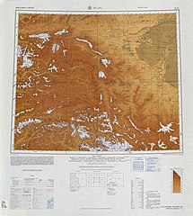
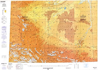
- Map including Artush A-t'u-shih (DMA, 1983)
Notes
- Locals in Xinjiang frequently observe UTC+6 (Xinjiang Time), 2 hours behind Beijing.
References
Wikiwand in your browser!
Seamless Wikipedia browsing. On steroids.
Every time you click a link to Wikipedia, Wiktionary or Wikiquote in your browser's search results, it will show the modern Wikiwand interface.
Wikiwand extension is a five stars, simple, with minimum permission required to keep your browsing private, safe and transparent.


