Akdeniz, Mersin
Secondary municipality in Mersin, Turkey From Wikipedia, the free encyclopedia
Akdeniz is a municipality and district of Mersin Province, Turkey.[2] Its area is 265 km2,[3] and its population is 255,946 (2022).[1] It covers the central and eastern part of the city of Mersin and the adjacent countryside.
Akdeniz | |
|---|---|
District and municipality | |
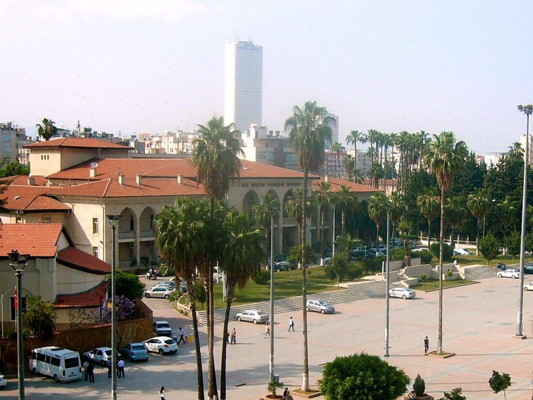
 Mersin Halkevi, a public building in Akdeniz | |
 Map showing Akdeniz District in Mersin Province | |
| Coordinates: 36°48′N 34°38′E | |
| Country | Turkey |
| Province | Mersin |
| Government | |
| • Mayor | Hoşyar Sarıyıldız (DEM) |
| Area | 265 km2 (102 sq mi) |
| Population (2022)[1] | 255,946 |
| • Density | 970/km2 (2,500/sq mi) |
| Time zone | UTC+3 (TRT) |
| Area code | 0324 |
| Website | www |
History
The municipality of Akdeniz was established in 1993 as a secondary level municipality. In 2008 the district Akdeniz was created from part of the former central district of Mersin, along with the districts Mezitli, Toroslar and Yenişehir. At the same time, the former municipalities Adanalıoğlu, Bahçeli, Dikilitaş, Karacailyas, Kazanlı, Yenitaşkent, Bağcılar and Huzurkent were absorbed into the municipality of Akdeniz.[4][5] At the 2013 Turkish local government reorganisation, the rural part of the district was integrated into the municipality, the villages becoming neighbourhoods.[6]
Location
Akdeniz borders the other districts Toroslar to the north and Yenişehir to the west. The south is bounded by the Mediterranean Sea and the west is bounded by Müftü River.[7]
Business
Most of government offices as well as the seats of Mersin governor and the mayor of Greater Mersin are in Akdeniz. Akdeniz also hosts most of the business quarters of the city. Mersin railway station, harbor, free port and maritime authority, as well as, shipping and customs agencies are in Akdeniz. The port of Mersin is the biggest in Turkey. It is especially used for export. In the port area there is a 100,000 tonnes grain silo and a fertiliser factory. East of Akdeniz is industrial region, with a petroleum refinery and factories of glass, cement, ferrochrome and soda.[8]
Composition
There are 65 neighbourhoods in Akdeniz District:[9]
- Abdullahşahutoğlu
- Adanalıoğlu
- Adnan Menderes
- Akdam
- Akdeniz
- Anadolu
- Aşağı Burhan
- Bağcılar-Ihsaniye
- Bağlarbaşı
- Bahçe
- Bahşiş
- Barış
- Bekirde
- Camili
- Camişerif
- Çankaya
- Çay
- Çilek
- Civanyaylağı
- Cumhuriyet
- Demirhisar
- Dikilitaş
- Emek
- Esenli
- Evci
- Evren
- Gazi
- Gündoğdu
- Güneş
- Hal
- Hamidiye
- Hebilli
- Hürriyet
- Iğdır
- İhsaniye
- Karacailyas
- Karaduvar
- Kazanlı
- Kiremithane
- Köselerli
- Kulak
- Kültür
- Kürkçü
- Limonlu
- Mahmudiye
- Mesudiye
- Mitatpaşa
- Müfide Ilhan
- Nacarlı
- Nusratiye
- Özgürlük
- Parmakkurdu
- Puğkaracadağ
- Şakirgülmen
- Sarıibrahimli
- Şevket Sümer
- Siteler
- Toroslar
- Turgut Reis
- Üçocak
- Yanpar
- Yenimahalle
- Yeşilçimen
- Yeşilova
- Yukarı Burhan
Sites of interest
Gallery
References and notes
External links
Wikiwand in your browser!
Seamless Wikipedia browsing. On steroids.
Every time you click a link to Wikipedia, Wiktionary or Wikiquote in your browser's search results, it will show the modern Wikiwand interface.
Wikiwand extension is a five stars, simple, with minimum permission required to keep your browsing private, safe and transparent.


