Loading AI tools
Highway im US-Bundesstaat Arizona Aus Wikipedia, der freien Enzyklopädie
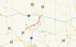
Die Arizona State Route 89A (kurz AZ 89A) ist eine State Route im US-Bundesstaat Arizona, der in Ost-West-Richtung verläuft.

| |
|---|---|
| Karte | |
 | |
| Basisdaten | |
| Gesamtlänge: | 82 mi/132 km |
| Eröffnung: | 1992 |
| Anfangspunkt: | |
| Endpunkt: | |
| Countys: | Coconino County Yavapai County |
| Wichtige Städte: | Sedona Cottonwood Clarkdale Jerome Prescott Valley |
Die State Route beginnt am Interstate 17 nahe Flagstaff und endet nahe Prescott an der Arizona State Route 89. Zwischen Flagstaff und Sedona führt die Straße durch den Oak Creek Canyon über den Mogollon Rim. Sie führt am Tuzigoot National Monument vorbei, bevor sie Clarkdale erreicht. Bis 1992 gehörte die Straße zum U.S. Highway 89A, der aber in diesem Abschnitt aufgelöst wurde.
Seamless Wikipedia browsing. On steroids.
Every time you click a link to Wikipedia, Wiktionary or Wikiquote in your browser's search results, it will show the modern Wikiwand interface.
Wikiwand extension is a five stars, simple, with minimum permission required to keep your browsing private, safe and transparent.