Datei:Rockford-Freeport-Rochelle_CSA.png
aus Wikipedia, der freien encyclopedia
Es ist keine höhere Auflösung vorhanden.
Rockford-Freeport-Rochelle_CSA.png (298 × 494 Pixel, Dateigröße: 20 KB, MIME-Typ: image/png)
![]()
Diese Datei und die Informationen unter dem roten Trennstrich werden aus dem zentralen Medienarchiv Wikimedia Commons eingebunden.
![]()
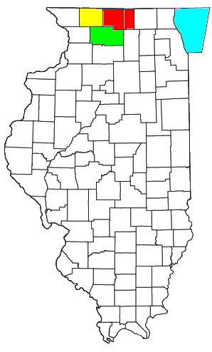
| BeschreibungRockford-Freeport-Rochelle CSA.png |
Locator map of the Rockford-Freeport-Rochelle Combined Statistical Area in the central part of the U.S. state of Illinois. The three components of the CSA are colored separately: |
|||
| Datum | ||||
| Quelle |
Modified from this United States Census Bureau file, based on the following Census definitions lists: |
|||
| Urheber | User:Nyttend | |||
| Genehmigung (Weiternutzung dieser Datei) |
US Government work is public domain, and my work is
|
Kurzbeschreibungen
Ergänze eine einzeilige Erklärung, was diese Datei darstellt.
In dieser Datei abgebildete Objekte
Motiv
26. Juli 2008
Dateiversionen
Klicke auf einen Zeitpunkt, um diese Version zu laden.
| Version vom | Vorschaubild | Maße | Benutzer | Kommentar | |
|---|---|---|---|---|---|
| aktuell | 17:05, 30. Jul. 2008 | | 298 × 494 (20 KB) | Nyttend | {{Information |Description=Locator map of the {{w|Rockford metropolitan area|Rockford-Freeport-Rochelle}} {{w|Combined Statistical Area}} in the central part of the {{w|U.S. state}} of {{w|Illinois}}. The three components of the CSA are colored separatel |
Dateiverwendung
Die folgende Seite verwendet diese Datei:
Globale Dateiverwendung
Die nachfolgenden anderen Wikis verwenden diese Datei:
- Verwendung auf es.wikipedia.org
- Verwendung auf tr.wikipedia.org