Datei:C77198s1_Ant.Map_Taylor_Glacier.jpg
aus Wikipedia, der freien encyclopedia
Größe dieser Vorschau: 795 × 600 Pixel. Weitere Auflösungen: 318 × 240 Pixel | 637 × 480 Pixel | 1.018 × 768 Pixel | 1.280 × 965 Pixel | 2.560 × 1.931 Pixel | 4.312 × 3.252 Pixel
Originaldatei (4.312 × 3.252 Pixel, Dateigröße: 1,45 MB, MIME-Typ: image/jpeg)
![]()
Diese Datei und die Informationen unter dem roten Trennstrich werden aus dem zentralen Medienarchiv Wikimedia Commons eingebunden.
![]()
Beschreibung
| BeschreibungC77198s1 Ant.Map Taylor Glacier.jpg |
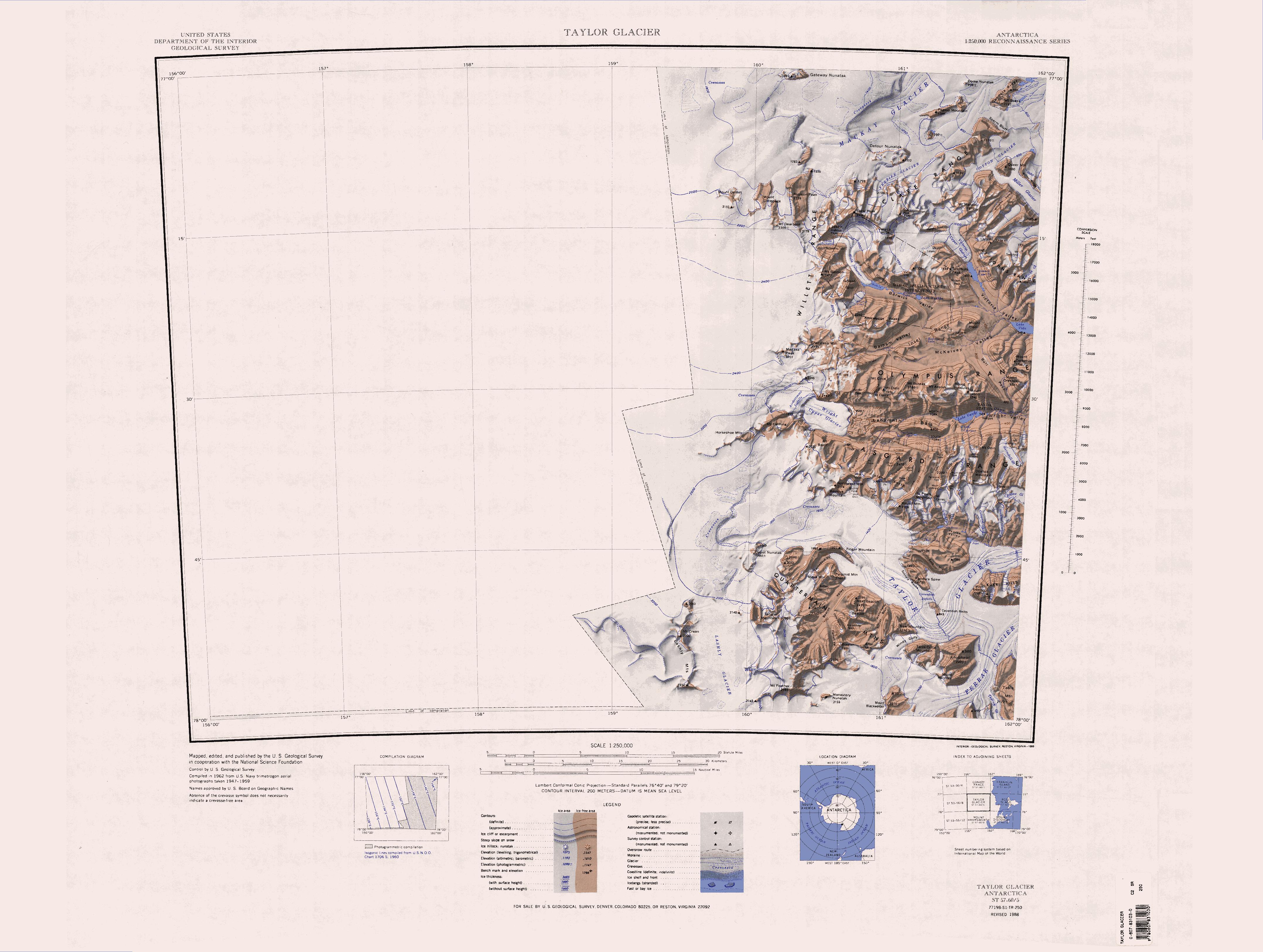
English: 1:250,000-scale topographic reconnaissance map of the Taylor Glacier area from 156°-162'E to 77°-78°S in Antarctica. Mapped, edited and published by the U.S. Geological Survey in cooperation with the National Science Foundation. |
||||
| Datum | |||||
| Quelle | http://usarc.usgs.gov/drg_dload.shtml | ||||
| Urheber | United States Geological Survey | ||||
| Genehmigung (Weiternutzung dieser Datei) |
|
| Bildnotizen InfoField | Diese Datei ist annotiert: Betrachte diese auf Commons. |
2875
824
249
173
4312
3252
The Fortress
Kurzbeschreibungen
Ergänze eine einzeilige Erklärung, was diese Datei darstellt.
In dieser Datei abgebildete Objekte
Motiv
image/jpeg
a30c23a74d401f4d641d027f59121174f3da926c
1.518.647 Byte
3.252 Pixel
4.312 Pixel
Dateiversionen
Klicke auf einen Zeitpunkt, um diese Version zu laden.
| Version vom | Vorschaubild | Maße | Benutzer | Kommentar | |
|---|---|---|---|---|---|
| aktuell | 15:30, 17. Apr. 2013 | | 4.312 × 3.252 (1,45 MB) | 4ing | == {{int:filedesc}} == {{Information |description={{en|1=1:250,000-scale topographic reconnaissance map of the Taylor Glacier area from 156°-162'E to 77°-78°S in Antarctica. Mapped, edited and published by the U.S. Geological Survey in cooperation w... |
Dateiverwendung
Die folgenden 27 Seiten verwenden diese Datei:
- Antarktische Trockentäler
- Apocalypse Peaks
- Balham Valley
- Barwick Valley
- Beacon Heights
- Beehive Mountain
- Bullseye Lake
- Canoe-Nunatak
- Clare Range
- Depot-Nunatak
- Gondola Ridge
- Head Mountains
- Insel Range
- Lashly Mountains
- Mackay-Gletscher
- McKelvey Valley
- Mount DeWitt
- Mount Handsley
- Northwest Mountain
- Pegtop Mountain
- Pyramid Mountain (Viktorialand)
- Quartermain Mountains
- Taylor-Gletscher (Viktorialand)
- The Fortress (Antarktika)
- Turnabout Valley
- West Beacon
- Willett Range
Globale Dateiverwendung
Die nachfolgenden anderen Wikis verwenden diese Datei:
- Verwendung auf ceb.wikipedia.org
- Verwendung auf en.wikipedia.org
- Royal Society Range
- Ferrar Glacier
- Taylor Glacier
- Wright Valley
- Wilkniss Mountains
- Quartermain Mountains
- Labyrinth (Antarctica)
- Asgard Range
- McKelvey Valley
- Inland Forts
- Insel Range
- Victoria Valley
- Willett Range
- Wilson Piedmont Glacier
- Wright Upper Glacier
- Apocalypse Peaks
- Balham Valley
- Barwick Valley
- Clare Range
- Olympus Range
- Kukri Hills
- Pearse Valley
- McAllister Hills
- Mackay Glacier
- Saint Johns Range
- Horowitz Ridge
- Lashly Mountains
- Helicopter Mountains
- Cruzen Range
- Mount Odin (Victoria Land)
- Table Mountain (Antarctica)
- Verwendung auf fr.wikipedia.org
- Verwendung auf he.wikipedia.org
- Verwendung auf it.wikipedia.org
Weitere globale Verwendungen dieser Datei anschauen.