File:United_States_1959-08-present.png
From Wikipedia, the free encyclopedia
Maint y rhagolwg: 800 × 542 picsel. Eglurdebau eraill: 320 × 217 picsel | 640 × 433 picsel | 1,000 × 677 picsel.
Maint llawn ((1,000 × 677 picsel, maint y ffeil: 47 KB, ffurf MIME: image/png))
Daw'r ffeil hon o Comin Wikimedia a gellir ei defnyddio gan brosiectau eraill. Dangosir isod y disgrifiad sydd ar dudalen ddisgrifio'r ffeil yno.
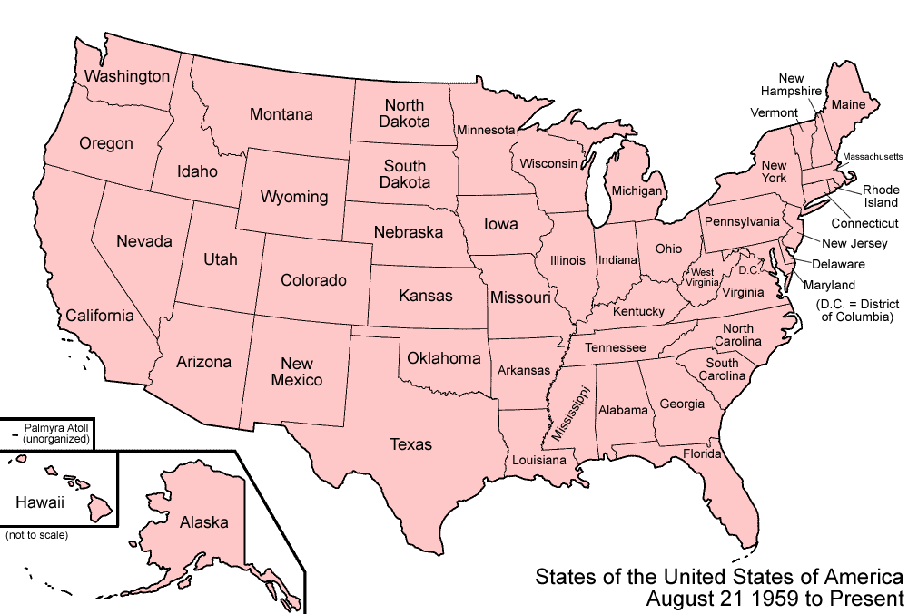
| DisgrifiadUnited States 1959-08-present.png | Map of the states and territories of the United States as it has been since August 21 1959, when Hawaii Territory was admitted as the state of Hawaii, completing the United States' present-day borders. |
| Ffynhonnell | Gwaith yr uwchlwythwr |
| Awdur | Made by User:Golbez. |
| Caniatâd (Ailddefnyddio'r ffeil hon) |
Own work, attribution required (Multi-license with GFDL and Creative Commons CC-BY 2.5) |

|
This historical map image could be re-created using vector graphics as an SVG file. This has several advantages; see Commons:Media for cleanup for more information. If an SVG form of this image is available, please upload it and afterwards replace this template with
{{vector version available|new image name}}.
It is recommended to name the SVG file “United States 1959-08-present.svg”—then the template Vector version available (or Vva) does not need the new image name parameter. |
Yr wyf fi, deiliad yr hawlfraint ar y gwaith hwn, yn ei gyhoeddi yn ôl termau'r trwyddedau a ganlyn:

|
Caniateir copïo, dosbarthu a/neu golygu'r ddogfen hon yn ôl telerau'r Drwydded Ddogfennaeth Rydd GNU, Fersiwn 1.2 neu unrhyw fersiwn diweddarach a gyhoeddwyd gan y Free Software Foundation; yn cynnwys dim Adrannau Di-syfl, dim Testunau Clawr Blaen, a dim Testunau Clawr Cefn. Cynhwysir copi o'r drwydded hon yn yr adran Trwydded Ddogfennaeth Rydd GNU".http://www.gnu.org/copyleft/fdl.htmlGFDLGNU Free Documentation Licensetruetrue |
| Trwyddedir y ffeil hon yn ôl termau'r drwydded Creative Commons Attribution-Share Alike 3.0 Unported. | ||
| ||
| Ychwangwyd y nod trwyddedu hwn wrth y ffeil hon yn ran o'r gwaith o ddiweddaru trwyddedau GFDL.http://creativecommons.org/licenses/by-sa/3.0/CC BY-SA 3.0Creative Commons Attribution-Share Alike 3.0truetrue |
Trwyddedir y ffeil hon yn ôl termau'r drwydded Creative Commons Attribution 2.5 Generic.
- Mae'n rhydd i chi:
- rhannu – gallwch gopïo, dosbarthu a throsglwyddo'r gwaith
- ailwampio – gallwch addasu'r gwaith
- Ar yr amodau canlynol:
- cydnabyddiaeth – Mae'n rhaid i chi nodi manylion y gwaith hwn, rhoi dolen i'r drwydded, a nodi os y bu golygu arni, yn y modd a benwyd gan yr awdur neu'r trwyddedwr (ond heb awgrymu o gwbl eu bod yn eich cymeradwyo chi na'ch defnydd o'r gwaith).
Gallwch ddewis y drwydded y mynnwch.
| Territorial evolution maps of the United States |
| v · d (template shows date of beginning of change yyyy-mm-dd) |
| 1789-03, 1789-08, 1790-04, 1790-05, 1791-03, 1791-09, 1792-03, 1792-06, 1795, 1796, 1798, 1800-07-04, 1800-07, 1802, 1803-03, 1803-04, 1804-03, 1804-10, 1805-01, 1805-07, 1809, 1810-04, 1810-10, 1812-04, 1812-05, 1812-06, 1816, 1817-03, 1817-12, 1818-10, 1818-12, 1819-03, 1819-12, 1820, 1821-07, 1821, 1822, 1824, 1828, 1834, 1836-03, 1836-06, 1836-07, 1837-01, 1837-03, 1838, 1842, 1845-03, 1845-12, 1846-06, 1846-12, 1848-02, 1848-05, 1848-08, 1849, 1850, 1853-03, 1853-12, 1854, 1858, 1859, 1860, 1861-01, 1861-02-04, 1861-02-28, 1861-03, 1861-08, 1862, 1863-02, 1863-03, 1863-06, 1864-05, 1864-10, 1865, 1866, 1867-01, 1867-03, 1867-10, 1868, 1876, 1884, 1889-11-02, 1889-11-08, 1889-11-11, 1890-05, 1890-07-03, 1890-07-10, 1896-01, 1896-05, 1898, 1907, 1912-01, 1912-02, 1912-08, 1959-01, 1959-08 |
Captions
Add a one-line explanation of what this file represents
Items portrayed in this file
yn portreadu
source of file Saesneg
original creation by uploader Saesneg
Hanes y ffeil
Cliciwch ar ddyddiad / amser i weld y ffeil fel ag yr oedd bryd hynny.
| Dyddiad / Amser | Bawdlun | Hyd a lled | Defnyddiwr | Sylw | |
|---|---|---|---|---|---|
| cyfredol | 07:37, 8 Mawrth 2007 | | 1,000 × 677 (47 KB) | Golbez | New version with Palmyra Atoll |
| 07:06, 29 Gorffennaf 2006 |  | 1,000 × 677 (96 KB) | Golbez | {{Information| |Description=Map of the states and territories of the United States as it was from |Source= |Date= |Author=Made by User:Golbez. |Permission=Own work, attribution required (Multi-license with GFDL and Creative Commons CC-BY 2.5) |other_ |
Cysylltiadau'r ffeil
Nid oes tudalennau'n defnyddio'r ffeil hon.
Defnydd cydwici y ffeil
Mae'r wicis eraill hyn yn defnyddio'r ffeil hon:
- Y defnydd ar de.wikipedia.org
- Y defnydd ar en.wikipedia.org
- U.S. territorial sovereignty
- User:Buaidh/Territorial evolution of Colorado
- List of territorial claims and designations in Colorado
- Territorial evolution of New Mexico
- Outline of Wyoming territorial evolution
- Territorial evolution of Montana
- Territorial evolution of Idaho
- Outline of Washington territorial evolution
- Outline of Oregon territorial evolution
- Territorial evolution of Utah
- Territorial evolution of Arizona
- Territorial evolution of Nevada
- Territorial evolution of California
- Outline of North Dakota territorial evolution
- Territorial evolution of South Dakota
- User:Falcaorib/Canada, United States and Mexico
- Y defnydd ar es.wikipedia.org
- Y defnydd ar fr.wikipedia.org
- Y defnydd ar ja.wikipedia.org
- Y defnydd ar uk.wikipedia.org
- Y defnydd ar vi.wikipedia.org
- Y defnydd ar zh.wikipedia.org