Tatarsk
sídlo v Novosibirské oblasti v Rusku From Wikipedia, the free encyclopedia
sídlo v Novosibirské oblasti v Rusku From Wikipedia, the free encyclopedia
Tatarsk (rusky Тата́рск) je město v Novosibirské oblasti v Ruské federaci. Při sčítání lidu v roce 2010 měl přes čtyřiadvacet tisíc obyvatel.
| Tatarsk Татарск | |
|---|---|
 Chrám Přímluvy Panny Marie v Tatarsku (Храм Покрова Пресвятой Богородицы) | |
_COA.jpg) znak .png) vlajka | |
| Poloha | |
| Souřadnice | 55°13′ s. š., 75°58′ v. d. |
| Nadmořská výška | 110 m n. m. |
| Časové pásmo | UTC+7 |
| Stát | |
| Federální okruh | Sibiřský |
| Oblast | Novosibirská |
_-_Novosibirsk_Oblast.svg) Novosibirská oblast na mapě Ruska | |
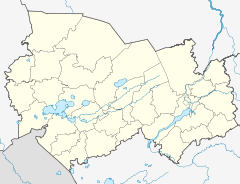 Tatarsk Město na mapě Novosibirské oblasti | |
| Rozloha a obyvatelstvo | |
| Rozloha | 80 km² |
| Počet obyvatel | 24 217 (2010) |
| Hustota zalidnění | 302,7 obyv./km² |
| Správa | |
| Vznik | 1894 |
| Telefonní předvolba | (+7) 38364 |
| PSČ | 632120 |
| Některá data mohou pocházet z datové položky. | |
Tatarsk leží na jihu Západosibiřské roviny jižně od Vasjuganských bažin, na severozápadním okraji Barabinské stepi. Od Novosibirsku, správního střediska celé oblasti, je vzdálen přibližně 450 kilometrů západně.
Vesnice Staraja Tatarka (Старая Татарка) pojmenovaná po Tatarech zde byla zhruba od 90. let osmnáctého století. V devadesátých letech devatenáctého století tudy byla postavena Transsibiřská magistrála, zdejší úsek z Omsku do Novosibirsku byl uveden do provozu v roce 1896. U zdejšího nádraží vzniklo osídlení zvané Stancionnij (Станционный)
V roce 1911 byla obě sídla sloučena pod jménem Tatarskaja. V roce 1914 byla zprovozněna vedlejší trať, které odtud vede do Kulundské stepi do Slavgorodu.
Městem se stal Tatarsk v roce 1925.
V tomto článku byl použit překlad textu z článku Tatarsk na německé Wikipedii.
Seamless Wikipedia browsing. On steroids.
Every time you click a link to Wikipedia, Wiktionary or Wikiquote in your browser's search results, it will show the modern Wikiwand interface.
Wikiwand extension is a five stars, simple, with minimum permission required to keep your browsing private, safe and transparent.

