Machteš Ramon
From Wikipedia, the free encyclopedia
From Wikipedia, the free encyclopedia
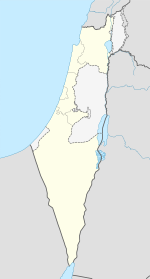
Machteš Ramon (hebrejsky: מכתש רמון; doslova: „Kráter Ramon“) je jedinečný geologický kráterovitý útvar Negevské pouště v Izraeli. Nachází se u úpatí masivu Har Negev, přibližně 85 km jižně od města Beerševa. Tento geomorfologický útvar není impaktní kráter, který by vznikl po dopadu meteoru, ale machteš. Tento machteš je 40 km dlouhý, 2–10 km široký a tvarem připomíná protáhlé srdce. Jediným sídlem v této oblasti je malé město Micpe Ramon (מצפה רמון, „Ramonova vyhlídka“), které se nachází při severním úpatí machteše. Machteš a okolní oblast tvoří největší izraelský národní park – Přírodní rezervace Ramon. Na západním okraji kráteru stojí hora Har Ramon – nejvyšší bod Negevu, s nadmořskou výškou 1035 metrů.
 מכתש רמון | |
|---|---|
| IUCN kategorie II (Národní park) | |
 Letecký pohled na Machteš Ramon | |
| Základní informace | |
| Správa | Úřad pro přírodu a parky |
| Poloha | |
| Stát | |
| Distrikt | Jižní distrikt |
| Umístění | Micpe Ramon |
| Souřadnice | 30°34′43″ s. š., 34°49′4″ v. d. |
 | |
| Další informace | |
| Některá data mohou pocházet z datové položky. | |
Název Ramon pochází z arabského slova Ruman („Římané“) a má nejspíše souvislost se starodávnou obchodní cestou skrze kráter, kterou využívala Římská říše. V Negevské poušti se kromě Machteše Ramon nachází další dva machteše a to Machteš Gadol a Machteš Katan, které byly oba zmapovány ještě před zmapováním největšího z nich, Machteše Ramon.


.jpg)
V tomto článku byl použit překlad textu z článku Makhtesh Ramon na anglické Wikipedii.
Seamless Wikipedia browsing. On steroids.
Every time you click a link to Wikipedia, Wiktionary or Wikiquote in your browser's search results, it will show the modern Wikiwand interface.
Wikiwand extension is a five stars, simple, with minimum permission required to keep your browsing private, safe and transparent.
