Iskitim
sídlo v Novosibirské oblasti v Rusku From Wikipedia, the free encyclopedia
sídlo v Novosibirské oblasti v Rusku From Wikipedia, the free encyclopedia
Iskitim (rusky Искитим) je město v Novosibirské oblasti v Ruské federaci. Při sčítání lidu v roce 2010 měl přes šedesát tisíc obyvatel.
| Iskitim Искитим | |
|---|---|
 Zimní pohled na město | |
 znak .png) vlajka | |
| Poloha | |
| Souřadnice | 54°38′ s. š., 83°18′ v. d. |
| Nadmořská výška | 140 m n. m. |
| Časové pásmo | UTC+7 |
| Stát | |
| Federální okruh | Sibiřský |
| Oblast | Novosibirská |
_-_Novosibirsk_Oblast.svg) Novosibirská oblast na mapě Ruska | |
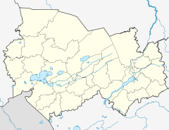 Iskitim Město na mapě Novosibirské oblasti | |
| Rozloha a obyvatelstvo | |
| Rozloha | 30 km² |
| Počet obyvatel | 60 078 (2010) |
| Hustota zalidnění | 2 002,6 obyv./km² |
| Správa | |
| Vznik | 1717 |
| Oficiální web | www |
| Telefonní předvolba | (+7) 38343 |
| PSČ | 63320x |
| Některá data mohou pocházet z datové položky. | |
Iskitim leží v jihovýchodní části Západosibiřské roviny na řece Berdi, pravém přítoku Obu. Od Novosibirska, správního střediska oblasti, je vzdálen přibližně 65 kilometrů jižně.
Přes Iskitim vede ze severu od Berdsku na jih do Altajské republiky silnice zvaná Čujský trakt.
Iskitim vznikl v roce 1933 jako sídlo zaměstnanců nové cementárny. Městem je od roku 1938.
V tomto článku byl použit překlad textu z článku Iskitim na německé Wikipedii.
Seamless Wikipedia browsing. On steroids.
Every time you click a link to Wikipedia, Wiktionary or Wikiquote in your browser's search results, it will show the modern Wikiwand interface.
Wikiwand extension is a five stars, simple, with minimum permission required to keep your browsing private, safe and transparent.

