Děvín (Ralská pahorkatina)
kopec v okrese Česká Lípa From Wikipedia, the free encyclopedia
kopec v okrese Česká Lípa From Wikipedia, the free encyclopedia
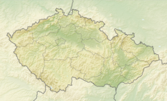
Děvín (436 m n. m.[1][pozn. 1]) je vrch v okrese Česká Lípa Libereckého kraje. Leží asi 1,5 kilometru jihovýchodně od obce Hamr na Jezeře, na stejnojmenném katastrálním území. Vrch je součástí chráněného území a je znám hlavně díky stejnojmenné zřícenině hradu na svém vrcholu. Zdejší území bylo desítky let součástí vojenského výcvikového prostoru Ralsko.
| Děvín | |
|---|---|
 Vrchol kopce se zříceninou | |
| Vrchol | 436 m n. m. |
| Prominence | 69 m ↓ sedlo s Hamerským Špičákem |
| Izolace | 340 m → Hamerský Špičák |
| Poloha | |
| Světadíl | Evropa |
| Stát | |
| Pohoří | Ralská pahorkatina / Zákupská pahorkatina / Kotelská vrchovina / Děvínská pahorkatina / Jelenovršská část |
| Souřadnice | 50°41′33″ s. š., 14°51′15″ v. d. |
 Děvín | |
| Hornina | pískovec, neovulkanit |
| Povodí | Ploučnice |
| Některá data mohou pocházet z datové položky. | |

Geologicky pozoruhodná lokalita vznikla vypreparováním zpevněných pískovců kolem žíly polzenitu o mocnosti kolem 2 metrů, která svými kontaktními účinky okolní pískovce zpevnila. Při zvětrávání žíly vznikaly minerály (limonit, jílové minerály), které byly v 17. a 18. století těženy jako železná ruda. Zachovaly se zajímavé pozůstatky historické těžby – dvě štoly a dvě tesané studny v pískovci.[2]
Geomorfologicky vrch náleží do celku Ralská pahorkatina, podcelku Zákupská pahorkatina, okrsku Kotelská vrchovina, podokrsku Děvínská pahorkatina a Jelenovršské části.[3]
Děvín je součástí přírodní památky Děvín a Ostrý, zahrnující i přiléhající vrchy na společné vulkanické žíle: cca 400 metrů jihozápadně ležící Hamerský Špičák (452 metrů) a asi 500 metrů dále na jihozápad ležící Schachtenstein (372 metrů). Navíc asi 700 metrů jihovýchodně se nachází pískovcová stolová hora Široký kámen (430 metrů).
Na Děvín s jeho hradem vede odbočka z červené turistické značky od Mimoně přes Hamr na Jezeře až na Ještěd. Přes rozcestník Pod Děvínem vede i modrý okruh z Hamru na Jezeře a je zde koncový bod zelené značky. Z rozcestníku k hradu je stoupání 46 výškových metrů.[4]
Seamless Wikipedia browsing. On steroids.
Every time you click a link to Wikipedia, Wiktionary or Wikiquote in your browser's search results, it will show the modern Wikiwand interface.
Wikiwand extension is a five stars, simple, with minimum permission required to keep your browsing private, safe and transparent.
