Zuckerhütl
nejvyšší vrchol Stubaiských Alp v Rakousku From Wikipedia, the free encyclopedia
nejvyšší vrchol Stubaiských Alp v Rakousku From Wikipedia, the free encyclopedia
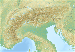
Zuckerhütl je se svými 3507 metry nejvyšším vrcholem Stubaiských Alp, které leží v rakouské spolkové zemi Tyrolsko a částečně v Itálii. Zuckerhütl leží v hlavním hřebeni v západní části pohoří na hranicích Rakouska a Itálie. Stubaiské Alpy patří do skupiny Východních Alp. Jméno Zuckerhütl – česky Homole cukru – dostal podle půvabného tvaru viditelného už od vstupu do údolí Stubaital.
| Zuckerhütl | |
|---|---|
 Zuckerhütl | |
| Vrchol | 3507 m n. m. |
| Prominence | 1 033 m |
| Poznámka | nejvyšší vrchol Stubaiských Alp |
| Poloha | |
| Světadíl | Evropa |
| Stát | |
| Pohoří | Stubaiské Alpy |
| Souřadnice | 46°57′52″ s. š., 11°9′13″ v. d. |
 Zuckerhütl | |
| Prvovýstup | Joseph Anton Specht a horský vůdce Alois Tanzer v roce 1863 |
| Hornina | žula, rula |
| Některá data mohou pocházet z datové položky. | |

Prvovýstup na vrchol Zuckerhütl podnikl Joseph Anton Specht a horský vůdce Alois Tanzer v roce 1863. První vrcholový kříž byl na vrcholu postaven v období 2. světové války vojáky Wehrmachtu pro lepší orientaci v horách v případě návratu domů. Tento kříž byl značně poškozen v zimě roku 2002. Proto zhotovil tyrolský umělec Johannes Maria Pittl kříž nový, který byl na vrchol dopraven vrtulníkem v roce 2003.
Nejvhodnější výstupové trasy vedou ze severu z údolí Stubaital. Jako záchytné body pro výstup poslouží chaty: Sulzenauhütte, Dresdner Hütte nebo Nürnberger Hütte.

Výstup na Zuckerhütl - česky

Seamless Wikipedia browsing. On steroids.
Every time you click a link to Wikipedia, Wiktionary or Wikiquote in your browser's search results, it will show the modern Wikiwand interface.
Wikiwand extension is a five stars, simple, with minimum permission required to keep your browsing private, safe and transparent.
