File:Mediterranean_Sea_16.61811E_38.99124N.jpg
From Wikipedia, the free encyclopedia
Imagine in alta resoluzione (2 046 × 1 496 pixel, dimensione del file: 720 KB, tipo MIME: image/jpeg)
Questo file proviene da Wikimedia Commons e può essere utilizzato da altri progetti. Di seguito viene mostrata la descrizione presente nella pagina di descrizione del file.
sommariu
| DescrizzioneMediterranean Sea 16.61811E 38.99124N.jpg |
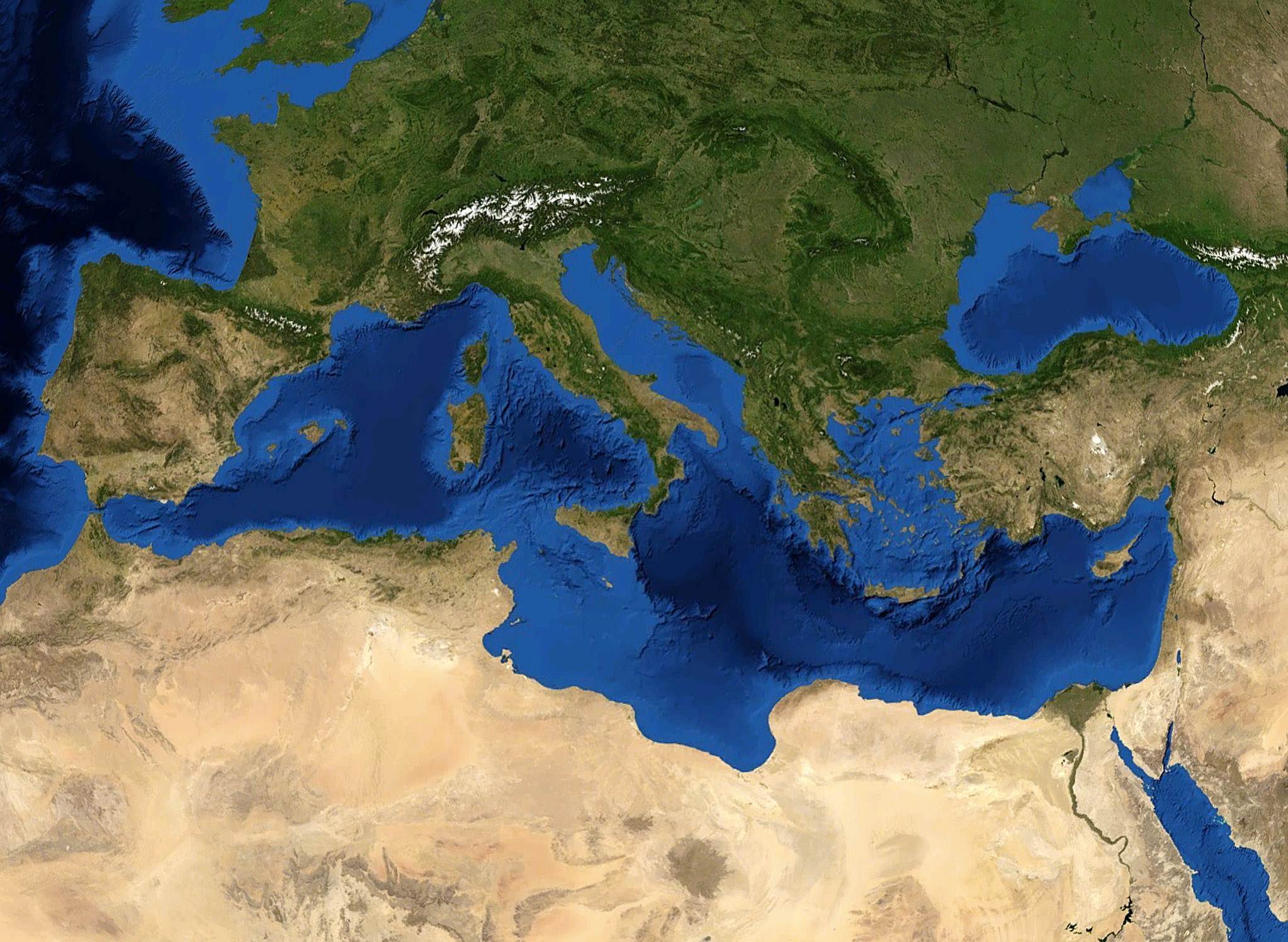
English: Satellite caption of the Mediterranean Sea. |
||
| Data | |||
| Fonte | Screenshot from NASA World Wind (retouched) | ||
| Autore | of the modification : Eric Gaba (Sting) | ||
| Permessu (Riusare questo file) |
All rights released | ||
| Altre versioni |
|
.jpg)


Licenzia:
| Public domainPublic domainfalsefalse |
| This image is in the public domain because it is a screenshot from NASA’s globe software World Wind using a public domain layer, such as Blue Marble, MODIS, Landsat, SRTM, USGS or GLOBE.
العربيَّة | English | فارسی | français | עברית | македонски | മലയാളം | Nederlands | русский | 中文(中国大陆) | +/− |
 |
| Public domainPublic domainfalsefalse |
| This work was previously under Public Domain, or a Free License. It has been digitally enhanced and/or modified. This derivative work has been (or is hereby) released into the public domain by its author, Sting at the French Wikipedia project. This applies worldwide. In some countries this is not legally possible; if so: |
Didascalie
Elementi ritratti in questo file
raffigura talianu
data di fondazione o creazione talianu
ghjugnu 2007
tipo di file talianu
image/jpeg
Cronolugia di l'imagine
Fare clic su un gruppo data/ora per vedere il file come si presentava nel momento indicato.
| Data/Óra | Previsualizzazione | Dimensione | Cuntributore | Cummentu | |
|---|---|---|---|---|---|
| attuale | 01:28, 21 ghju 2007 | | 2 046 × 1 496 (720 KB) | Sting | Larger, of better quality and with better colours |
| 10:52, 19 mag 2005 |  | 1 280 × 958 (154 KB) | Rex | Mediterranian Sea {{World Wind}} Category:Seas |
Ligami
La seguente pagina usa questo file:
Usu glubale di u schedariu
Anche i seguenti wiki usano questo file:
- Usu nantu à af.wikipedia.org
- Usu nantu à als.wikipedia.org
- Usu nantu à ang.wikipedia.org
- Usu nantu à an.wikipedia.org
- Usu nantu à ar.wikipedia.org
- بونيقيون
- غرنة
- حوض البحر الأبيض المتوسط
- البحر الليبي
- الريفييرا الفرنسية
- إستريا
- قائمة جزر البحر الأبيض المتوسط
- قالب:بذرة البحر الأبيض المتوسط
- جبل إيدا
- زلزال كريت 365
- قائمة الدول المتوسطية
- خليج العرب
- بوابة:العالم الإسلامي/ساحل مختار/أرشيف
- بوابة:العالم الإسلامي/ساحل مختار/1
- بوابة:العالم الإسلامي
- بوابة:المتوسط
- بوابة:المتوسط/مقدمة
- مستخدم:ASammour/بذرة-بوابة
- وادي المفشوخ
- كابل الهند والشرق الأوسط وغرب أوروبا
- متنزه ميرسين المائي
- قائمة الرؤوس البحرية في الجزائر
- محمية المحيط الحيوي العابرة للقارات في البحر الأبيض المتوسط
- مخلاة
- Usu nantu à azb.wikipedia.org
- Usu nantu à az.wikipedia.org
- Usu nantu à bar.wikipedia.org
- Usu nantu à ba.wikipedia.org
- Usu nantu à bg.wikipedia.org
- Usu nantu à bjn.wikipedia.org
- Usu nantu à bn.wikipedia.org
- Usu nantu à bn.wikivoyage.org
- Usu nantu à br.wikipedia.org
- Usu nantu à bxr.wikipedia.org
- Usu nantu à ca.wikipedia.org
- Usu nantu à ceb.wikipedia.org
- Usu nantu à ckb.wikipedia.org
Visualizza l'utilizzo globale di questo file.
Metadati
Questo file contiene informazioni aggiuntive, probabilmente aggiunte dalla fotocamera o dallo scanner usati per crearlo o digitalizzarlo. Se il file è stato modificato, alcuni dettagli potrebbero non corrispondere alla realtà.
| Orientamento | Normale |
|---|---|
| Risoluzione orizzontale | 72 punti per pollice (dpi) |
| Risoluzione verticale | 72 punti per pollice (dpi) |
| Software | Adobe Photoshop 7.0 |
| Data e ora di modifica del file | 21:39, 20 ghju 2007 |
| Spazio dei colori | Non calibrato |