Payl:Upper_lough_erne.jpg
From Wikipedia, the free encyclopedia
Walay mas taas nga resolusyon.
Upper_lough_erne.jpg (640 × 411 pixels, size sa payl: 97 KB, MIME type: image/jpeg)
Kining maong payl gikan sa Wikimedia Commons ug mahimong gigamit sa ubang proyekto. Ang deskripsyon niini didto gipakita sa ubos.
Mubong sugid:
| DeskripsyonUpper lough erne.jpg |
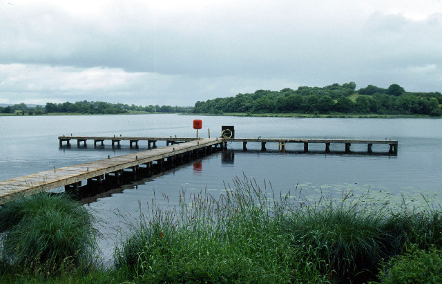
English: Galloon Island, Upper Lough Erne This jetty is on the eastern shore of Galloon Island. |
| Petsa | |
| Gigikanan | From geograph.org.uk |
| Tagsulat | Stephen McKay |
| Camera location | 54° 08′ 59.51″ N, 7° 23′ 47.93″ W | View this and other nearby images on: OpenStreetMap |
|---|
Pagtugot

|
This image was taken from the Geograph project collection. See this photograph's page on the Geograph website for the photographer's contact details. The copyright on this image is owned by Stephen McKay and is licensed for reuse under the Creative Commons Attribution-ShareAlike 2.0 license.
|
This file is licensed under the Creative Commons Attribution-Share Alike 2.0 Generic license.
Attribution: Stephen McKay
- Libre ka:
- sa pagsabwag – sa pagkopya, pag-apod-apod ug pagsabwag sa hinimo
- sa pag-remix – sa pag-adap sa binuhat
- Ubos sa mosunod nga mga kondisyon:
- atribusyon – Kinahanglan nimo nga hatagan ang angay nga kredito, maghatag usa ka link sa lisensya, ug ipakita kung adunay mga pagbag-o. Mahimo nimo kini buhaton sa bisan unsang makatarunganon nga paagi, apan dili sa bisan unsang paagi nga nagsugyot nga gi-endorso ka sa licensor o ang imong paggamit.
- share parehas – Kung imong gi-remix, gibag-o, o gibase sa materyal, kinahanglan nimo nga iapod-apod ang imong mga kontribusyon sa ilawom sa parehas o katugma nga lisensya sama sa orihinal.
Captions
Add a one-line explanation of what this file represents
Items portrayed in this file
depicts English
creator English
some value
copyright status English
copyrighted English
source of file English
file available on the internet English
coordinates of the point of view English
54°8'59.507"N, 7°23'47.929"W
Hunyo 2004
Kaagi sa payl
I-klik ang petsa/oras aron makit-an ang hulagway sa payl niadtong panahona.
| Petsa/Takna | Thumbnail | Mga dimensyon | Tiggamit | Komento | |
|---|---|---|---|---|---|
| kasamtangan | 09:37, 17 Enero 2007 | | 640 × 411 (97 KB) | Kanchelskis | H3922 : Galloon Island, Upper Lough Erne 6 km from Drumsloe, Monaghan, Ireland Grid Square H3922 (find images nearby) Photographer Stephen McKay (find more nearby) Image status First geograph for H3922 Date Taken June 2004 Submitte |
Mga paggamit sa payl
Ang mosunod nga mga panid misumpay niining payl:
Global nga paggamit sa payl
Kining ubang wiki naggamit ning maong payl:
- Paggamit sa ar.wikipedia.org
- Paggamit sa cs.wikipedia.org
- Paggamit sa cy.wikipedia.org
- Paggamit sa en.wikipedia.org
- Paggamit sa eu.wikipedia.org
- Paggamit sa fr.wikipedia.org
- Paggamit sa it.wikipedia.org
- Paggamit sa lt.wikipedia.org
- Paggamit sa nl.wikipedia.org
- Paggamit sa no.wikipedia.org
- Paggamit sa sk.wikipedia.org
- Paggamit sa sv.wikipedia.org
- Paggamit sa tr.wikipedia.org
- Paggamit sa uk.wikipedia.org
- Paggamit sa www.wikidata.org
Metadata
Ang kining payl adunay dugang nga impormasyon, mahimong nadugang gikan sa digital camera o scanner nga gigamit sa paghimo o pag-digitize niini.
Kon ang payl namodipikar gikan sa orihinal nga estado, ang ubang detalye mamahimong dili moreplek sa namodipikar nga payl.
| Camera manufacturer | Manufacturer |
|---|---|
| Camera model | CyberView 35 v1.74 |
| Date and time of data generation | 17:40, 10 Septiyembre 2005 |
| Orientation | Normal |
| Horizontal resolution | 234 dpi |
| Vertical resolution | 234 dpi |
| Software used | Adobe Photoshop Album 2.0 |
| File change date and time | 17:43, 10 Septiyembre 2005 |
| Y and C positioning | Centered |
| Exif version | 0 |
| Date and time of digitizing | 17:40, 10 Septiyembre 2005 |
| Meaning of each component |
|
| Supported Flashpix version | 0 |
| Color space | sRGB |
Gikuha gikan sa "https://ceb.wikipedia.org/wiki/Payl:Upper_lough_erne.jpg"