Payl:USACE_Tenkiller_Lake_and_Dam.jpg
From Wikipedia, the free encyclopedia
Tibuok resolusyon (1,500 × 1,200 pixels, size sa payl: 810 KB, MIME type: image/jpeg)
Kining maong payl gikan sa Wikimedia Commons ug mahimong gigamit sa ubang proyekto. Ang deskripsyon niini didto gipakita sa ubos.
| DeskripsyonUSACE Tenkiller Lake and Dam.jpg |
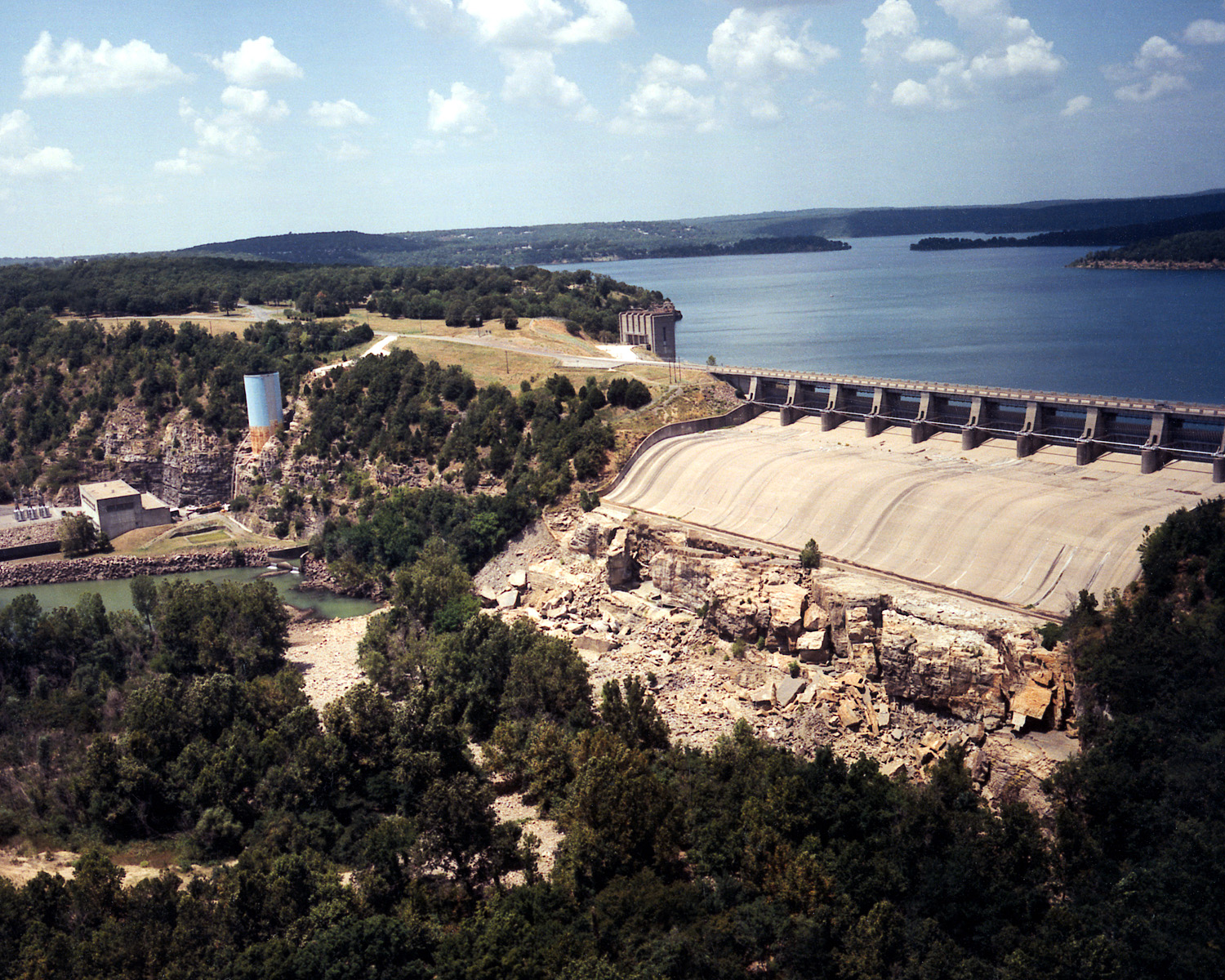
English: Aerial view of Tenkiller Ferry Lake (also known as Tenkiller Lake) and Dam on the Illinois River in Sequoyah County, Oklahoma, USA. The lake backs up into Cherokee County. The earth-fill dam was constructed between 1947 and 1952 by the United States Army Corps of Engineers for purposes of flood control and hydroelectric power generation. This photograph shows only the concrete spillway and powerhouse, and, does not show the largest, earth-fill part of the dam, which would be off to the right of the picture. View is to the north.
Coordinates: 35°35′42.36″N 95°2′51.5″W / 35.5951°N 95.047639°W / 35.5951; -95.047639 |
||||
| Location InfoField | Sequoyah County, Oklahoma, USA | ||||
| Petsa | (Caveat: Dates provided by U.S. Army Corps of Engineers Digital Visual Library are not reliable and may be wrong.) | ||||
| Gigikanan |
U.S. Army Corps of Engineers Digital Visual Library Image page Image description page Digital Visual Library home page |
||||
| Tagsulat | U.S. Army Corps of Engineers, photographer not specified or unknown | ||||
| Pagtugot (Paggamit pag-usab niini nga file) |
|
Captions
Items portrayed in this file
depicts English
3 Marso 1999
Kaagi sa payl
I-klik ang petsa/oras aron makit-an ang hulagway sa payl niadtong panahona.
| Petsa/Takna | Thumbnail | Mga dimensyon | Tiggamit | Komento | |
|---|---|---|---|---|---|
| kasamtangan | 04:07, 11 Mayo 2007 | | 1,500 × 1,200 (810 KB) | DanMS | {{Information | Description = {{en|Aerial view of Tenkiller Ferry Lake (also known as Tenkiller Lake) and Dam on the Illinois River in Sequoyah County, Oklahoma, USA. The lake backs up into Cherokee County. The earth-fill dam was constructed between 19 |
Mga paggamit sa payl
Ang mosunod nga mga panid misumpay niining payl:
Global nga paggamit sa payl
Kining ubang wiki naggamit ning maong payl:
- Paggamit sa en.wikipedia.org
- Paggamit sa en.wikivoyage.org
- Paggamit sa www.wikidata.org
- Paggamit sa zh.wikipedia.org
Metadata
Ang kining payl adunay dugang nga impormasyon, mahimong nadugang gikan sa digital camera o scanner nga gigamit sa paghimo o pag-digitize niini.
Kon ang payl namodipikar gikan sa orihinal nga estado, ang ubang detalye mamahimong dili moreplek sa namodipikar nga payl.
| JPEG file comment | File written by Adobe Photoshop¨ 5.0 |
|---|