Payl:Middle_America_relief_location_map.png
From Wikipedia, the free encyclopedia
Gidak-on ning maong paunang tan-aw: 800 x 538 ka mga piksel. Uban pang mga resoluyon: 320 x 215 ka mga piksel | 640 x 430 ka mga piksel | 1,024 x 688 ka mga piksel | 1,280 x 860 ka mga piksel | 2,000 x 1,344 ka mga piksel.
Tibuok resolusyon (2,000 × 1,344 pixels, size sa payl: 3.56 MB, MIME type: image/png)
Kining maong payl gikan sa Wikimedia Commons ug mahimong gigamit sa ubang proyekto. Ang deskripsyon niini didto gipakita sa ubos.
Mubong sugid:
| DeskripsyonMiddle America relief location map.png |
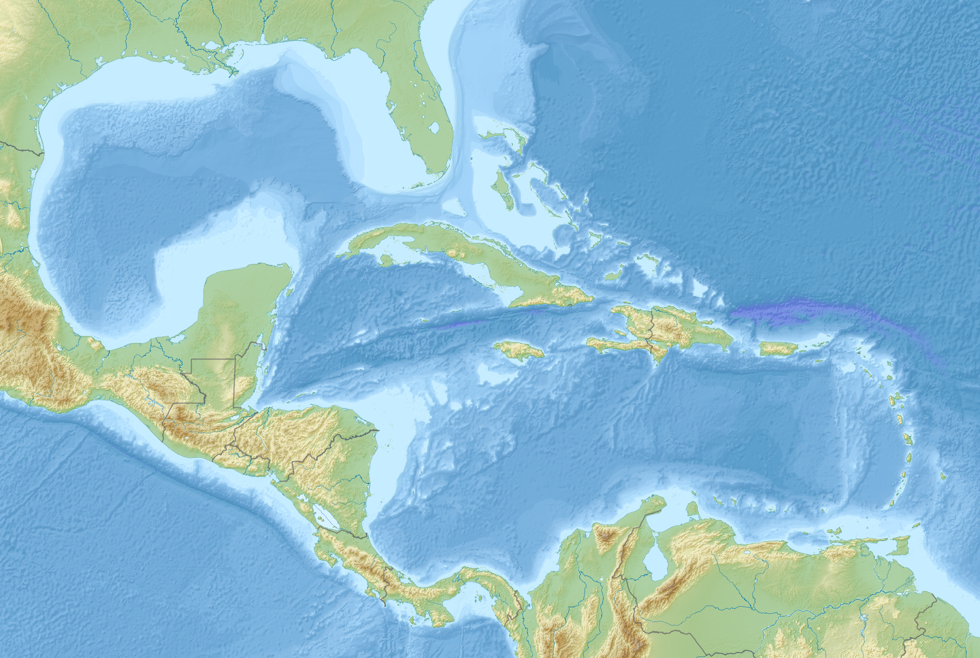
English: Map of Middle America, including the Gulf of Mexico and the Caribbean Sea, with the addition of national borders.
Equirectangular projection. Strechted by 106.0%. Geographic limits of the map:
Relief: ETOPO1. Coastline, borders, rivers etc: Made with Natural Earth. Free vector and raster map data @ naturalearthdata.com. |
| Petsa | |
| Gigikanan | Kaugalingong trabaho |
| Tagsulat | Uwe Dedering |
Pagtugot
I, the copyright holder of this work, hereby publish it under the following license:
This file is licensed under the Creative Commons Attribution-Share Alike 3.0 Unported license.
- Libre ka:
- sa pagsabwag – sa pagkopya, pag-apod-apod ug pagsabwag sa hinimo
- sa pag-remix – sa pag-adap sa binuhat
- Ubos sa mosunod nga mga kondisyon:
- atribusyon – Kinahanglan nimo nga hatagan ang angay nga kredito, maghatag usa ka link sa lisensya, ug ipakita kung adunay mga pagbag-o. Mahimo nimo kini buhaton sa bisan unsang makatarunganon nga paagi, apan dili sa bisan unsang paagi nga nagsugyot nga gi-endorso ka sa licensor o ang imong paggamit.
- share parehas – Kung imong gi-remix, gibag-o, o gibase sa materyal, kinahanglan nimo nga iapod-apod ang imong mga kontribusyon sa ilawom sa parehas o katugma nga lisensya sama sa orihinal.
Captions
Add a one-line explanation of what this file represents
Items portrayed in this file
depicts English
creator English
some value
copyright status English
copyrighted English
source of file English
original creation by uploader English
19 Agosto 2010
media type English
image/png
Kaagi sa payl
I-klik ang petsa/oras aron makit-an ang hulagway sa payl niadtong panahona.
| Petsa/Takna | Thumbnail | Mga dimensyon | Tiggamit | Komento | |
|---|---|---|---|---|---|
| kasamtangan | 09:14, 19 Agosto 2010 | | 2,000 × 1,344 (3.56 MB) | Uwe Dedering | {{Information |Description={{en|1=Map of Middle America, including the Gulf of Mexico and the Carribean Sea. Equirectangular projection. Strechted by 106.0%. Geographic limits of the map: * N: 32.0° N * S: 6.0° N * W: 99.0° W * E: 58.0° W Relief: [ |
Mga paggamit sa payl
Ang mosunod nga mga panid misumpay niining payl:
Global nga paggamit sa payl
Kining ubang wiki naggamit ning maong payl:
- Paggamit sa ar.wikipedia.org
- Paggamit sa az.wikipedia.org
- Paggamit sa ba.wikipedia.org
- Paggamit sa ce.wikipedia.org
- Paggamit sa de.wikipedia.org
- Paggamit sa en.wikipedia.org
- 2006 Gulf of Mexico earthquake
- American Mediterranean Sea
- Module:Location map/data/Middle America/doc
- San Esteban (1554 shipwreck)
- 2004 Les Saintes earthquake
- 1843 Guadeloupe earthquake
- Module:Location map/data/Middle America
- 1867 Virgin Islands earthquake and tsunami
- 1839 Martinique earthquake
- Maya Block
- Yucatán Platform
- Paggamit sa es.wikipedia.org
- Paggamit sa et.wikipedia.org
- Paggamit sa fr.wikipedia.org
View more global usage of this file.