Payl:Kouri_Island_gsi-20180219.jpg
From Wikipedia, the free encyclopedia
Tibuok resolusyon (5,000 × 5,000 pixels, size sa payl: 6.67 MB, MIME type: image/jpeg)
Kining maong payl gikan sa Wikimedia Commons ug mahimong gigamit sa ubang proyekto. Ang deskripsyon niini didto gipakita sa ubos.
Mubong sugid:
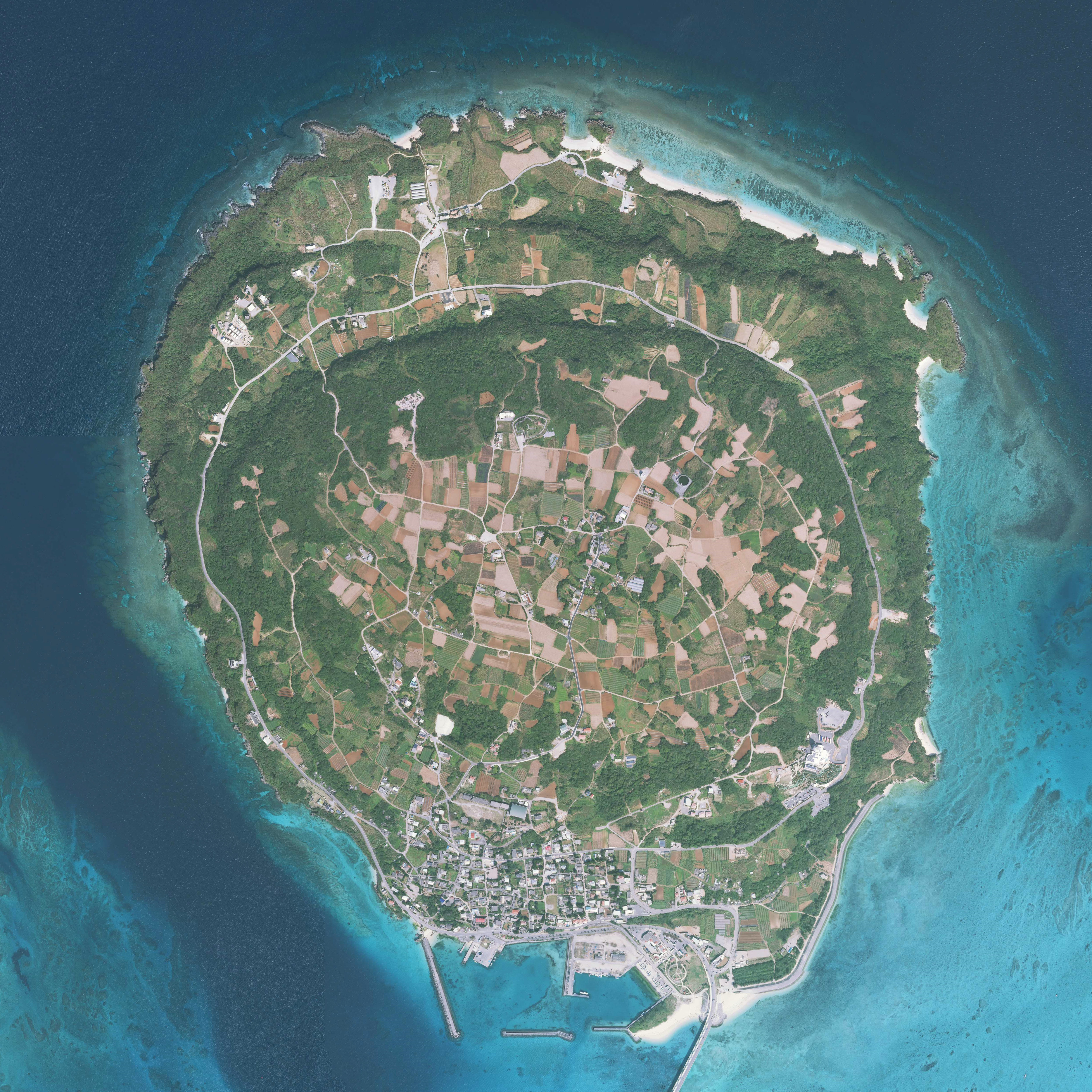
| DeskripsyonKouri Island gsi-20180219.jpg |
English: Kouri Island, Nakijin, Okinawa Prefecture, Japan. Combined 10 aerial photos taken by Geospatial Information Authority of Japan.
日本語: 古宇利島
国土交通省の地図・空中写真閲覧サービスを元に作成。10枚の航空写真を使用。
|
| Petsa | Taken on 19 Pebrero 2018 |
| Gigikanan | COK20172-C1-2, C1-3, C1-4, C1-5, C1-6, C2-3, C2-4, C2-5, C2-6, C2-7 |
| Tagsulat |
English: Geospatial Information Authority of Japan
日本語: 国土地理院 |
| Camera location | 26° 42′ 17.86″ N, 128° 01′ 06.25″ E | View this and other nearby images on: OpenStreetMap |
|---|
| This is a retouched picture, which means that it has been digitally altered from its original version. Modifications: Combined 10 aerial photos and cropped. Modifications made by Kugel~commonswiki.
|

|
NOTE: This image is a panorama consisting of 10 frames that were merged or stitched in software. As a result, this image necessarily underwent some form of digital manipulation. These manipulations may include blending, blurring, cloning, and colour and perspective adjustments. As a result of these adjustments, the image content may be slightly different from reality at the points where multiple images were combined. This manipulation is often required due to lens, perspective, and parallax distortions.
Boarisch | български | dansk | Deutsch | Zazaki | Ελληνικά | English | Canadian English | British English | Esperanto | español | eesti | suomi | français | hrvatski | magyar | italiano | 日本語 | 한국어 | македонски | മലയാളം | Nederlands | polski | português | русский | sicilianu | slovenščina | svenska | Türkçe | українська | العربية | 中文 | +/− |
Pagtugot

|
The copyright holder of this file, Ministry of Land, Infrastructure, Transport and Tourism, allows anyone to use it for any purpose, provided that the copyright holder is properly attributed. Redistribution, derivative work, commercial use, and all other use is permitted. |
Attribution:
National Land Image Information (Color Aerial Photographs), created by Ministry of Land, Infrastructure, Transport and Tourism, distributed by Geospatial Information Authority of Japan Attribution |

|
When you use this image on an article, please include the following phrase or equivalent for attribution and citation: "National Land Image Information (Color Aerial Photographs), created by Ministry of Land, Infrastructure, Transport and Tourism, distributed by Geospatial Information Authority of Japan." |
Captions
Items portrayed in this file
depicts English
copyright status English
copyrighted English
copyright license English
attribution only license English
19 Pebrero 2018
coordinates of the point of view English
26°42'17.860"N, 128°1'6.251"E
Kaagi sa payl
I-klik ang petsa/oras aron makit-an ang hulagway sa payl niadtong panahona.
| Petsa/Takna | Thumbnail | Mga dimensyon | Tiggamit | Komento | |
|---|---|---|---|---|---|
| kasamtangan | 06:16, 19 Hunyo 2018 | | 5,000 × 5,000 (6.67 MB) | Kugel~commonswiki | {{Information |Description={{en|1=Kouri Island, Nakijin, Okinawa Prefecture, Japan. Combined 10 aerial photos taken by Geospatial Information Authority of Japan. *Reference Number : COK20172 *Location : Nago *Course and Photo Number : C1-2~6, C2-3~7 *Date taken : 19 February 2018 }} {{ja|1=古宇利島 国土交通省の地図・空中写真閲覧サービスを元に作成。10枚の航空写真を使用。 * 整理番号 : COK20172 * 撮影地域 : 名護 * コース - 写真番号 : C1-2からC1-6, C2-3からC2-7 * 撮影年月日 : 2018年2月19日 }} |Source=[http://mapps.gsi.go.jp/contentsImageDisplay.do?specificationId... |
Mga paggamit sa payl
Ang mosunod nga mga panid misumpay niining payl:
Global nga paggamit sa payl
Kining ubang wiki naggamit ning maong payl:
Metadata
Ang kining payl adunay dugang nga impormasyon, mahimong nadugang gikan sa digital camera o scanner nga gigamit sa paghimo o pag-digitize niini.
Kon ang payl namodipikar gikan sa orihinal nga estado, ang ubang detalye mamahimong dili moreplek sa namodipikar nga payl.
| Software used | Microsoft ICE v2.0.3.0 |
|---|