Payl:C71192s1_Ant.Map_Ebbe_Glacier.jpg
From Wikipedia, the free encyclopedia
Tibuok resolusyon (3,507 × 3,271 pixels, size sa payl: 1.71 MB, MIME type: image/jpeg)
Kining maong payl gikan sa Wikimedia Commons ug mahimong gigamit sa ubang proyekto. Ang deskripsyon niini didto gipakita sa ubos.
Mubong sugid:
| DeskripsyonC71192s1 Ant.Map Ebbe Glacier.jpg |
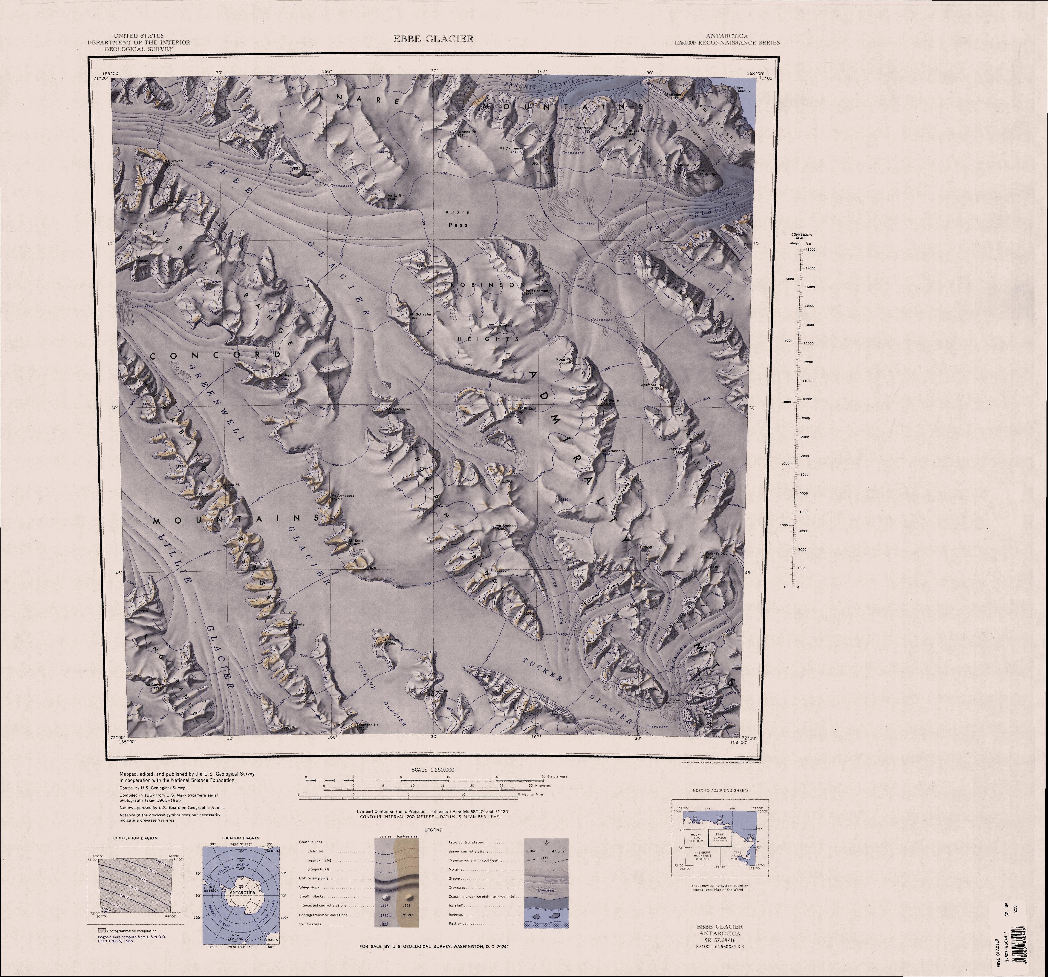
English: 1:250,000-scale topographic reconnaissance map of the Ebbe Glacier area in the Admiralty Range from 165°-168°E to 71°-72°S in Antarctica, including Greenwell, Lillie and Tucker Glacier. Mapped, edited and published by the U.S. Geological Survey in cooperation with the National Science Foundation. |
||||
| Petsa | |||||
| Gigikanan | http://usarc.usgs.gov/drg_dload.shtml | ||||
| Tagsulat | United States Geological Survey | ||||
| Pagtugot (Paggamit pag-usab niini nga file) |
|
Captions
Items portrayed in this file
depicts English
media type English
image/jpeg
checksum English
a5a19dba5b3da37cd9b916d15575700f0426e29a
data size English
1,792,992 byte
height English
3,271 pixel
width English
3,507 pixel
Kaagi sa payl
I-klik ang petsa/oras aron makit-an ang hulagway sa payl niadtong panahona.
| Petsa/Takna | Thumbnail | Mga dimensyon | Tiggamit | Komento | |
|---|---|---|---|---|---|
| kasamtangan | 20:31, 3 Abril 2005 | | 3,507 × 3,271 (1.71 MB) | Achim Raschka | Map of Antarctica by the United States Antarctic Ressource Center of the US Geological Society. {{PD-US}} Copyrights and Trademarks USGS-authored or produced data and information are in the public domain. While the content of most USGS web pages is in th |
Mga paggamit sa payl
Ang mosunod nga mga panid misumpay niining payl:
Global nga paggamit sa payl
Kining ubang wiki naggamit ning maong payl:
- Paggamit sa bg.wikipedia.org
- Paggamit sa de.wikipedia.org
- Paggamit sa en.wikipedia.org
- Admiralty Mountains
- Dennistoun Glacier
- Everett Range
- Lyttelton Range
- Dunedin Range
- Homerun Range
- Anare Mountains
- Lillie Glacier
- Concord Mountains
- Mirabito Range
- King Range (Antarctica)
- Tucker Glacier
- Victory Mountains
- Quam Heights
- Barnett Glacier
- Findlay Range
- Hedgpeth Heights
- Robinson Heights
- McGregor Range (Antarctica)
- Paggamit sa he.wikipedia.org
- Paggamit sa it.wikipedia.org
View more global usage of this file.
Metadata
Ang kining payl adunay dugang nga impormasyon, mahimong nadugang gikan sa digital camera o scanner nga gigamit sa paghimo o pag-digitize niini.
Kon ang payl namodipikar gikan sa orihinal nga estado, ang ubang detalye mamahimong dili moreplek sa namodipikar nga payl.
| _error | 0 |
|---|