Payl:Bluebells,_Bannisdale_-_geograph.org.uk_-_441229.jpg
From Wikipedia, the free encyclopedia
Walay mas taas nga resolusyon.
Bluebells,_Bannisdale_-_geograph.org.uk_-_441229.jpg (640 × 480 pixels, size sa payl: 136 KB, MIME type: image/jpeg)
Kining maong payl gikan sa Wikimedia Commons ug mahimong gigamit sa ubang proyekto. Ang deskripsyon niini didto gipakita sa ubos.
Mubong sugid:
| DeskripsyonBluebells, Bannisdale - geograph.org.uk - 441229.jpg |
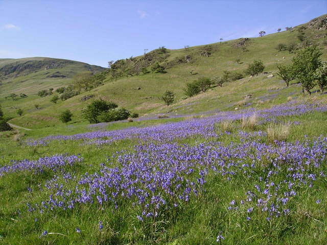
English: Bluebells, Bannisdale Looking up the dale under Lamb Pasture.It seems likely that the dale was thickly wooded in the past, hence the Bluebells. |
| Petsa | |
| Gigikanan | From geograph.org.uk |
| Tagsulat | Michael Graham |
| Attribution (required by the license) InfoField | Michael Graham / Bluebells, Bannisdale / |
InfoField | Michael Graham / Bluebells, Bannisdale |
| Camera location | 54° 24′ 41″ N, 2° 43′ 21″ W | View this and other nearby images on: OpenStreetMap |
|---|
| Object location | 54° 24′ 58″ N, 2° 43′ 20″ W | View this and other nearby images on: OpenStreetMap |
|---|
Pagtugot

|
This image was taken from the Geograph project collection. See this photograph's page on the Geograph website for the photographer's contact details. The copyright on this image is owned by Michael Graham and is licensed for reuse under the Creative Commons Attribution-ShareAlike 2.0 license.
|
This file is licensed under the Creative Commons Attribution-Share Alike 2.0 Generic license.
Attribution: Michael Graham
- Libre ka:
- sa pagsabwag – sa pagkopya, pag-apod-apod ug pagsabwag sa hinimo
- sa pag-remix – sa pag-adap sa binuhat
- Ubos sa mosunod nga mga kondisyon:
- atribusyon – Kinahanglan nimo nga hatagan ang angay nga kredito, maghatag usa ka link sa lisensya, ug ipakita kung adunay mga pagbag-o. Mahimo nimo kini buhaton sa bisan unsang makatarunganon nga paagi, apan dili sa bisan unsang paagi nga nagsugyot nga gi-endorso ka sa licensor o ang imong paggamit.
- share parehas – Kung imong gi-remix, gibag-o, o gibase sa materyal, kinahanglan nimo nga iapod-apod ang imong mga kontribusyon sa ilawom sa parehas o katugma nga lisensya sama sa orihinal.
Captions
Add a one-line explanation of what this file represents
Items portrayed in this file
depicts English
creator English
some value
copyright status English
copyrighted English
source of file English
file available on the internet English
22 Mayo 2007
coordinates of the point of view English
54°24'40.79"N, 2°43'21.00"W
coordinates of depicted place English
54°24'58.28"N, 2°43'20.28"W
exposure time English
0.004978 second
f-number English
5.6
focal length English
5.4 millimetre
ISO speed English
50
media type English
image/jpeg
instance of English
checksum English
ffa11cfec915af663f2683564e4b2a748d937eab
data size English
139,767 byte
height English
480 pixel
width English
640 pixel
Kaagi sa payl
I-klik ang petsa/oras aron makit-an ang hulagway sa payl niadtong panahona.
| Petsa/Takna | Thumbnail | Mga dimensyon | Tiggamit | Komento | |
|---|---|---|---|---|---|
| kasamtangan | 10:42, 4 Pebrero 2011 | | 640 × 480 (136 KB) | GeographBot | == {{int:filedesc}} == {{Information |description={{en|1=Bluebells, Bannisdale Looking up the dale under Lamb Pasture.It seems likely that the dale was thickly wooded in the past, hence the Bluebells.}} |date=2007-05-22 |source=From [http://www.geograph.o |
Mga paggamit sa payl
Ang mosunod nga mga panid misumpay niining payl:
Global nga paggamit sa payl
Kining ubang wiki naggamit ning maong payl:
- Paggamit sa en.wikipedia.org
- Paggamit sa nl.wikipedia.org
- Paggamit sa sv.wikipedia.org
- Paggamit sa www.wikidata.org
- Paggamit sa zh-min-nan.wikipedia.org
Metadata
Ang kining payl adunay dugang nga impormasyon, mahimong nadugang gikan sa digital camera o scanner nga gigamit sa paghimo o pag-digitize niini.
Kon ang payl namodipikar gikan sa orihinal nga estado, ang ubang detalye mamahimong dili moreplek sa namodipikar nga payl.
| Image title | ACER |
|---|---|
| Camera manufacturer | ACER |
| Camera model | CE-5330 |
| Exposure time | 2,489/500,000 sec (0.004978) |
| F Number | f/5.6 |
| ISO speed rating | 50 |
| Date and time of data generation | 16:57, 22 Mayo 2007 |
| Lens focal length | 5.4 mm |
| Orientation | Normal |
| Horizontal resolution | 72 dpi |
| Vertical resolution | 72 dpi |
| Software used | V1.00 |
| File change date and time | 16:57, 22 Mayo 2007 |
| Y and C positioning | Co-sited |
| Exposure Program | Landscape mode (for landscape photos with the background in focus) |
| Exif version | 2.2 |
| Date and time of digitizing | 16:57, 22 Mayo 2007 |
| APEX exposure bias | 0 |
| Maximum land aperture | 2.97 APEX (f/2.8) |
| Metering mode | Center weighted average |
| Light source | Unknown |
| Flash | Flash did not fire, auto mode |
| Color space | sRGB |
| Custom image processing | Normal process |
| Exposure mode | Auto exposure |
| White balance | Auto white balance |
| Digital zoom ratio | 1 |
| Scene capture type | Landscape |
| Contrast | Normal |
| Saturation | Normal |
| Sharpness | Normal |