Fitxer:LocationHungaryInterbellum.png
From Wikipedia, the free encyclopedia
No hi ha cap versió amb una resolució més gran.
LocationHungaryInterbellum.png (248 × 113 píxels, mida del fitxer: 6 Ko, tipus MIME: image/png)
| Aquest fitxer i la informació mostrada a continuació provenen del dipòsit multimèdia lliure Wikimedia Commons. |
Resum
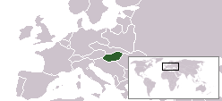
| DescripcióLocationHungaryInterbellum.png | Location of Hungary during 1920s and 1930s |
| Font | based on Image:LocationCzechoslovakia.png |
| Autor | Hanhil |
Llicència
| Public domainPublic domainfalsefalse |
| Jo, el titular del copyright d'aquesta obra, l'allibero al domini públic. Això s'aplica a tot el món. En alguns països això pot no ser legalment possible, en tal cas: Jo faig concessió a tothom del dret d'usar aquesta obra per a qualsevol propòsit, sense cap condició llevat d'aquelles requerides per la llei. |
Llegendes
Afegeix una explicació d'una línia del que representa aquest fitxer
Elements representats en aquest fitxer
representa l'entitat
Algun valor sense element de Wikidata
Historial del fitxer
Cliqueu una data/hora per veure el fitxer tal com era aleshores.
| Data/hora | Miniatura | Dimensions | Usuari/a | Comentari | |
|---|---|---|---|---|---|
| actual | 09:59, 20 abr 2008 | | 248 × 113 (6 Ko) | Hanhil | {{Information |Description=Location of Hungary during 1920s and 1930s |Source=based on Image:LocationCzechoslovakia.png |Date= |Author= Hanhil |Permission= |other_versions= }} Category:Maps of the history of Hungary |
Ús del fitxer
La pàgina següent utilitza aquest fitxer:
Ús global del fitxer
Utilització d'aquest fitxer en altres wikis:
- Utilització a hr.wikipedia.org
- Utilització a nl.wikipedia.org
- Utilització a rue.wikipedia.org