File:Locationmap_Korea.png
From Wikipedia, the free encyclopedia
No higher resolution available.
Locationmap_Korea.png (༢༥༠ × ༡༡༥ བརྙན་རྒྱུ།, ཡིག་ཆ་ཆེ་ཆུང།: ༥ KB, རྣམ་གཞག།: image/png)
ཡིག་ཆ་འདི་ནས་Wikimedia Commons རེད་འདུག། ལས་འཆར་གཞན་ཁག་ནང་བེད་སྤྱོད་ཡོད་ངེས། འགྲེལ་བརྗོད་ཤོག་ངོས་འདིའི་འགྲེལ་བརྗོད་གཤམ་དུ་འཁོད་ཡོད།
བསྡུས་དོན།


གན་རྒྱ་ནང་ཞུགས་པ།
| This file is licensed under the Creative Commons Attribution-Share Alike 3.0 Unported license. Subject to disclaimers. | ||
| ||
| This licensing tag was added to this file as part of the GFDL licensing update.http://creativecommons.org/licenses/by-sa/3.0/CC BY-SA 3.0Creative Commons Attribution-Share Alike 3.0truetrue |

|
Permission is granted to copy, distribute and/or modify this document under the terms of the GNU Free Documentation License, Version 1.2 or any later version published by the Free Software Foundation; with no Invariant Sections, no Front-Cover Texts, and no Back-Cover Texts. A copy of the license is included in the section entitled GNU Free Documentation License. Subject to disclaimers.http://www.gnu.org/copyleft/fdl.htmlGFDLGNU Free Documentation Licensetruetrue |
Original upload log
The original description page was here. All following user names refer to en.wikipedia.
- 2007-07-20 02:50 IAMTHEEGGMAN 250×115× (4768 bytes) Updated to borders at the time...
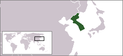
- 2004-08-16 18:18 Kokiri 250×115× (3976 bytes) map showing location of the Korean peninsula
Captions
Add a one-line explanation of what this file represents
شبه جزيرة كوريا
Items portrayed in this file
depicts དབྱིན་ཇིའི་སྐད།
copyright status དབྱིན་ཇིའི་སྐད།
copyrighted དབྱིན་ཇིའི་སྐད།
copyright license དབྱིན་ཇིའི་སྐད།
GNU Free Documentation License, version 1.2 or later དབྱིན་ཇིའི་སྐད།
Creative Commons Attribution-ShareAlike 3.0 Unported དབྱིན་ཇིའི་སྐད།
inception དབྱིན་ཇིའི་སྐད།
༡༦ ཟླ་བ་བརྒྱད་པ། 2004
ཡིག་ཆའི་ལོ་རྒྱུས།
ཟླ་ཚེས་/དུས་ཚོད་གནུན་ཏེ་རྩོམ་ཡིག་ལ་ལྟ་བ།
| ཚེས་གྲངས། / དུས་ཚོད། | བསྡུས་དོན། | ཚད། | སྤྱོད་མི། | བསམ་ཚུལ། | |
|---|---|---|---|---|---|
| ད་ལྟ། | ༠༠:༠༨, ༣༠ ཟླ་དགུ་བ། ༢༠༡༢ | | ༢༥༠ × ༡༡༥ (༥ KB) | OgreBot | (BOT): Uploading old version of file from en.wikipedia; originally uploaded on 2007-07-20 02:50:53 by IAMTHEEGGMAN |
| ༡༢:༠༡, ༡༨ ཟླ་གཉིས་པ། ༢༠༠༥ |  | ༢༥༠ × ༡༡༥ (༤ KB) | Knutux | location of the Korean peninsula. |
ཡིག་ཆ་བེད་སྤྱོད་ཁུལ།
There are no pages that use this file.
Global file usage
The following other wikis use this file:
- Usage on ar.wikipedia.org
- Usage on be-tarask.wikipedia.org
- Usage on en.wikipedia.org
- Usage on et.wikipedia.org
- Usage on fy.wikipedia.org
- Usage on hr.wikipedia.org
- Usage on it.wikinews.org
- Usage on jv.wikipedia.org
- Usage on km.wikipedia.org
- Usage on ms.wikipedia.org
- Usage on nl.wikipedia.org
- Usage on ro.wikipedia.org
- Usage on sah.wikipedia.org
- Usage on sh.wikipedia.org
- Usage on tl.wikipedia.org
- Usage on uz.wikipedia.org
- Usage on wuu.wikipedia.org
- Usage on zh-classical.wikipedia.org
- Usage on zh-min-nan.wikipedia.org
- Usage on zh-yue.wikipedia.org
"https://bo.wikipedia.org/wiki/File:Locationmap_Korea.png"ལས་སླར་རྙེད་སོང།