चित्र:Location_Vosges.PNG
From Wikipedia, the free encyclopedia
ए से उच्च गुणवत्ता उपलब्ध नइखे।
Location_Vosges.PNG (506 × 439 पिक्सेल, फाइल साइज: 40 KB, MIME टाइप: image/png)
ई फाइल Wikimedia Commons से बा आ अउरी प्रोजेक्ट भी एकर इस्तेमाल कर सकत बाड़ें। एकर विवरण फाइल विवरण पन्ना नीचे देखावल गइल बा।

|
This locator map image could be re-created using vector graphics as an SVG file. This has several advantages; see Commons:Media for cleanup for more information. If an SVG form of this image is available, please upload it and afterwards replace this template with
{{vector version available|new image name}}.
It is recommended to name the SVG file “Location Vosges.svg”—then the template Vector version available (or Vva) does not need the new image name parameter. |
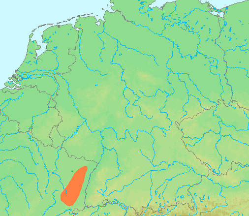
| बिबरणLocation Vosges.PNG | Locator maps for mountain ranges : Location Vosges.PNG |
| स्रोत | demis maps, see below |
| लेखक |
This file is lacking author information.
|
| Public domainPublic domainfalsefalse |
This image is in the public domain because it came from the site https://www.demis.nl/products/web-map-server/examples/ and was released by the copyright holder. Permission is granted to copy, distribute and/or modify this map since it is based on free of copyright images from: www.demis.nl. See also approval email on de.wp and its clarification.
Deutsch | English | македонски | മലയാളം | Nederlands | slovenščina | +/− |
| Public domainPublic domainfalsefalse |
| This work has been released into the public domain by its copyright holder, www.demis.nl. This applies worldwide. In some countries this may not be legally possible; if so: www.demis.nl grants anyone the right to use this work for any purpose, without any conditions, unless such conditions are required by law. Public domainPublic domainfalsefalse |
Captions
Add a one-line explanation of what this file represents
locatie van de Vogezen (gebergte)
Items portrayed in this file
depicts अंगरेजी
data size अंगरेजी
४०,७०४ byte
height अंगरेजी
४३९ पिक्सेल
width अंगरेजी
५०६ पिक्सेल
media type अंगरेजी
image/png
checksum अंगरेजी
6e3ee56c494fa0ee16c19831a88180172a45f9d4
फाइल के इतिहास
ओ समय ई फाइल कइसन लउके ई देखे खातिर कौनों तारीख/समय पर क्लिक करीं।
| तारीख/समय | चिप्पी रूप | डाइमेंशन | प्रयोगकर्ता | टिप्पणी | |
|---|---|---|---|---|---|
| वर्तमान | 13:43, 29 जून 2007 | | 506 × 439 (40 KB) | Michiel1972 | {{Information |Description=Locator maps for mountain ranges : {{subst:PAGENAME}} |Source=demis maps, see below |Date= |Author={{Statistics Netherlands map}} |Permission=see below |other_versions= }} {{PD-Demis}} [[Category:Maps of mountain_ranges_of_Eu |
फाइल के उपयोग
फाइल के इस्तेमाल पन्ना करत बा:
बैस्विक फाइल उपयोग
नीचे दिहल अउरी विकिसभ पर एह फाइल के इस्तेमाल हो रहल बा:
- br.wikipedia.org पर इस्तेमाल
- ca.wikipedia.org पर इस्तेमाल
- de.wikipedia.org पर इस्तेमाल
- eu.wikipedia.org पर इस्तेमाल
- fa.wikipedia.org पर इस्तेमाल
- fi.wikipedia.org पर इस्तेमाल
- fr.wikipedia.org पर इस्तेमाल
- fy.wikipedia.org पर इस्तेमाल
- lv.wikipedia.org पर इस्तेमाल
- nl.wikipedia.org पर इस्तेमाल
- no.wikipedia.org पर इस्तेमाल
- oc.wikipedia.org पर इस्तेमाल
- pnb.wikipedia.org पर इस्तेमाल
- uk.wikipedia.org पर इस्तेमाल
- www.wikidata.org पर इस्तेमाल
"https://bh.wikipedia.org/wiki/चित्र:Location_Vosges.PNG" से लिहल गइल