File:Countries_by_immigrant_population.png
From Wikipedia, the free encyclopedia
Размер на този преглед: 800 × 406 пиксела. Други разделителни способности: 320 × 162 пиксела | 640 × 325 пиксела | 1024 × 520 пиксела | 1280 × 649 пиксела | 3132 × 1589 пиксела.
Оригинален файл (3132 × 1589 пиксела, големина на файла: 165 КБ, MIME-тип: image/png)
| Този файл е от Общомедия и може да се използва от други проекти.
Следва информация за файла, достъпна през оригиналната му описателна страница. |
Резюме
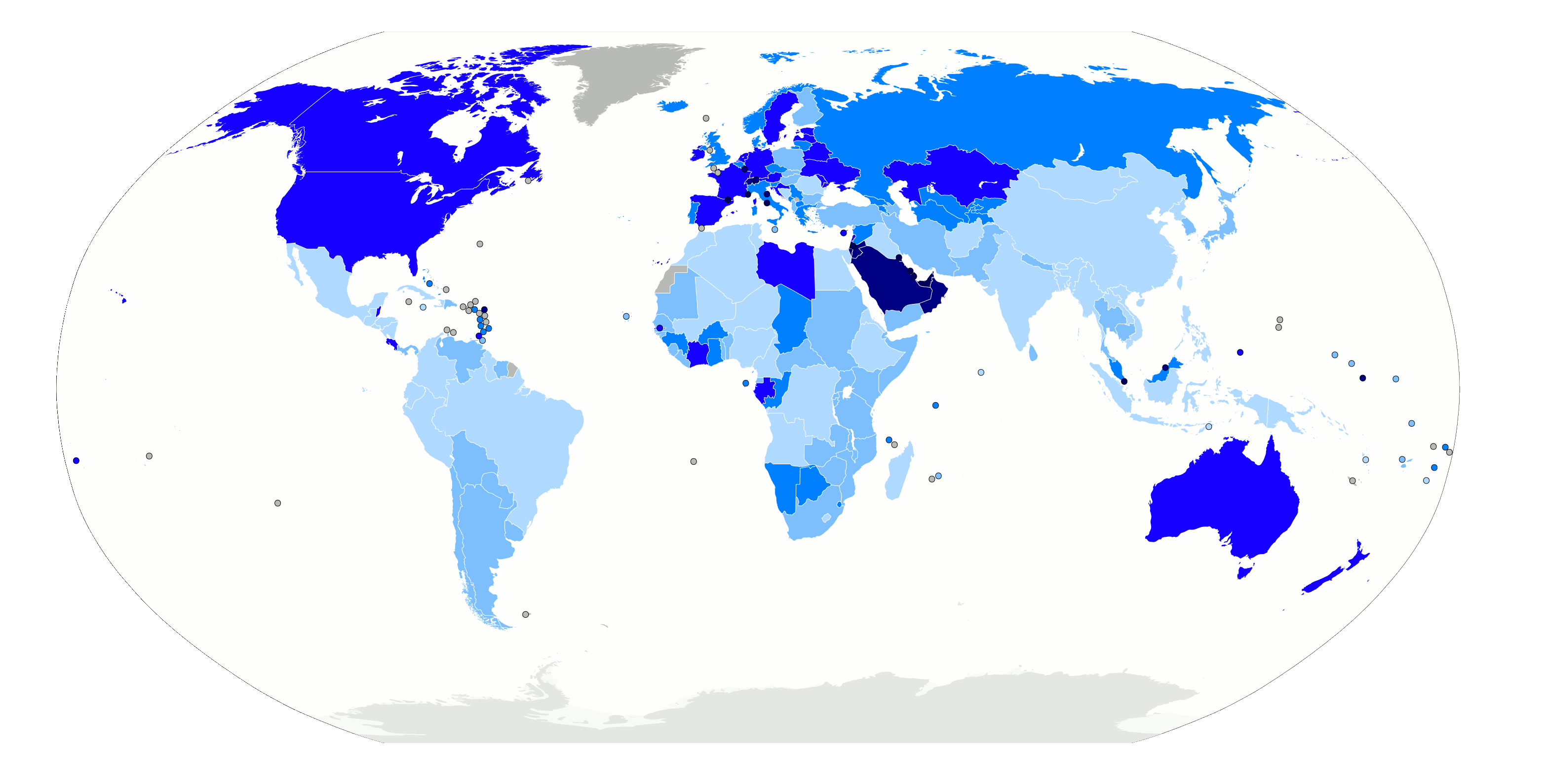
| ОписаниеCountries by immigrant population.png |
Map of the world with countries coloured according to their immigrant population as a percentage of the whole population, based on the UN's World Population Policies 2005 data ([1]). Legend: no data more than 50% 20% to 50% 10% to 20% 4% to 10% 1% to 4% less than 1% |
| Дата | |
| Източник | Own work, derived from Image:BlankMap-World6.svg |
| Автор | Thebainer (Stephen Bain) |
| Права (Повторно използване на файла) |
N/A |
| други версии | File:Countries by immigrant population.svg, vector version |
Лицензиране
| I, Stephen Bain, hereby publish this work under the following licences: | ||
Този файл се разпространява под лиценза Криейтив Комънс Признание - Споделяне на споделеното 3.0 Нелокализиран, 2.5 Неадаптиран, 2.0 Неадаптиран и 1.0 Неадаптиран.
You may select the licence of your choice. |

Описания
Add a one-line explanation of what this file represents
Items portrayed in this file
изобразен обект
copyright status английски
copyrighted английски
11 март 2007
media type английски
image/png
checksum английски
662242e14201c83b9ad00ffa52041c1fd77afe22
data size английски
169 104 Байт
1589 пиксел
3132 пиксел
История на файла
Избирането на дата/час ще покаже как е изглеждал файлът към онзи момент.
| Дата/Час | Миникартинка | Размер | Потребител | Коментар | |
|---|---|---|---|---|---|
| текуща | 02:59, 13 ноември 2012 | | 3132 × 1589 (165 КБ) | JohnnyMrNinja | color indexed |
| 12:48, 11 март 2007 |  | 3132 × 1589 (479 КБ) | Stephen Bain | ==Information== {{Information |Description=Map of the world with countries coloured according to their immigrant population as a percentage of the whole population, based on the UN's World Population Policies 2005 data ([http://www.u |
Използване на файла
Следната страница използва следния файл: