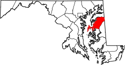
Queen Anne’s County[1] is a County im Bundesstoot Maryland in da USA. Des County hod 47.798 Eihwohna. Da Sitz vo da Vawoitung is in Centreville.

| Vawoitung | |
|---|---|
| US-Bundesstoot: | Maryland |
| Sitz vo da Vawoitung: | Centreville |
| Adress vom Vawoitungssitz: |
Queen Anne's County Government 107 N. Liberty St. Centreville, MD 21617 |
| Grindung: | 1706 |
| Buidt aus: | Talbot County |
| Vuawoi: | 001 410 |
| Demographie | |
| Eihwohna: | 47.798 (2010) |
| Dichtn: | 47,1 Eihwohna/km² |
| Eadkund | |
| Flächn gesamt: | 1.370 km² |
| Wossaflächn: | 356 km² |
| Koartn | |
 | |
| Hoamseitn: www.qac.org | |

Geografie
Des County liegt auf da Delmarva-Halbinsel am östlichn Ufa vo da Chesapeake Bay und grenzt im Ostn an Delaware. Zum Queen Anne’s County gheat Kent Island, de greßte Insl in da Chesapeake Bay. Des County hod a Flächn vo 1370 Quadratkilometa davo san 356 Quadratkilometa Wossaflächn.
Es grenzt an foignde Countys:
| Kent County | ||
| Anne Arundel County1 |  |
Kent County (Delaware) |
| Talbot County | Caroline County |
1 - Seegrenz in da Chesapeake Bay
Gmoana
Towns
- Barcley
- Centreville
- Church Hill
- Millington
- Queen Anne
- Queenstown
- Sudlersville
- Templeville
Census-designated places (CDP)
- Chester
- Grasonville
- Kent Narrows
- Kingstown
- Stevensville
- Crumpton
- Dominion
- Ingleside
- Love Point
- Matapeake
- Price
- Romancoke
- Ruthsburg
Beleg
Im Netz
Wikiwand in your browser!
Seamless Wikipedia browsing. On steroids.
Every time you click a link to Wikipedia, Wiktionary or Wikiquote in your browser's search results, it will show the modern Wikiwand interface.
Wikiwand extension is a five stars, simple, with minimum permission required to keep your browsing private, safe and transparent.
