File:Africa-countries-western.png
From Wikipedia, the free encyclopedia
Daha yüksək versiyası yoxdur.
Africa-countries-western.png (360 × 392 piksel, fayl həcmi: 10 KB, MIME növü: image/png)
| Bu fayl "Vikimedia Commons"dadır və digər layihələrdə istifadə edilə bilər. |
 |
Faylın təsvir səhifəsinə get |

|
File:Africa-countries-western.svg is a vector version of this file. It should be used in place of this PNG file when not inferior.
File:Africa-countries-western.png → File:Africa-countries-western.svg
For more information, see Help:SVG.
|
 |
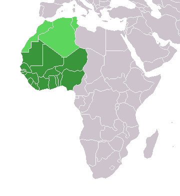
Map of countries in Western Africa.
Originally uploaded to the English Wikipedia:
- 11:32, 3 Feb 2005 . . Lucidity (13890 bytes) (Map of countries in Western Africa)
- 11:12, 3 Feb 2005 . . Lucidity (13885 bytes) (Map of countries in Western Africa)
where it was tagged by Lucidity as GFDL. This map is a modification of Image:BlankMap-World.png.

|
Bu sənədi GNU Azad Sənədləşdirmə Lisenziyası, Versiya 1.2 və ya Azad Proqram Fondu tərəfindən nəşr olunan hər hansı sonrakı versiya şərtlərinə əsasən dəyişməz bölmələr, ön qapaq mətnləri və arxa qapaq mətnləri olmadan köçürmək, yayımlamaq və / və ya dəyişdirmək üçün icazə verilir; Lisenziyanın bir nüsxəsi GNU Azad Sənədləşdirmə Lisenziyası adlı hissəyə daxil edilmişdir.http://www.gnu.org/copyleft/fdl.htmlGFDLGNU Free Documentation Licensetruetrue |
| Bu fayl Creative Commons Attribution-Share Alike 3.0 Unported lisenziyası altında yayımlanır. | ||
| ||
| This licensing tag was added to this file as part of the GFDL licensing update.http://creativecommons.org/licenses/by-sa/3.0/CC BY-SA 3.0Creative Commons Attribution-Share Alike 3.0truetrue |
.
Captions
Add a one-line explanation of what this file represents
Items portrayed in this file
təsvir edir
copyright status ingilis
copyrighted ingilis
media type ingilis
image/png
checksum ingilis
13a5cbdf913cfca343b69f25579339997718d075
data size ingilis
10.106 Bayt
392 piksel
360 piksel
Faylın tarixçəsi
Faylın əvvəlki versiyasını görmək üçün gün/tarix bölməsindəki tarixlərə klikləyin.
| Tarix/Vaxt | Miniatür | Ölçülər | İstifadəçi | Şərh | |
|---|---|---|---|---|---|
| hal-hazırkı | 19:10, 17 mart 2018 | | 360 × 392 (10 KB) | Maphobbyist | Upload |
| 23:02, 29 oktyabr 2017 |  | 360 × 392 (8 KB) | أنس | WS current status | |
| 17:30, 13 yanvar 2014 |  | 360 × 392 (10 KB) | VVVF | As File:LocationWesternAfrica.png | |
| 20:06, 9 iyul 2011 |  | 360 × 392 (13 KB) | Maphobbyist | South Sudan has become independent on July 9, 2011. Sudan and South Sudan are shown with the new international border between them. | |
| 21:35, 31 mart 2011 |  | 360 × 392 (13 KB) | Hoshie | added Cabinda (Angola) and Montenengro to the map. | |
| 11:13, 5 may 2006 |  | 360 × 392 (4 KB) | Hautala | optimized with png | |
| 21:01, 2 mart 2005 |  | 360 × 392 (14 KB) | Atamari | source en:wiki |
Faylın istifadəsi
Bu faylı istifadə edən səhifə yoxdur.
Faylın qlobal istifadəsi
Bu fayl aşağıdakı vikilərdə istifadə olunur:
- incubator.wikimedia.org layihəsində istifadəsi
- kbd.wikipedia.org layihəsində istifadəsi
- kk.wikipedia.org layihəsində istifadəsi
- ko.wikipedia.org layihəsində istifadəsi
- oc.wikipedia.org layihəsində istifadəsi
- pt.wikipedia.org layihəsində istifadəsi
- ru.wikipedia.org layihəsində istifadəsi
- ru.wikinews.org layihəsində istifadəsi
- sl.wikipedia.org layihəsində istifadəsi
- sv.wikinews.org layihəsində istifadəsi
- sv.wiktionary.org layihəsində istifadəsi
- tg.wikipedia.org layihəsində istifadəsi
- tk.wikipedia.org layihəsində istifadəsi
- uk.wikipedia.org layihəsində istifadəsi
- uz.wikipedia.org layihəsində istifadəsi
- wo.wikipedia.org layihəsində istifadəsi
Metaməlumatlar
Bu faylda fotoaparat və ya skanerlə əlavə olunmuş məlumatlar var. Əgər fayl sonradan redaktə olunubsa, bəzi parametrlər bu şəkildə göstərilənlərdən fərqli ola bilər.
| Üfüqi xətt | 37,8 dpc |
|---|---|
| Şaquli xətt | 37,8 dpc |