ملف:US_map-Northeast.PNG
من ويكيبيديا، الموسوعة encyclopedia
US_map-Northeast.PNG (572 × 371 بكسل حجم الملف: 16 كيلوبايت، نوع MIME: image/png)
| هذا ملف من ويكيميديا كومنز. معلومات من صفحة وصفه مبينة في الأسفل. كومنز مستودع ملفات ميديا ذو رخصة حرة. |

|
هذه locator map الصورة / الصورتان باستعمال رسومات متجهية ملفات رسوميات شعاعية.
It is recommended to name the SVG file "US map-Northeast.svg" - then the template Vector version available (or Vva) does not need the new image name parameter.
|
ملخص
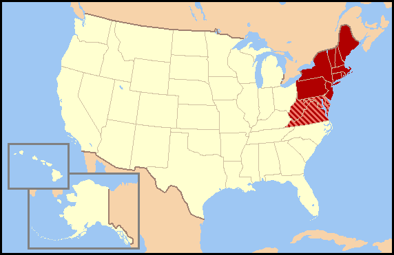
| الوصفUS map-Northeast.PNG |
This map was commissioned by WikiProject U.S. regions. Regional definitions vary from source to source and this map does not attempt to favor a single definition. There are most likely definitions that differ from yours so, please do not make changes to this map without discussing them on WikiProject U.S. regions' talk page. en:Wikipedia:WikiProject U.S. regions/mnote JCarriker@en.Wikipedia.org made this from the exisiting image , which is also released under GNU. |
| التاريخ | |
| المصدر | en:Image:US map-Northeast.PNG |
| المؤلف | en:User:JCarriker |
| الترخيص (إعادة استخدام هذا الملف) |
hui |
ترخيص
|
NOTE: "subject to disclaimers" below may not actually apply, this was tagged with {{GFDL-user-en}}, and after May 2007, en:Template:GFDL-self did not require disclaimers. Please check the image description page on the English Wikipedia (or, if it has been deleted, ask an English Wikipedia administrator). See Wikipedia:GFDL standardization for details. | ||||||||
JCarriker من en.wikipedia.org، صاحب حقوق التأليف والنشر لهذا العمل، أنشر هذا العمل تحت الرخصة التالية:
| ||||||||
|
Note: This tag should not be used. For images that were released on the English Wikipedia using either GFDL or GFDL-self with disclaimers, use {{GFDL-user-en-with-disclaimers}}. For images without disclaimers please use {{GFDL-user-en-no-disclaimers}} instead. If you are the copyright holder of files that were released on Wikipedia, please consider removing the disclaimers. |

الشروحات
العناصر المصورة في هذا الملف
يُصوِّر
١٢ ديسمبر 2005
تاريخ الملف
اضغط على زمن/تاريخ لرؤية الملف كما بدا في هذا الزمن.
| زمن/تاريخ | صورة مصغرة | الأبعاد | مستخدم | تعليق | |
|---|---|---|---|---|---|
| حالي | 03:44، 7 أبريل 2007 | | 572 × 371 (16 كيلوبايت) | Nikopoley | {{Information |Description=This map was commissioned by WikiProject U.S. regions. Regional definitions vary from source to source and this map does not attempt to favor a single definition. There are most likely definitions that differ from yours so, plea |
استخدام الملف
الصفحة التالية تستخدم هذا الملف:
الاستخدام العالمي للملف
الويكيات الأخرى التالية تستخدم هذا الملف:
- الاستخدام في ca.wikipedia.org
- الاستخدام في de.wikipedia.org
- الاستخدام في en.wikipedia.org
- Wikipedia talk:WikiProject United States regions/Archive1
- Wikipedia:WikiProject United States regions/Maps
- User:JCarriker/test
- Wikipedia:Meetup/Philadelphia 7
- Wikipedia:Meetup/Connecticut/January 2009
- Wikipedia:Meetup/Connecticut/Main
- Wikipedia:Meetup Box/Northeast
- Wikipedia:Meetup/Connecticut/April 2009
- Wikipedia:WikiProject Philadelphia/Wikipedia Takes Philadelphia 1
- Wikipedia:Meetup/Philly/Main
- Wikipedia:Meetup/Philadelphia 8
- Wikipedia:Meetup/Connecticut/June 2009
- Wikipedia:Meetup/Philadelphia 9
- Wikipedia:WikiProject Philadelphia/Wikipedia Takes Philadelphia 2
- Wikipedia:Meetup/Connecticut
- الاستخدام في eo.wikipedia.org
- الاستخدام في es.wikipedia.org
- الاستخدام في eu.wikipedia.org
- الاستخدام في mk.wikipedia.org
- الاستخدام في ru.wikipedia.org
- الاستخدام في sk.wikipedia.org
- الاستخدام في sr.wikipedia.org
- الاستخدام في uk.wikipedia.org
- الاستخدام في vi.wikipedia.org
- الاستخدام في www.wikidata.org
- الاستخدام في zh.wikipedia.org