ስዕል:Map_of_USA_highlighting_Virginia.png
From Wikipedia, the free encyclopedia
ከዚህ በላይ ማጉላት አይቻልም።
Map_of_USA_highlighting_Virginia.png (280 × 183 ፒክስል፤ መጠን፦ 35 KB፤ የMIME ዓይነት፦ image/png)
ይህ ፋይል ከWikimedia Commons የተቀሰመ ነው እና በሌላ ዊኪ ላይ ሊጠቅም ይችላል። በhttps://commons.wikimedia.org/wiki/File:Map_of_USA_highlighting_Virginia.png ላይ የሚገኘው የፋይሉ መግለጫ ከዚህ በታች ቀርቧል።

|
File:Map of USA VA.svg is a vector version of this file. It should be used in place of this PNG file when not inferior.
File:Map of USA highlighting Virginia.png → File:Map of USA VA.svg
For more information, see Help:SVG.
|
 |
ማጠቃለያ
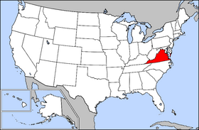
Public domain map courtesy of The General Libraries, The University of Texas at Austin, modified to highlight state boundaries.
Source: Modified version of United States (Outline Map) 1998 from Perry-Castañeda Library Map Collection: United States Maps
| This image is a copy or a derivative work of usa_blank.jpg, from the map collection of the Perry–Castañeda Library (PCL) of the University of Texas at Austin.
This tag does not indicate the copyright status of the attached work. A normal copyright tag is still required. See Commons:Licensing for more information. |
From en:wikipedia
የፈቃድ አይነት፦

|
Permission is granted to copy, distribute and/or modify this document under the terms of the GNU Free Documentation License, Version 1.2 or any later version published by the Free Software Foundation; with no Invariant Sections, no Front-Cover Texts, and no Back-Cover Texts. A copy of the license is included in the section entitled GNU Free Documentation License.http://www.gnu.org/copyleft/fdl.htmlGFDLGNU Free Documentation Licensetruetrue |
| This file is licensed under the Creative Commons Attribution-Share Alike 3.0 Unported license. | ||
| ||
| This licensing tag was added to this file as part of the GFDL licensing update.http://creativecommons.org/licenses/by-sa/3.0/CC BY-SA 3.0Creative Commons Attribution-Share Alike 3.0truetrue |
Captions
Add a one-line explanation of what this file represents
Items portrayed in this file
depicts እንግሊዝኛ
copyright status እንግሊዝኛ
copyrighted እንግሊዝኛ
የፋይሉ ታሪክ
የቀድሞው ዕትም ካለ ቀን/ሰዓቱን በመጫን መመልከት ይቻላል።
| ቀን /ሰዓት | ናሙና | ክልሉ (በpixel) | አቅራቢው | ማጠቃለያ | |
|---|---|---|---|---|---|
| ያሁኑኑ | 18:25, 2 ኦገስት 2005 | | 280 × 183 (35 KB) | Edbrown05~commonswiki | Public domain map courtesy of [http://www.lib.utexas.edu/ The General Libraries, The University of Texas at Austin], modified to highlight state boundaries. {{GFDL}} Category:Maps of U.S. states |
| 08:43, 14 ፌብሩዌሪ 2005 |  | 280 × 183 (35 KB) | Dodo | en:, GFDL |
መያያዣዎች
የሚከተለው ገጽ ወደዚሁ ፋይል ተያይዟል፦
ሌሎች ውኪዎች
የሚከተሉት ሌሎች ውኪዎች ይህን ፋይል ይጠቀማሉ፦
- Usage on br.wikipedia.org
- Usage on en.wikipedia.org
- Usage on en.wiktionary.org
- Usage on eo.wikipedia.org
- Usage on frp.wikipedia.org
- Usage on fr.wikinews.org
- Usage on he.wikipedia.org
- Usage on hr.wiktionary.org
- Usage on jv.wikipedia.org
- Usage on kw.wikipedia.org
- Usage on lij.wikipedia.org
- Usage on li.wikipedia.org
- Usage on no.wikipedia.org
- Usage on no.wiktionary.org
- Usage on pam.wikipedia.org
- Usage on pap.wikipedia.org
- Usage on pl.wiktionary.org
- Usage on rm.wikipedia.org
- Usage on ro.wikipedia.org
- Usage on ru.wiktionary.org
- Usage on sl.wikipedia.org
- Usage on sv.wikipedia.org
- Usage on szl.wikipedia.org
- Usage on tr.wiktionary.org
- Usage on ug.wikipedia.org