File:Map_Bih_entities-he.png
From Wikipedia, the free encyclopedia
Size of this preview: 633 × 599 pixels. Other resolutions: 254 × 240 pixels | 507 × 480 pixels | 811 × 768 pixels | 1,103 × 1,044 pixels.
ዋና ፋይል (1,103 × 1,044 ፒክስል፤ መጠን፦ 53 KB፤ የMIME ዓይነት፦ image/png)
ይህ ፋይል ከWikimedia Commons የተቀሰመ ነው እና በሌላ ዊኪ ላይ ሊጠቅም ይችላል። በhttps://commons.wikimedia.org/wiki/File:Map_Bih_entities-he.png ላይ የሚገኘው የፋይሉ መግለጫ ከዚህ በታች ቀርቧል።
| ማጠቃለያMap Bih entities-he.png |
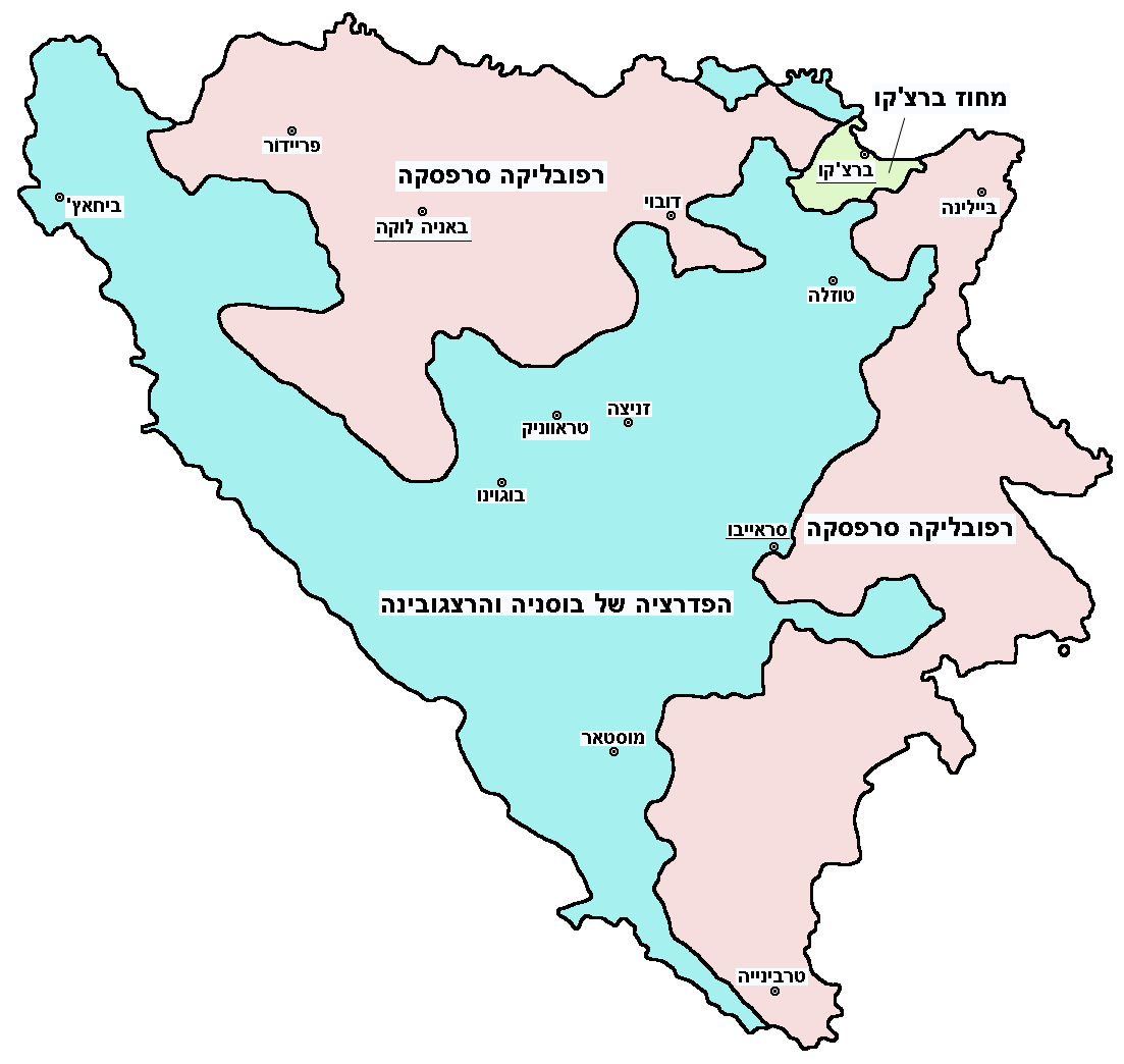
English: Federation of Bosnia and Herzegovina, Republika Srpska and Brčko district.
עברית: הפדרציה של בוסניה והרצגובינה, רפובליקה סרפסקה ומחוז ברצ'קו. |
|||
| ቀን | ||||
| ምንጭ | Image:Map Bih entities.png | |||
| አቅራቢው | User:PANONIAN (translated by User:Gilado) | |||
| የማብዛት ፈቃድ (Reusing this file) |
|
Captions
Add a one-line explanation of what this file represents
Items portrayed in this file
depicts እንግሊዝኛ
inception እንግሊዝኛ
7 ሴፕቴምበር 2009
የፋይሉ ታሪክ
የቀድሞው ዕትም ካለ ቀን/ሰዓቱን በመጫን መመልከት ይቻላል።
| ቀን /ሰዓት | ናሙና | ክልሉ (በpixel) | አቅራቢው | ማጠቃለያ | |
|---|---|---|---|---|---|
| ያሁኑኑ | 14:34, 5 ኦክቶበር 2012 | | 1,103 × 1,044 (53 KB) | PANONIAN | improved version |
| 13:02, 7 ሴፕቴምበር 2009 |  | 700 × 615 (37 KB) | Gilado | {{Information |Description={{en|1=Federation of Bosnia and Herzegovina, Republika Srpska and Brčko district.}} {{he|1=הפדרציה של בוסניה והרצגובינה, רפובליקה סרפסקה ומחוז ברצ'קו.}} |Source=[[:Image:Map Bih |
መያያዣዎች
ወዲህ ፋይል የተያያዘ ገጽ የለም።
ሌሎች ውኪዎች
የሚከተሉት ሌሎች ውኪዎች ይህን ፋይል ይጠቀማሉ፦