Lêer:Colombia.A2004117.1535.250m.jpg
From Wikipedia, the free encyclopedia
Oorspronklike lêer (1 500 × 2 000 piksels, lêergrootte: 898 KG, MIME-tipe: image/jpeg)
Hierdie lêer kom vanaf Wikimedia Commons en kan ook in ander projekte gebruik word. Die beskrywing op die lêer se inligtingsblad word hieronder weergegee.
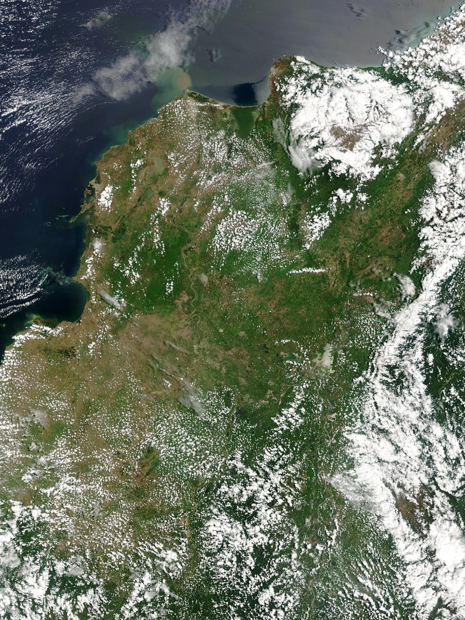
Floods in Colombia, April 2004.
Marshes and wetlands line Colombia’s Magdalena River in its course north from the Andes Mountains to the Caribbean Sea. The wetlands, which form black and blue patches along the river in the false color image, are important for birds arriving from the north for the winter. The area had received heavy rain which triggered floods and landslides. Though the floods aren't visible in these images, the tan plume of sediment flowing into the Caribbean from the Magdalena River in the true-color image may be a result of high, fast-moving waters carrying extra mud into the sea. This true and false color image pair was captured by the Moderate Resolution Imaging Spectroradiometer (MODIS) on the Aqua satellite on April 26, 2004.
http://visibleearth.nasa.gov/view_rec.php?id=6531 archive copy at the Wayback Machine
| Public domainPublic domainfalsefalse |
| This file is in the public domain in the United States because it was solely created by NASA. NASA copyright policy states that "NASA material is not protected by copyright unless noted". (See Template:PD-USGov, NASA copyright policy page or JPL Image Use Policy.) | ||
 |
Warnings:
|
Captions
Items portrayed in this file
uitbeelding
media type Engels
image/jpeg
checksum Engels
45746fc25f3f909b025e6024bf413592fa3e7335
data size Engels
919 626 greep
height Engels
2 000 pieksel
width Engels
1 500 pieksel
Lêergeskiedenis
Klik op die datum/tyd om te sien hoe die lêer destyds gelyk het.
| Datum/Tyd | Duimnael | Dimensies | Gebruiker | Opmerking | |
|---|---|---|---|---|---|
| huidig | 19:36, 27 Oktober 2005 | | 1 500 × 2 000 (898 KG) | Brian0918 | Floods in Colombia, April 2004. Marshes and wetlands line Colombia’s Magdalena River in its course north from the Andes Mountains to the Caribbean Sea. The wetlands, which form black and blue patches along the river in the false color image, are import |
Lêergebruik
Die volgende bladsy gebruik dié lêer:
Globale lêergebruik
Die volgende ander wiki's gebruik hierdie lêer:
- Gebruik in ar.wikipedia.org
- Gebruik in el.wikipedia.org
- Gebruik in en.wikipedia.org
- Gebruik in fr.wikipedia.org
- Gebruik in ms.wikipedia.org
- Gebruik in ru.wikipedia.org
- Gebruik in sl.wikipedia.org
- Gebruik in uk.wikipedia.org
- Gebruik in vi.wikipedia.org
Metadata
Die lêer bevat aanvullende inligting wat moontlik deur 'n digitale kamera of skandeerder bygevoeg is.
As die lêer verander is, sal sekere inligting dalk nie meer ooreenkom met dié van die gewysigde lêer nie.
| _error | 0 |
|---|