Lêer:Antarctica_map_indicating_Antarctic_Peninsula.JPG
From Wikipedia, the free encyclopedia
Oorspronklike lêer (1 074 × 976 piksels, lêergrootte: 222 KG, MIME-tipe: image/jpeg)
Hierdie lêer kom vanaf Wikimedia Commons en kan ook in ander projekte gebruik word. Die beskrywing op die lêer se inligtingsblad word hieronder weergegee.
 | This image was uploaded in the JPEG format even though it consists of non-photographic data. This information could be stored more efficiently or accurately in the PNG or SVG format. If possible, please upload a PNG or SVG version of this image without compression artifacts, derived from a non-JPEG source (or with existing artifacts removed). After doing so, please tag the JPEG version with {{Superseded|NewImage.ext}} and remove this tag. This tag should not be applied to photographs or scans. If this image is a diagram or other image suitable for vectorisation, please tag this image with {{Convert to SVG}} instead of {{BadJPEG}}. If not suitable for vectorisation, use {{Convert to PNG}}. For more information, see {{BadJPEG}}. |  |
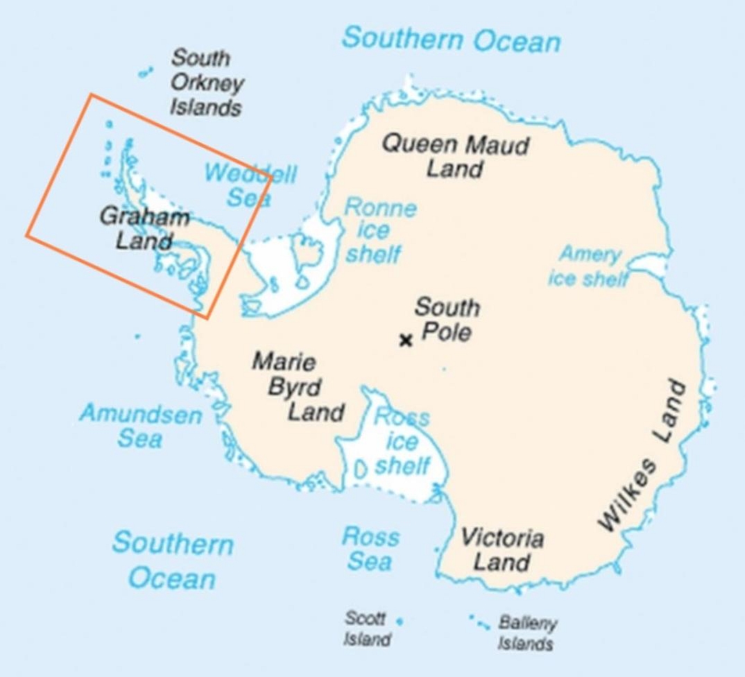
| BeskrywingAntarctica map indicating Antarctic Peninsula.JPG | Map of Antarctica indicating location of Antarctic Peninsula. |
| Datum | (UTC) |
| Bron | |
| Outeur |
|
| Ander weergawes | العربيَّة |
| This is a retouched picture, which means that it has been digitally altered from its original version. Modifications: Added frame indicating location of Antarctic Peninsula. The original can be viewed here: Map-antarctica-ross-ice-shelf-red-x.png:
|
| Public domainPublic domainfalsefalse |
This image is in the public domain because it contains materials that originally came from the United States Central Intelligence Agency's World Factbook.
Bahasa Indonesia ∙ čeština ∙ Deutsch ∙ eesti ∙ English ∙ español ∙ Esperanto ∙ français ∙ galego ∙ hrvatski ∙ italiano ∙ Nederlands ∙ norsk nynorsk ∙ polski ∙ português ∙ sicilianu ∙ slovenščina ∙ suomi ∙ Türkçe ∙ Zazaki ∙ беларуская (тарашкевіца) ∙ македонски ∙ русский ∙ српски / srpski ∙ українська ∙ ქართული ∙ বাংলা ∙ தமிழ் ∙ മലയാളം ∙ 한국어 ∙ 日本語 ∙ 中文 ∙ 中文(简体) ∙ 中文(繁體) ∙ العربية ∙ +/− |
 |
Oorspronklike oplaailogboek
This image is a derivative work of the following images:
- File:Map-antarctica-ross-ice-shelf-red-x.png licensed with PD-USGov-CIA-WF
- 2009-02-16T17:22:04Z Jeandré du Toit 316x313 (26247 Bytes) {{Information |Description=*Map of Antarctica with a red X on the Ross ice shelf. |Source=*[[:File:Antarctica_Map.png|]] |Date=2009-02-16 17:20 (UTC) |Author=*[[:File:Antarctica_Map.png|]] *derivative work: ~~~ |Permission=se
Uploaded with derivativeFX
Captions
Items portrayed in this file
uitbeelding
6 April 2009
media type Engels
image/jpeg
checksum Engels
3467cb2d585809b75166aaf66ec806e7720c442f
data size Engels
227 070 greep
height Engels
976 pieksel
width Engels
1 074 pieksel
Lêergeskiedenis
Klik op die datum/tyd om te sien hoe die lêer destyds gelyk het.
| Datum/Tyd | Duimnael | Dimensies | Gebruiker | Opmerking | |
|---|---|---|---|---|---|
| huidig | 06:30, 6 April 2009 | | 1 074 × 976 (222 KG) | Anna Frodesiak | Removed red X indicating location of Ross Ice Shelf. Sharpened image slightly. |
| 23:08, 5 April 2009 |  | 1 074 × 976 (225 KG) | Anna Frodesiak | {{Information |Description=Map of Antarctica indicating location of Antarctic Peninsula. |Source=*File:Map-antarctica-ross-ice-shelf-red-x.png |Date=2009-04-06 00:04 (UTC) |Author=*File:Map-antarctica-ross-ice-shelf-red-x.png: *[[:File:Antarct |
Lêergebruik
Die volgende bladsy gebruik dié lêer:
Globale lêergebruik
Die volgende ander wiki's gebruik hierdie lêer:
- Gebruik in ang.wikipedia.org
- Gebruik in ar.wikipedia.org
- Gebruik in be.wikipedia.org
- Gebruik in bn.wikipedia.org
- Gebruik in bs.wikipedia.org
- Gebruik in da.wikipedia.org
- Gebruik in el.wikipedia.org
- Gebruik in en.wikipedia.org
- Gebruik in fi.wikipedia.org
- Gebruik in ga.wikipedia.org
- Gebruik in hi.wikipedia.org
- Gebruik in hr.wikipedia.org
- Gebruik in hu.wikipedia.org
- Gebruik in hy.wikipedia.org
- Gebruik in it.wikipedia.org
- Gebruik in ja.wikipedia.org
- Gebruik in kk.wikipedia.org
- Gebruik in ko.wikipedia.org
- Gebruik in la.wikipedia.org
- Gebruik in mk.wikipedia.org
- Gebruik in ms.wikipedia.org
- Gebruik in nn.wikipedia.org
- Gebruik in pa.wikipedia.org
- Gebruik in pnb.wikipedia.org
- Gebruik in ro.wikipedia.org
- Gebruik in ru.wikipedia.org
- Gebruik in simple.wikipedia.org
- Gebruik in sk.wikipedia.org
- Gebruik in sw.wikipedia.org
- Gebruik in ta.wikipedia.org
- Gebruik in uk.wikipedia.org
- Gebruik in ur.wikipedia.org
- Gebruik in vi.wikipedia.org
- Gebruik in war.wikipedia.org
- Gebruik in zh-yue.wikipedia.org
Metadata
Die lêer bevat aanvullende inligting wat moontlik deur 'n digitale kamera of skandeerder bygevoeg is.
As die lêer verander is, sal sekere inligting dalk nie meer ooreenkom met dié van die gewysigde lêer nie.
| _error | 0 |
|---|