File:USACE_Tenkiller_Lake_and_Dam.jpg
From Wikipedia, the free encyclopedia
Size of this preview: 750 × 600 pixels. Other resolutions: 300 × 240 pixels | 600 × 480 pixels | 960 × 768 pixels | 1,280 × 1,024 pixels | 1,500 × 1,200 pixels.
Original file (1,500 × 1,200 pixels, file size: 810 KB, MIME type: image/jpeg)
| This is a file from the Wikimedia Commons. Information from its description page there is shown below. Commons is a freely licensed media file repository. You can help. |
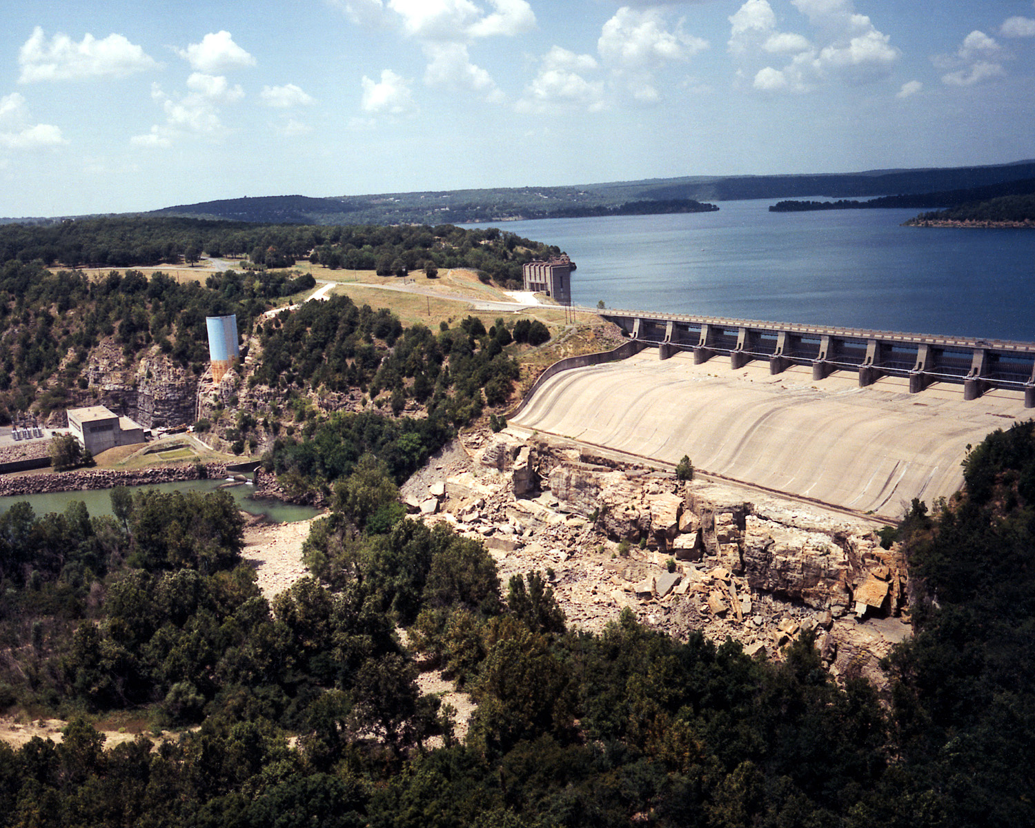
| DescriptionUSACE Tenkiller Lake and Dam.jpg |
English: Aerial view of Tenkiller Ferry Lake (also known as Tenkiller Lake) and Dam on the Illinois River in Sequoyah County, Oklahoma, USA. The lake backs up into Cherokee County. The earth-fill dam was constructed between 1947 and 1952 by the United States Army Corps of Engineers for purposes of flood control and hydroelectric power generation. This photograph shows only the concrete spillway and powerhouse, and, does not show the largest, earth-fill part of the dam, which would be off to the right of the picture. View is to the north.
Coordinates: 35°35′42.36″N 95°2′51.5″W / 35.5951°N 95.047639°W / 35.5951; -95.047639 |
||||
| Location InfoField | Sequoyah County, Oklahoma, USA | ||||
| Date | (Caveat: Dates provided by U.S. Army Corps of Engineers Digital Visual Library are not reliable and may be wrong.) | ||||
| Source |
U.S. Army Corps of Engineers Digital Visual Library Image page Image description page Digital Visual Library home page |
||||
| Author | U.S. Army Corps of Engineers, photographer not specified or unknown | ||||
| Permission (Reusing this file) |
|
Captions
Add a one-line explanation of what this file represents
Items portrayed in this file
depicts
3 March 1999
File history
Click on a date/time to view the file as it appeared at that time.
| Date/Time | Thumbnail | Dimensions | User | Comment | |
|---|---|---|---|---|---|
| current | 04:07, 11 May 2007 | | 1,500 × 1,200 (810 KB) | DanMS | {{Information | Description = {{en|Aerial view of Tenkiller Ferry Lake (also known as Tenkiller Lake) and Dam on the Illinois River in Sequoyah County, Oklahoma, USA. The lake backs up into Cherokee County. The earth-fill dam was constructed between 19 |
File usage
The following pages on the English Wikipedia use this file (pages on other projects are not listed):
Global file usage
The following other wikis use this file:
- Usage on ceb.wikipedia.org
- Usage on en.wikivoyage.org
- Usage on www.wikidata.org
- Usage on zh.wikipedia.org
Metadata
This file contains additional information, probably added from the digital camera or scanner used to create or digitize it.
If the file has been modified from its original state, some details may not fully reflect the modified file.
| JPEG file comment | File written by Adobe Photoshop¨ 5.0 |
|---|
Retrieved from "https://en.wikipedia.org/wiki/File:USACE_Tenkiller_Lake_and_Dam.jpg"