File:Tafone_at_Salt_Point_State_Park,_Sonoma.jpg
From Wikipedia, the free encyclopedia
Size of this preview: 800 × 533 pixels. Other resolutions: 320 × 213 pixels | 640 × 427 pixels | 1,024 × 683 pixels | 1,280 × 854 pixels | 2,242 × 1,495 pixels.
Original file (2,242 × 1,495 pixels, file size: 2.8 MB, MIME type: image/jpeg)
| This is a file from the Wikimedia Commons. Information from its description page there is shown below. Commons is a freely licensed media file repository. You can help. |
Summary
| DescriptionTafone at Salt Point State Park, Sonoma.jpg |
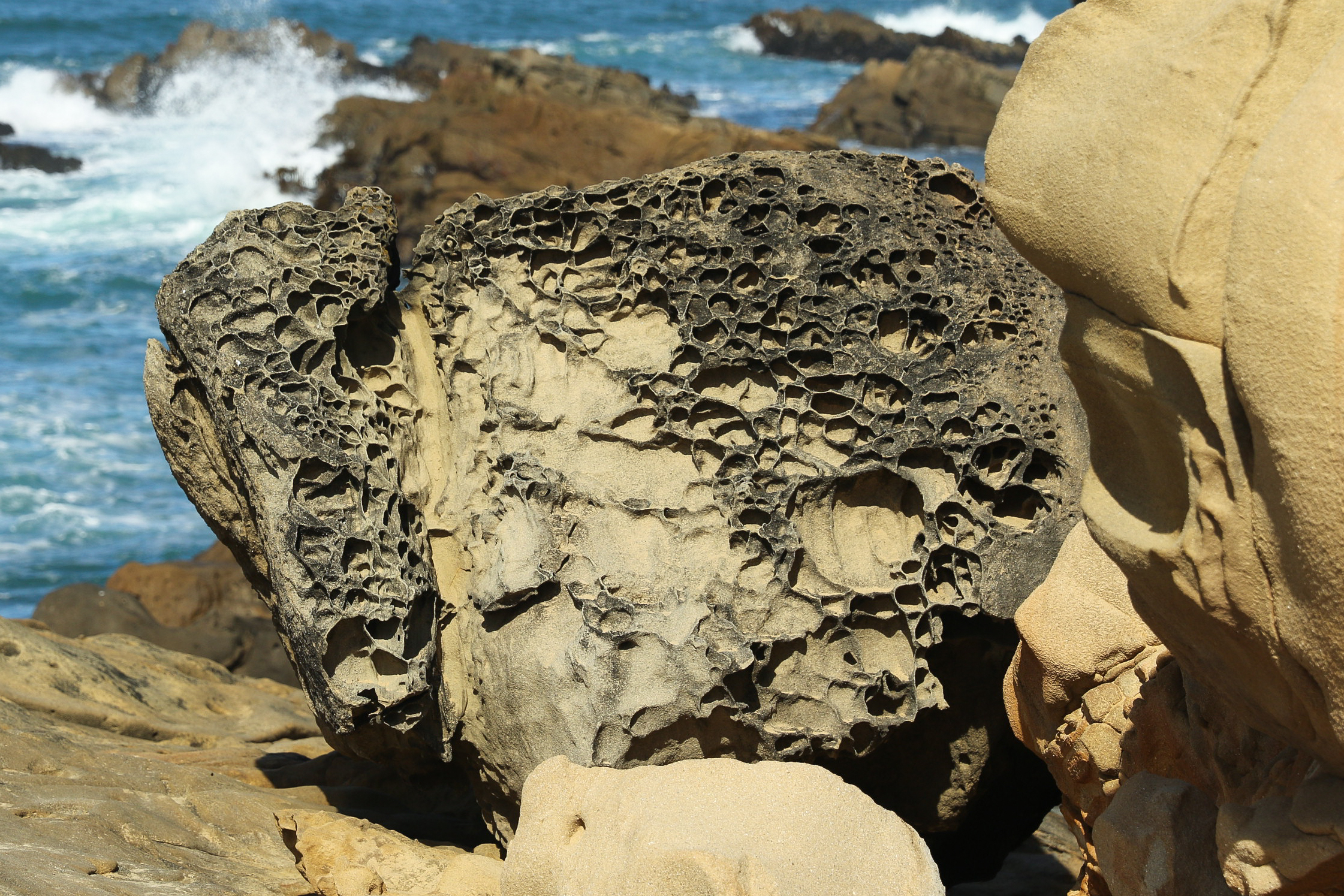
English: Tafone at Salt Point State Park, Sonoma County, California |
| Date | Taken on 1 October 2017, 10:16:28 |
| Source | Own work |
| Author | Frank Schulenburg |
| Camera location | 38° 34′ 03.86″ N, 123° 20′ 05.22″ W | View this and other nearby images on: OpenStreetMap |
|---|
Licensing
I, the copyright holder of this work, hereby publish it under the following license:
This file is licensed under the Creative Commons Attribution-Share Alike 4.0 International license.
- You are free:
- to share – to copy, distribute and transmit the work
- to remix – to adapt the work
- Under the following conditions:
- attribution – You must give appropriate credit, provide a link to the license, and indicate if changes were made. You may do so in any reasonable manner, but not in any way that suggests the licensor endorses you or your use.
- share alike – If you remix, transform, or build upon the material, you must distribute your contributions under the same or compatible license as the original.
Captions
Add a one-line explanation of what this file represents
Items portrayed in this file
depicts
some value
1 October 2017
38°34'3.857"N, 123°20'5.219"W
File history
Click on a date/time to view the file as it appeared at that time.
| Date/Time | Thumbnail | Dimensions | User | Comment | |
|---|---|---|---|---|---|
| current | 00:20, 2 October 2017 | | 2,242 × 1,495 (2.8 MB) | Frank Schulenburg | Better version |
| 00:02, 2 October 2017 |  | 2,248 × 1,499 (1.84 MB) | Frank Schulenburg | User created page with UploadWizard |
File usage
The following pages on the English Wikipedia use this file (pages on other projects are not listed):
Global file usage
The following other wikis use this file:
- Usage on fr.wikipedia.org
- Usage on ko.wikipedia.org
- Usage on ml.wikipedia.org
- Usage on www.wikidata.org
Metadata
This file contains additional information, probably added from the digital camera or scanner used to create or digitize it.
If the file has been modified from its original state, some details may not fully reflect the modified file.
| Camera manufacturer | Canon |
|---|---|
| Camera model | Canon EOS 7D Mark II |
| Author | Frank Schulenburg |
| Copyright holder |
|
| Exposure time | 1/800 sec (0.00125) |
| F-number | f/5 |
| ISO speed rating | 100 |
| Date and time of data generation | 10:16, 1 October 2017 |
| Lens focal length | 67 mm |
| Latitude | 38° 34′ 3.89″ N |
| Longitude | 123° 20′ 5.26″ W |
| Altitude | 2.5 meters above sea level |
| Online copyright statement | https://creativecommons.org/licenses/by-sa/4.0/ |
| City shown | Jenner |
| Horizontal resolution | 240 dpi |
| Vertical resolution | 240 dpi |
| Software used | Adobe Photoshop Lightroom 6.12 (Macintosh) |
| File change date and time | 17:19, 1 October 2017 |
| Exposure Program | Aperture priority |
| Exif version | 2.3 |
| Date and time of digitizing | 10:16, 1 October 2017 |
| Shutter speed | 9.643856 |
| APEX aperture | 4.643856 |
| Exposure bias | −0.33333333333333 |
| Maximum land aperture | 3 APEX (f/2.83) |
| Metering mode | Pattern |
| Flash | Flash did not fire, compulsory flash suppression |
| DateTimeOriginal subseconds | 06 |
| DateTimeDigitized subseconds | 06 |
| Color space | sRGB |
| Focal plane X resolution | 3,043.3815350389 |
| Focal plane Y resolution | 3,045.0751252087 |
| Focal plane resolution unit | inches |
| Custom image processing | Normal process |
| Exposure mode | Auto exposure |
| White balance | Manual white balance |
| Scene capture type | Standard |
| GPS time (atomic clock) | 18:16:41.704 |
| Satellites used for measurement | 22 |
| Receiver status | Measurement in progress |
| Measurement mode | 3-dimensional measurement |
| Measurement precision | Fair (1.5) |
| Reference for direction of image | Magnetic direction |
| Direction of image | 338 |
| Geodetic survey data used | WGS-84 |
| GPS date | 1 October 2017 |
| GPS tag version | 0.0.3.2 |
| Serial number of camera | 058021011142 |
| Lens used | EF24-70mm f/2.8L II USM |
| Date metadata was last modified | 10:19, 1 October 2017 |
| Unique ID of original document | C0862A4EBDCB12C78D3D3EF7E5E0E8A2 |
| Copyright status | Copyrighted |
| Keywords |
|
| Contact information | frank@wikiphotographer.net
150 Seminary Drive 2A Mill Valley, California, 94941 United States |
| Province or state shown | California |
| Country shown | USA |
| Code for country shown | US |
| IIM version | 4 |