File:Position_Schottische_See.PNG
From Wikipedia, the free encyclopedia
No higher resolution available.
Position_Schottische_See.PNG (649 × 475 pixels, file size: 13 KB, MIME type: image/png)
| This is a file from the Wikimedia Commons. Information from its description page there is shown below. Commons is a freely licensed media file repository. You can help. |

|
This locator map image could be re-created using vector graphics as an SVG file. This has several advantages; see Commons:Media for cleanup for more information. If an SVG form of this image is available, please upload it and afterwards replace this template with
{{vector version available|new image name}}.
It is recommended to name the SVG file “Position Schottische See.svg”—then the template Vector version available (or Vva) does not need the new image name parameter. |
Summary
| DescriptionPosition Schottische See.PNG |
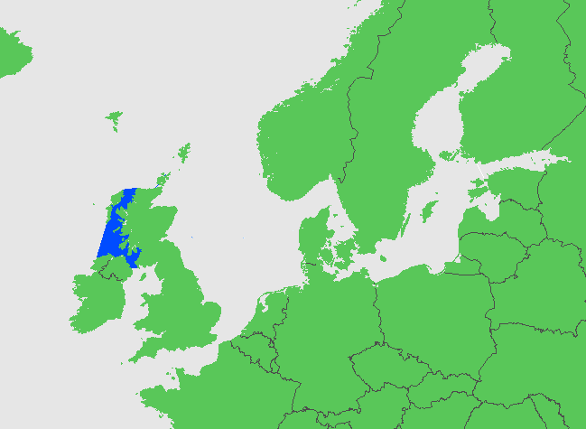
English: IHO region Inner Seas to the West Coast of Scotland Deutsch: Schottische See |
| Date | |
| Source |
 |
| Author | M. Minderhoud |
| Camera location | 56° 00′ 00″ N, 7° 00′ 00″ W | View this and other nearby images on: OpenStreetMap |
|---|
Licensing
| Public domainPublic domainfalsefalse |
This image is in the public domain because it came from the site https://www.demis.nl/products/web-map-server/examples/ and was released by the copyright holder. Permission is granted to copy, distribute and/or modify this map since it is based on free of copyright images from: www.demis.nl. See also approval email on de.wp and its clarification.
Deutsch | English | македонски | മലയാളം | Nederlands | slovenščina | +/− |
| Public domainPublic domainfalsefalse |
| This work has been released into the public domain by its copyright holder, www.demis.nl. This applies worldwide. In some countries this may not be legally possible; if so: www.demis.nl grants anyone the right to use this work for any purpose, without any conditions, unless such conditions are required by law. Public domainPublic domainfalsefalse |
Captions
Add a one-line explanation of what this file represents
Items portrayed in this file
depicts
24 September 2014
56°N, 7°W
File history
Click on a date/time to view the file as it appeared at that time.
| Date/Time | Thumbnail | Dimensions | User | Comment | |
|---|---|---|---|---|---|
| current | 15:13, 24 September 2014 | | 649 × 475 (13 KB) | Nomentz | User created page with UploadWizard |
File usage
The following pages on the English Wikipedia use this file (pages on other projects are not listed):
Global file usage
The following other wikis use this file:
- Usage on cs.wikipedia.org
- Usage on de.wikipedia.org
- Usage on eo.wikipedia.org
- Usage on fr.wikipedia.org
- Usage on fy.wikipedia.org
- Usage on pl.wikipedia.org
- Usage on pl.wiktionary.org
- Usage on www.wikidata.org
Metadata
This file contains additional information, probably added from the digital camera or scanner used to create or digitize it.
If the file has been modified from its original state, some details may not fully reflect the modified file.
| Horizontal resolution | 37.8 dpc |
|---|---|
| Vertical resolution | 37.8 dpc |
| File change date and time | 14:55, 24 September 2014 |
Retrieved from "https://en.wikipedia.org/wiki/File:Position_Schottische_See.PNG"