File:Norwegian_Sea_map_sv.png
From Wikipedia, the free encyclopedia
Size of this preview: 657 × 600 pixels. Other resolutions: 263 × 240 pixels | 526 × 480 pixels | 1,000 × 913 pixels.
Original file (1,000 × 913 pixels, file size: 360 KB, MIME type: image/png)
| This is a file from the Wikimedia Commons. Information from its description page there is shown below. Commons is a freely licensed media file repository. You can help. |
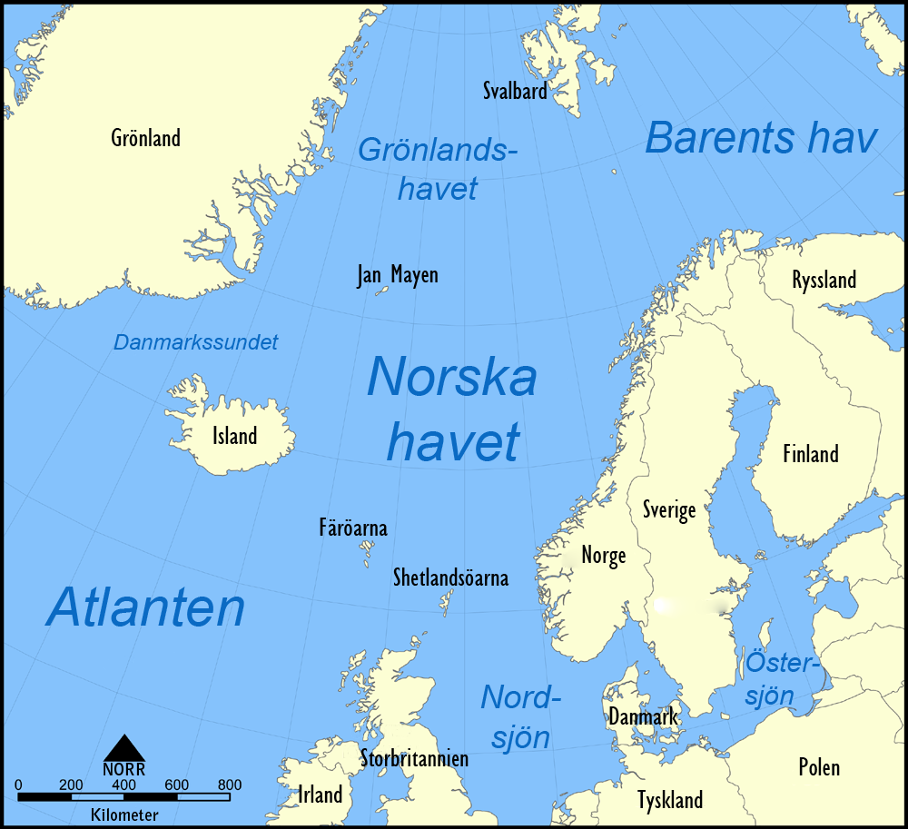
| DescriptionNorwegian Sea map sv.png |
English: A map in Swedish showing the location of the Norwegian Sea in the North Atlantic Ocean.
Svenska: En svensk karta över Norska havets läge i norra Atlanten. |
| Date | (UTC) |
| Source | |
| Author |
|
| Other versions |
[edit]
|


I, the copyright holder of this work, hereby publish it under the following licenses:
| This file is licensed under the Creative Commons Attribution-Share Alike 3.0 Unported license. | ||
| ||
| This licensing tag was added to this file as part of the GFDL licensing update.http://creativecommons.org/licenses/by-sa/3.0/CC BY-SA 3.0Creative Commons Attribution-Share Alike 3.0truetrue |

|
Permission is granted to copy, distribute and/or modify this document under the terms of the GNU Free Documentation License, Version 1.2 or any later version published by the Free Software Foundation; with no Invariant Sections, no Front-Cover Texts, and no Back-Cover Texts. A copy of the license is included in the section entitled GNU Free Documentation License.http://www.gnu.org/copyleft/fdl.htmlGFDLGNU Free Documentation Licensetruetrue |
You may select the license of your choice.
Original upload log
This image is a derivative work of the following images:
- File:Norwegian_Sea_map.png licensed with Cc-by-sa-3.0-migrated, GFDL
- 2005-11-07T16:10:45Z NormanEinstein 1000x913 (525159 Bytes)
| This file is licensed under the Creative Commons Attribution-Share Alike 3.0 Unported license. | ||
| ||
| This licensing tag was added to this file as part of the GFDL licensing update.http://creativecommons.org/licenses/by-sa/3.0/CC BY-SA 3.0Creative Commons Attribution-Share Alike 3.0truetrue |
Captions
Add a one-line explanation of what this file represents
Items portrayed in this file
depicts
25 August 2010
File history
Click on a date/time to view the file as it appeared at that time.
| Date/Time | Thumbnail | Dimensions | User | Comment | |
|---|---|---|---|---|---|
| current | 09:35, 25 August 2010 | | 1,000 × 913 (360 KB) | Dcastor | {{Information |Description={{en|A map in Swedish showing the location of the Norwegian Sea in the North Atlantic Ocean.}} {{sv|En svensk karta över Norska havets läge i norra Atlanten.}} |Source=*File:Norwegian_Sea_map.png |Date=2010-08-25 09:25 ( |
File usage
No pages on the English Wikipedia use this file (pages on other projects are not listed).
Global file usage
The following other wikis use this file:
- Usage on sv.wikipedia.org
Retrieved from "https://en.wikipedia.org/wiki/File:Norwegian_Sea_map_sv.png"