File:Myrtle_Beach_International_Airport_FAA_Diagram.png
From Wikipedia, the free encyclopedia
No higher resolution available.
Myrtle_Beach_International_Airport_FAA_Diagram.png (290 × 445 pixels, file size: 7 KB, MIME type: image/png)
| This is a file from the Wikimedia Commons. Information from its description page there is shown below. Commons is a freely licensed media file repository. You can help. |
Summary
| DescriptionMyrtle Beach International Airport FAA Diagram.png |
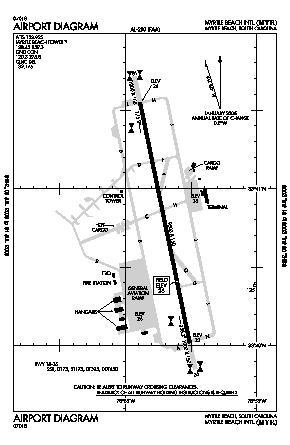
English: A FAA Diagram Myrtle Beach International Airport. |
| Source | http://155.178.201.160/d-tpp/1210/00280AD.PDF |
| Author | w:United Statesw:Federal Aviation Administration |
Licensing
| Public domainPublic domainfalsefalse |
| This image is a work of a United States Department of Transportation employee, taken or made as part of that person's official duties. As a work of the U.S. federal government, the image is in the public domain.
|
Captions
Add a one-line explanation of what this file represents
Items portrayed in this file
depicts
image/png
File history
Click on a date/time to view the file as it appeared at that time.
| Date/Time | Thumbnail | Dimensions | User | Comment | |
|---|---|---|---|---|---|
| current | 01:32, 17 October 2012 | | 290 × 445 (7 KB) | Sk8terguy27 | Uploading a public-domain item using File Upload Wizard |
File usage
The following pages on the English Wikipedia use this file (pages on other projects are not listed):
Global file usage
The following other wikis use this file:
- Usage on es.wikipedia.org
- Usage on ur.wikipedia.org
Metadata
This file contains additional information, probably added from the digital camera or scanner used to create or digitize it.
If the file has been modified from its original state, some details may not fully reflect the modified file.
| Horizontal resolution | 21.25 dpc |
|---|---|
| Vertical resolution | 21.25 dpc |
| Software used |