File:Map_of_Erie_County_Ohio_Highlighting_Huron_City.png
From Wikipedia, the free encyclopedia
No higher resolution available.
Map_of_Erie_County_Ohio_Highlighting_Huron_City.png (655 × 597 pixels, file size: 27 KB, MIME type: image/png)
| This is a file from the Wikimedia Commons. Information from its description page there is shown below. Commons is a freely licensed media file repository. You can help. |
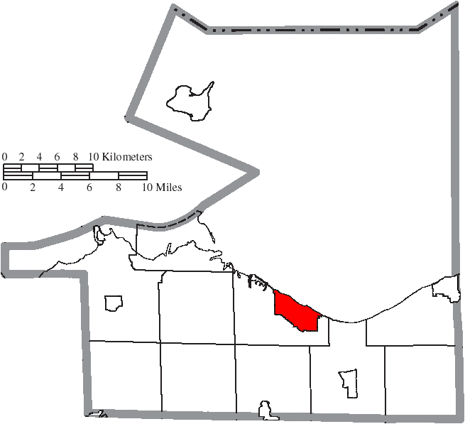
| DescriptionMap of Erie County Ohio Highlighting Huron City.png |
English: Map of the municipal and township boundaries of Erie County, Ohio, United States, as of the 2000 census, with the location of the city of Huron highlighted. Township borders are shown only in unincorporated areas in order to differentiate incorporated and unincorporated areas more clearly. |
| Date | |
| Source | File:Map of Erie County Ohio With Municipal and Township Labels.PNG |
| Author | Ruhrfisch and Nyttend |
| Permission (Reusing this file) |
This file is licensed under the Creative Commons Attribution-Share Alike 3.0 Unported license.
|
Captions
Add a one-line explanation of what this file represents
Items portrayed in this file
depicts
8 August 2015
File history
Click on a date/time to view the file as it appeared at that time.
| Date/Time | Thumbnail | Dimensions | User | Comment | |
|---|---|---|---|---|---|
| current | 01:04, 17 August 2015 | | 655 × 597 (27 KB) | Nyttend | {{Information |Description={{en|Map of the municipal and township boundaries of {{w|Erie County, Ohio|Erie County}}, {{w|Ohio}}, {{w|United States}}, as of the 2000 census, with the location of the city of {{w|Huron, Ohio|Huron}} highlighted. Township... |
File usage
The following pages on the English Wikipedia use this file (pages on other projects are not listed):
Metadata
This file contains additional information, probably added from the digital camera or scanner used to create or digitize it.
If the file has been modified from its original state, some details may not fully reflect the modified file.
| Horizontal resolution | 37.8 dpc |
|---|---|
| Vertical resolution | 37.8 dpc |