File:Machair_east_of_Uig_Bay_-_geograph.org.uk_-_126686.jpg
From Wikipedia, the free encyclopedia
No higher resolution available.
Machair_east_of_Uig_Bay_-_geograph.org.uk_-_126686.jpg (640 × 425 pixels, file size: 168 KB, MIME type: image/jpeg)
| This is a file from the Wikimedia Commons. Information from its description page there is shown below. Commons is a freely licensed media file repository. You can help. |
Summary
| DescriptionMachair east of Uig Bay - geograph.org.uk - 126686.jpg |
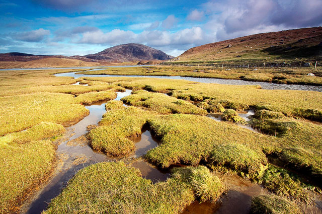
English: Machair east of Uig Bay. Various lochs drain into Uig Bay cutting through the machair as they go. In the distance is Suaineabhal |
| Date | |
| Source | From geograph.org.uk |
| Author | Les Ellingham |
| Attribution (required by the license) InfoField | Les Ellingham / Machair east of Uig Bay / |
InfoField | Les Ellingham / Machair east of Uig Bay |
| Camera location | 58° 11′ 08.1″ N, 7° 01′ 13″ W | View this and other nearby images on: OpenStreetMap |
|---|
| Object location | 58° 11′ 08.1″ N, 7° 01′ 13″ W | View this and other nearby images on: OpenStreetMap |
|---|
Licensing

|
This image was taken from the Geograph project collection. See this photograph's page on the Geograph website for the photographer's contact details. The copyright on this image is owned by Les Ellingham and is licensed for reuse under the Creative Commons Attribution-ShareAlike 2.0 license.
|
This file is licensed under the Creative Commons Attribution-Share Alike 2.0 Generic license.
Attribution: Les Ellingham
- You are free:
- to share – to copy, distribute and transmit the work
- to remix – to adapt the work
- Under the following conditions:
- attribution – You must give appropriate credit, provide a link to the license, and indicate if changes were made. You may do so in any reasonable manner, but not in any way that suggests the licensor endorses you or your use.
- share alike – If you remix, transform, or build upon the material, you must distribute your contributions under the same or compatible license as the original.
- Remove redundant categories and try to put this image in the most specific category/categories
- Remove this template
- The location categories are based on information from this geonames tool and this OpenStreetMap tool combined with a database. You can also have a look at this tool from mysociety.
- The topic category from Geograph was Machair (find similar images at Geograph)
English | suomi | français | galego | עברית | magyar | македонски | മലയാളം | português | português do Brasil | Türkçe | +/−
Captions
Add a one-line explanation of what this file represents
Items portrayed in this file
depicts
some value
58°11'8.05"N, 7°1'12.72"W
13 April 2005
58°11'8.05"N, 7°1'12.72"W
File history
Click on a date/time to view the file as it appeared at that time.
| Date/Time | Thumbnail | Dimensions | User | Comment | |
|---|---|---|---|---|---|
| current | 03:48, 31 January 2010 | | 640 × 425 (168 KB) | GeographBot | == {{int:filedesc}} == {{Information |description={{en|1=Machair east of Uig Bay. Various lochs drain into Uig Bay cutting through the machair as they go. In the distance is Suaineabhal}} |date=2005-04-13 |source=From [http://www.geograph.org.uk/photo/126 |
File usage
The following pages on the English Wikipedia use this file (pages on other projects are not listed):
Global file usage
The following other wikis use this file:
- Usage on sl.wikipedia.org
Metadata
This file contains additional information, probably added from the digital camera or scanner used to create or digitize it.
If the file has been modified from its original state, some details may not fully reflect the modified file.
| Image title | Suaineabhal (OS ref NB 050328) |
|---|---|
| Camera manufacturer | Canon |
| Camera model | Canon EOS 300D DIGITAL |
| Exposure time | 1/160 sec (0.00625) |
| F-number | f/10 |
| ISO speed rating | 200 |
| Date and time of data generation | 17:56, 13 April 2005 |
| Lens focal length | 10 mm |
| Width | 3,072 px |
| Height | 2,040 px |
| Compression scheme | Uncompressed |
| Pixel composition | RGB |
| Orientation | Normal |
| Number of components | 3 |
| Horizontal resolution | 300 dpi |
| Vertical resolution | 300 dpi |
| Data arrangement | chunky format |
| Software used | Adobe Photoshop CS2 Windows |
| File change date and time | 21:27, 22 February 2006 |
| Exposure Program | Aperture priority |
| Exif version | 2.21 |
| Date and time of digitizing | 17:56, 13 April 2005 |
| Image compression mode | 9 |
| Shutter speed | 7.3219299316406 |
| APEX aperture | 6.6438598632812 |
| Exposure bias | 0 |
| Maximum land aperture | 3.6147155761719 APEX (f/3.5) |
| Metering mode | Pattern |
| Flash | Flash did not fire |
| Color space | sRGB |
| Focal plane X resolution | 3,443.9461883408 |
| Focal plane Y resolution | 3,442.0168067227 |
| Focal plane resolution unit | inches |
| Sensing method | One-chip color area sensor |
| Custom image processing | Normal process |
| Exposure mode | Auto exposure |
| White balance | Auto white balance |
| Scene capture type | Standard |