File:Larnaca_01-2017_img30_Salt_Lake.jpg
From Wikipedia, the free encyclopedia
Original file (4,765 × 3,176 pixels, file size: 6.15 MB, MIME type: image/jpeg)
| This is a file from the Wikimedia Commons. Information from its description page there is shown below. Commons is a freely licensed media file repository. You can help. |
| DescriptionLarnaca 01-2017 img30 Salt Lake.jpg |
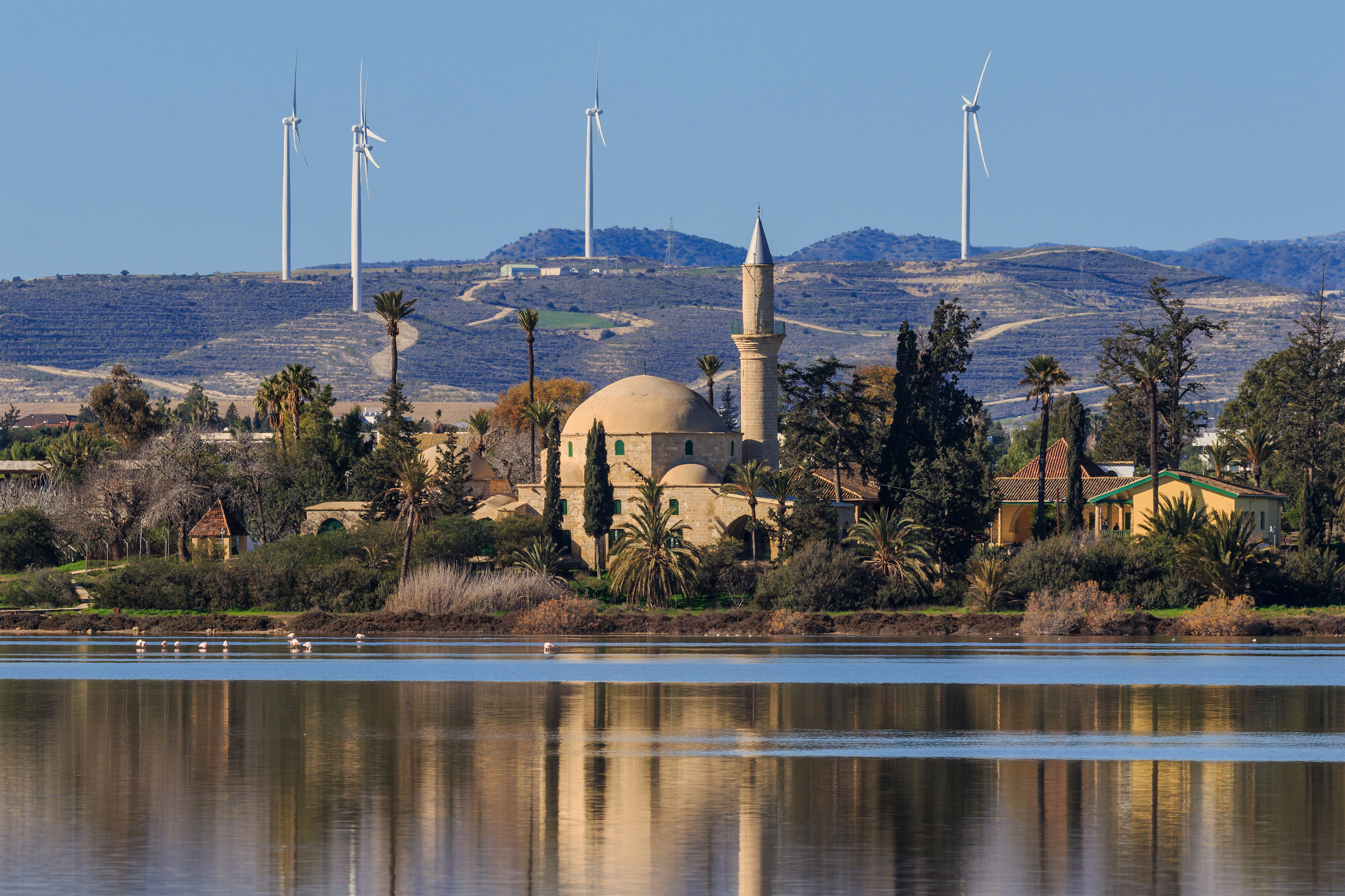
English: Hala Sultan Tekke Mosque at the Salt Lake in Larnaca, Cyprus
Русский: Мечеть Хала Султан Текке около Солёного озера в Ларнаке, Кипр
Українська: Мечеть Хала Султан Текке біля Солоного озера в Ларнаці, Кіпр |
| Date | |
| Source | Own work |
| Author | A.Savin |
| Permission (Reusing this file) |
.svg) Just attribute the author: «A.Savin, Wikipedia»; if you have questions — Telegram, or e-mail to wikiphotospace@gmail.com..svg) Просто укажите в качестве автора: «А.Савин, Википедия»; если есть вопрос — телеграм, или эл.почта на wikiphotospace@gmail.com. Kennzeichnen Sie einfach als Autor: «A.Savin, Wikipedia»; falls Sie Fragen haben — Telegram, oder E-Mail an wikiphotospace@gmail.com.
Thank you. |
| Camera location | 34° 53′ 12.6″ N, 33° 37′ 28.4″ E | View this and other nearby images on: OpenStreetMap |
|---|
This image has been assessed using the Quality image guidelines and is considered a Quality image.
العربية ∙ جازايرية ∙ беларуская ∙ беларуская (тарашкевіца) ∙ български ∙ বাংলা ∙ català ∙ čeština ∙ Cymraeg ∙ Deutsch ∙ Schweizer Hochdeutsch ∙ Zazaki ∙ Ελληνικά ∙ English ∙ Esperanto ∙ español ∙ eesti ∙ euskara ∙ فارسی ∙ suomi ∙ français ∙ galego ∙ עברית ∙ हिन्दी ∙ hrvatski ∙ magyar ∙ հայերեն ∙ Bahasa Indonesia ∙ italiano ∙ 日本語 ∙ Jawa ∙ ქართული ∙ 한국어 ∙ kurdî ∙ Lëtzebuergesch ∙ lietuvių ∙ македонски ∙ മലയാളം ∙ मराठी ∙ Bahasa Melayu ∙ Nederlands ∙ Norfuk / Pitkern ∙ polski ∙ português ∙ português do Brasil ∙ rumantsch ∙ română ∙ русский ∙ sicilianu ∙ slovenčina ∙ slovenščina ∙ shqip ∙ српски / srpski ∙ svenska ∙ தமிழ் ∙ తెలుగు ∙ ไทย ∙ Tagalog ∙ Türkçe ∙ toki pona ∙ українська ∙ vèneto ∙ Tiếng Việt ∙ 中文 ∙ 中文(简体) ∙ 中文(繁體) ∙ +/− |
Licensing
| Copyleft: This work of art is free; you can redistribute it and/or modify it according to terms of the Free Art License. You will find a specimen of this license on the Copyleft Attitude site as well as on other sites. http://artlibre.org/licence/lal/enFALFree Art Licensefalsetrue |
Captions
Items portrayed in this file
depicts
34°53'12.599"N, 33°37'28.402"E
6,443,650 byte
3,176 pixel
4,765 pixel
image/jpeg
33afe5ea256396cfda5d7e084f16d3ce0f187eb6
0.003125 second
100
278 millimetre
File history
Click on a date/time to view the file as it appeared at that time.
| Date/Time | Thumbnail | Dimensions | User | Comment | |
|---|---|---|---|---|---|
| current | 18:37, 22 January 2017 | | 4,765 × 3,176 (6.15 MB) | A.Savin | {{User:A.Savin/F |Description= {{en|Hala Sultan Tekke Mosque at the Salt Lake in Larnaca, Cyprus}} {{ru|Мечеть Хала Султан Текке около Солёного озера в Ларнаке, Кипр}} |Year=2017 |Country=Cyprus |Month... |
File usage
Global file usage
The following other wikis use this file:
- Usage on ar.wikipedia.org
- Usage on arz.wikipedia.org
- Usage on az.wikipedia.org
- Usage on bn.wikipedia.org
- Usage on ca.wikipedia.org
- Usage on cs.wikipedia.org
- Usage on da.wikipedia.org
- Usage on de.wikipedia.org
- Usage on el.wikipedia.org
- Usage on en.wikivoyage.org
- Usage on es.wikipedia.org
- Usage on es.wikivoyage.org
- Usage on eu.wikipedia.org
- Usage on fi.wikipedia.org
- Usage on fr.wikipedia.org
- Usage on fr.wikivoyage.org
- Usage on hy.wikipedia.org
- Usage on id.wikipedia.org
- Usage on is.wikipedia.org
- Usage on it.wikipedia.org
- Usage on it.wikivoyage.org
- Usage on la.wikipedia.org
- Usage on lt.wikipedia.org
- Usage on mk.wikipedia.org
- Usage on nl.wikipedia.org
- Usage on pl.wikipedia.org
View more global usage of this file.
Metadata
This file contains additional information, probably added from the digital camera or scanner used to create or digitize it.
If the file has been modified from its original state, some details may not fully reflect the modified file.
| Camera manufacturer | Canon |
|---|---|
| Camera model | Canon EOS 7D Mark II |
| Author | A.Savin |
| Copyright holder |
|
| Exposure time | 1/320 sec (0.003125) |
| F-number | f/9 |
| ISO speed rating | 100 |
| Date and time of data generation | 10:31, 11 January 2017 |
| Lens focal length | 278 mm |
| Latitude | 34° 53′ 12.83″ N |
| Longitude | 33° 37′ 27.63″ E |
| Altitude | 16.2 meters above sea level |
| Width | 5,472 px |
| Height | 3,648 px |
| Bits per component |
|
| Pixel composition | RGB |
| Orientation | Normal |
| Number of components | 3 |
| Horizontal resolution | 300 dpi |
| Vertical resolution | 300 dpi |
| Software used | Adobe Photoshop CC (Windows) |
| File change date and time | 00:34, 20 January 2017 |
| Exposure Program | Manual |
| Exif version | 2.3 |
| Date and time of digitizing | 10:31, 11 January 2017 |
| Shutter speed | 8.321928 |
| APEX aperture | 6.33985 |
| Exposure bias | 0 |
| Maximum land aperture | 4.75 APEX (f/5.19) |
| Metering mode | Pattern |
| Flash | Flash did not fire, compulsory flash suppression |
| Color space | sRGB |
| Focal plane X resolution | 2,439.5010070801 |
| Focal plane Y resolution | 2,439.5010070801 |
| Focal plane resolution unit | 3 |
| Custom image processing | Normal process |
| Exposure mode | Manual exposure |
| White balance | Auto white balance |
| Scene capture type | Standard |
| GPS time (atomic clock) | 08:30:57.907 |
| Satellites used for measurement | 21 |
| Receiver status | Measurement in progress |
| Measurement mode | 3-dimensional measurement |
| Measurement precision | Fair (1.6) |
| Geodetic survey data used | WGS-84 |
| GPS date | 11 January 2017 |
| GPS tag version | 0.0.3.2 |
| Serial number of camera | 033021000431 |
| Lens used | EF100-400mm f/4.5-5.6L IS II USM |
| Date metadata was last modified | 03:34, 20 January 2017 |
| Unique ID of original document | 6655757F06E375FB4B7238C165251C96 |
| IIM version | 4 |