File:Karte_Kranjska_Gora_si.png
From Wikipedia, the free encyclopedia
No higher resolution available.
Karte_Kranjska_Gora_si.png (300 × 201 pixels, file size: 44 KB, MIME type: image/png)
| This is a file from the Wikimedia Commons. Information from its description page there is shown below. Commons is a freely licensed media file repository. You can help. |
Internationalization

|
Permission is granted to copy, distribute and/or modify this document under the terms of the GNU Free Documentation License, Version 1.2 or any later version published by the Free Software Foundation; with no Invariant Sections, no Front-Cover Texts, and no Back-Cover Texts. A copy of the license is included in the section entitled GNU Free Documentation License.http://www.gnu.org/copyleft/fdl.htmlGFDLGNU Free Documentation Licensetruetrue |
| This file is licensed under the Creative Commons Attribution-Share Alike 3.0 Unported license. | ||
| ||
| This licensing tag was added to this file as part of the GFDL licensing update.http://creativecommons.org/licenses/by-sa/3.0/CC BY-SA 3.0Creative Commons Attribution-Share Alike 3.0truetrue |
Captions
Add a one-line explanation of what this file represents
Items portrayed in this file
depicts
File history
Click on a date/time to view the file as it appeared at that time.
| Date/Time | Thumbnail | Dimensions | User | Comment | |
|---|---|---|---|---|---|
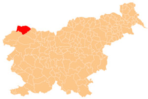
| current | 15:35, 16 July 2005 | | 300 × 201 (44 KB) | Besednjak~commonswiki | Karte der Gemeinde Kranjska Gora in Slowenien. Hergestellt von Benutzer Plp der sl.wikipedia. {{GFDL}} |
File usage
The following pages on the English Wikipedia use this file (pages on other projects are not listed):
- Belca
- Dovje
- Gozd Martuljek
- Heathen Maiden
- Kajžnk House
- Kot (valley)
- Kranjska Gora
- Krma
- Liznjek Farm
- Log, Kranjska Gora
- Mežakla
- Mojstrana
- Municipality of Kranjska Gora
- Nadiža (stream)
- Peričnik Falls
- Planica
- Podkoren
- Rateče
- Russian Chapel (Vršič Pass)
- Slovenian Alpine Museum
- Srednji Vrh, Kranjska Gora
- Vršič Pass
- Wurzen Pass
- Zelenci
- Zgornja Radovna
- Template:Kranjska Gora
Global file usage
The following other wikis use this file:
- Usage on ca.wikipedia.org
- Usage on cs.wikipedia.org
- Usage on de.wikipedia.org
- Usage on eo.wikipedia.org
- Usage on es.wikipedia.org
- Usage on fa.wikipedia.org
- Usage on fi.wikipedia.org
- Usage on hr.wikipedia.org
- Usage on hu.wikipedia.org
- Usage on id.wikipedia.org
- Usage on it.wikipedia.org
- Usage on ja.wikipedia.org
- Usage on ko.wikipedia.org
- Usage on lmo.wikipedia.org
- Usage on mk.wikipedia.org
- Usage on ml.wikipedia.org
- Usage on nl.wikipedia.org
- Usage on pl.wikipedia.org
- Usage on pt.wikipedia.org
- Usage on ro.wikipedia.org
- Usage on ru.wikipedia.org
- Usage on sh.wikipedia.org
- Usage on sl.wikipedia.org
- Usage on sr.wikipedia.org
- Usage on th.wikipedia.org
- Usage on tt.wikipedia.org
- Usage on uk.wikipedia.org
- Usage on vi.wikipedia.org
- Usage on www.wikidata.org
- Usage on zh-min-nan.wikipedia.org
Retrieved from "https://en.wikipedia.org/wiki/File:Karte_Kranjska_Gora_si.png"